Enable Location

We need your location to show you interesting places around you

Discover nearby places

Find interesting locations and hidden gems around you

Precise directions

Get accurate directions and distances to places

Your location is never shared with other users. It's only used when you tap the location button.

Ville Haute

Log in to your account

Start exploring — it's free

Trusted by 61,906 travelers worldwide

Continue with Google
Continue with Apple
or

We will send you a code to connect

By continuing, you accept our Terms and Conditions and our Privacy Policy

Check your inbox

We've sent a pincode in your inbox. Please enter the code below.

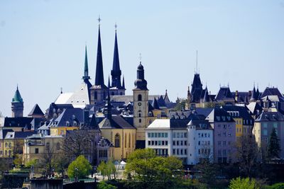
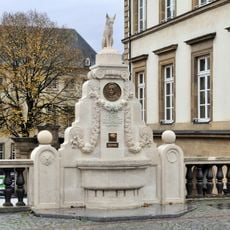
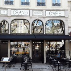
Ville Haute, Medieval town center in Luxembourg City, Luxembourg

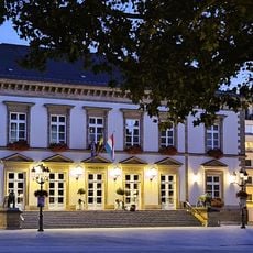
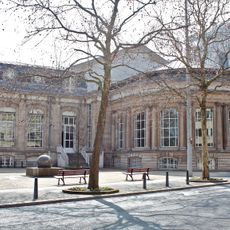
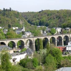
Ville Haute is the historic upper district of Luxembourg City, situated on a natural plateau and characterized by wide avenues, public squares, and buildings spanning several centuries. The terrain drops sharply to the valleys below, offering views across lower neighborhoods and surrounding fortifications.

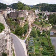
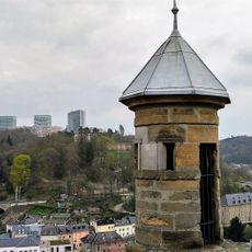
A count called Siegfried founded the settlement in 963 by building a fortress named Lucilinburhuc on the Bock promontory, marking the start of Luxembourg's history. Over the centuries, this fortress expanded into a city as successive architectural layers were added.

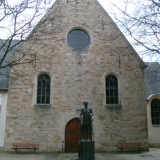
The Notre-Dame Cathedral stands at the center with its blend of Gothic and modern architecture, housing the grand dukes' tombs beneath the floor. Visitors experience the religious heritage of the nation while observing how the building evolved through different periods.

Free public transportation connects all areas, and two elevators provide easy access between the upper and lower sections. Walking is straightforward on the flat streets of the upper town, though stairs between levels can be difficult for those with mobility challenges.

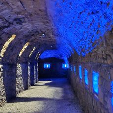
The Pfaffenthal Panoramic Elevator reaches a glass-bottom platform where visitors can look down into the gorge while viewing medieval fortifications. This unexpected perspective merges modern engineering with views of ancient walls and the valley below.

The community of curious travelers

AroundUs brings together thousands of curated places, local tips, and hidden gems, enriched daily by 60,000 contributors worldwide.

Start exploring
Location
Elevation above the sea
312.8 m
Shares border with
Limpertsberg, Pfaffenthal, Grund, Gare, Hollerich, Belair
GPS coordinates
49.61200,6.12900
Latest update
December 8, 2025 21:01
« Ville Haute - Medieval town center in Luxembourg City, Luxembourg » is provided by Around Us (aroundus.com). Images and texts are derived from Wikimedia project under a Creative Commons license. You are allowed to copy, distribute, and modify copies of this page, under the conditions set by the license, as long as this note is clearly visible.

Discover hidden gems everywhere you go!

From secret cafés to breathtaking viewpoints, skip the crowded tourist spots and find places that match your style. Our app makes it easy with voice search, smart filtering, route optimization, and insider tips from travelers worldwide. Download now for the complete mobile experience.

Around Us App Screenshot

A unique approach to discovering new places

Le Figaro

All the places worth exploring

France Info

A tailor-made excursion in just a few clicks

20 Minutes

Around Us
Travel Guide & Maps
Download

Send to your phone

QR Code
1

Open the camera app on your mobile.

2

Point at the QR code with your camera. A notification will appear.

3

Tap the notification to open the link.