Fossa Corbulonis

Log in to your account

AroundUs is a community-driven map of interesting places, built by curious explorers like you. It grows with every review, story, and photo you share.
Connect to save your favorite spots, contribute locations, and create personalized routes.
Continue with Google
Continue with Apple
Continue with X
Continue with Facebook
Continue with email
By continuing, you accept our Terms and Conditions and our Privacy Policy
Create an account
Add to collection
Map
Suggest a change
Share

Fossa Corbulonis, Roman canal in South Holland, Netherlands.

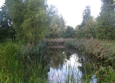
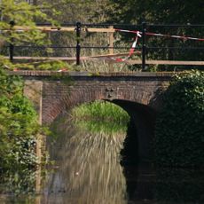
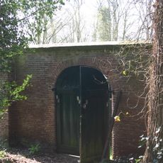
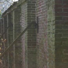
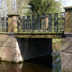
The Fossa Corbulonis is a Roman canal that stretches roughly 34 kilometers between the Rhine and Meuse rivers and served as an ancient shipping route. The waterway was engineered to guide Roman vessels through the landscape with protected passages and regular fortifications along its banks.

Roman general Gnaeus Domitius Corbulo ordered the construction around 50 CE to create a protected shipping corridor for military vessels. This waterway became crucial for the Roman Navy to defend and patrol the northern frontier of their territory.

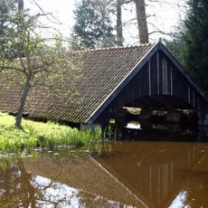
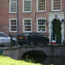
The canal became part of the Lower German Limes and served as a vital waterway that the Romans maintained to connect their territories. Today you can walk along sections where the ancient route still shapes the landscape and local water systems.

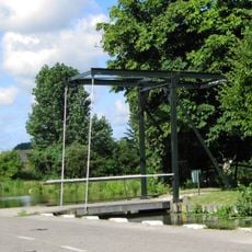
Several access points along the route have information panels that explain the Roman history and navigation systems of the canal. Wear sturdy footwear since most sections follow paths along the waterway's banks and terrain.

Archaeological digs have uncovered wooden pilings and artifacts from the Classis Germanica, the naval fleet that operated here during Roman times. These discoveries reveal details about Roman shipbuilding techniques and the daily life of sailors who worked these waters.

Location: South Holland

Part of: Lower German Limes, Frontiers of the Roman Empire — The Lower German Limes (Netherlands)

GPS coordinates: 52.09620,4.41580

Latest update: December 8, 2025 19:41

Photos
Around this place
Duivenvoorde Castle
Netherlands

Duivenvoorde Castle

1.7 km
Netherlands

Vlinders aan de Vliet

632 m
De Salamander
Netherlands

De Salamander

1.8 km
Knipmolen
Netherlands

Knipmolen

1.6 km
Veursestraatweg 217, Leidschendam
Netherlands

Veursestraatweg 217, Leidschendam

1 km
Haagwijk 4, Voorschoten
Netherlands

Haagwijk 4, Voorschoten

983 m
Stompwijkseweg 13, Leidschendam
Netherlands

Stompwijkseweg 13, Leidschendam

1.7 km
Zuidhoeve
Netherlands

Zuidhoeve

1.8 km
Kasteel Duivenvoorde: Brug over de ringsloot
Netherlands

Kasteel Duivenvoorde: Brug over de ringsloot

1.6 km
Westbosch
Netherlands

Westbosch

1.7 km
Kniplaan 3, Voorschoten
Netherlands

Kniplaan 3, Voorschoten

1.8 km
Hammestein
Netherlands

Hammestein

952 m
Kasteel Duivenvoorde: Toegangsweg naar het kasteel. Terras met bruggen.
Netherlands

Kasteel Duivenvoorde: Toegangsweg naar het kasteel. Terras met bruggen.

1.7 km
Veursestraatweg 104, Leidschendam
Netherlands

Veursestraatweg 104, Leidschendam

658 m
Noortheylaan 1, Leidschendam
Netherlands

Noortheylaan 1, Leidschendam

826 m
Kasteel Duivenvoorde: Vlotbrug over de vijver
Netherlands

Kasteel Duivenvoorde: Vlotbrug over de vijver

1.7 km
Kasteel Duivenvoorde: Brug over de vijver
Netherlands

Kasteel Duivenvoorde: Brug over de vijver

1.7 km
Vliet en Weege, Voorschoten
Netherlands

Vliet en Weege, Voorschoten

1.6 km
Kasteel Duivenvoorde: Jagershuis
Netherlands

Kasteel Duivenvoorde: Jagershuis

1.7 km
Kasteel Duivenvoorde: Botenhuis
Netherlands

Kasteel Duivenvoorde: Botenhuis

1.7 km
Kasteel Duivenvoorde: Bouwhuis
Netherlands

Kasteel Duivenvoorde: Bouwhuis

1.6 km
Kasteel Duivenvoorde: Muur van de voormalige moestuin
Netherlands

Kasteel Duivenvoorde: Muur van de voormalige moestuin

1.8 km
Kasteel Duivenvoorde: Hek in de noordelijke tuinmuur van de Leidse tuin
Netherlands

Kasteel Duivenvoorde: Hek in de noordelijke tuinmuur van de Leidse tuin

1.7 km
Kasteel Duivenvoorde: Tuinmuren Leidse tuin
Netherlands

Kasteel Duivenvoorde: Tuinmuren Leidse tuin

1.7 km
Kasteel Duivenvoorde: Brug over de Dobbewatering
Netherlands

Kasteel Duivenvoorde: Brug over de Dobbewatering

1.7 km
Kasteel Duivenvoorde: Boogbrug achterzijde kasteel
Netherlands

Kasteel Duivenvoorde: Boogbrug achterzijde kasteel

1.7 km
Boerderij, laag met pannen gedekt dak, haaks op elkaar staande vleugels
Netherlands

Boerderij, laag met pannen gedekt dak, haaks op elkaar staande vleugels

396 m
Boerderij. gepleisterd dwarshuis met riet gedekt, geschoren linden voor het huis
Netherlands

Boerderij. gepleisterd dwarshuis met riet gedekt, geschoren linden voor het huis

1.7 km
Show the full map
Reviews

Visited this place? Tap the stars to rate it and share your experience / photos with the community! Try now! You can cancel it anytime.

« Fossa Corbulonis - Roman canal in South Holland, Netherlands » is provided by Around Us (aroundus.com). Images and texts are derived from Wikimedia project under a Creative Commons license. You are allowed to copy, distribute, and modify copies of this page, under the conditions set by the license, as long as this note is clearly visible.

Discover hidden gems everywhere you go!

From secret cafés to breathtaking viewpoints, skip the crowded tourist spots and find places that match your style. Our app makes it easy with voice search, smart filtering, route optimization, and insider tips from travelers worldwide. Download now for the complete mobile experience.

Around Us App Screenshot

A unique approach to discovering new places

Le Figaro

All the places worth exploring

France Info

A tailor-made excursion in just a few clicks

20 Minutes