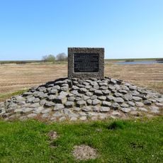
Afsluitdijk, Dam between North Holland and Friesland, Netherlands
The Afsluitdijk is a 32.5 kilometer long dam between North Holland and Friesland that carries a road and bicycle path over former seawater. The structure runs straight across the water and connects two provinces directly to each other.
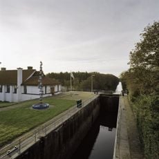
Construction started in 1927 using artificial work islands for support and finished in 1932 after closing off the former Zuiderzee. The project transformed the saltwater sea into the freshwater lake called the Ijsselmeer and marked a turning point in Dutch water management.
The name comes from the Dutch word "afsluiten," meaning to seal off, reflecting the dam's role in blocking the sea. Visitors here experience the direct transition between two provinces while crossing open water.
Drivers need about half an hour to cross, while cyclists should plan for over an hour depending on wind conditions. Wind can be strong on the open water, so appropriate clothing is important and stability on the exposed route is necessary.
Some sections of the dam construction use the difference between salt and fresh water to generate energy. Completing the dam reduced the total coastline of the Netherlands by approximately 300 kilometers.
Location: Súdwest-Fryslân
Location: Hollands Kroon
Inception: 1932
Length: 32,500 m
Part of: Zuiderzee Works
GPS coordinates: 53.00000,5.16667
Latest update: December 18, 2025 15:40
Afsluitdijk and Stevinsluizen in Den Oever
11.1 km
Nederlands Hervormde Kerk, Den Oever
12.9 km
Vlietermonument
5.2 km
Vlieter
5.7 km
Zendmast Wieringermeer
12.5 km
Stelling bij Den Oever
11.1 km
Den Oever Lighthouse
11.2 km
Gemaal Leemans
12.3 km
De Hoop
11.8 km
Heidense Kapel
14.4 km
Stroeërweg 39, Stroe
14.5 km
Monument op de Noorderdijkweg
13.8 km
Villa Nieuwland
13 km
Leemans: schutsluis met brug
12.3 km
Standbeeld Cornelis Lely (Afsluitdijk)
5.4 km
Steenzetter
5.2 km
Stroeërweg 29, Stroe
14.8 km
Tower of Michaëlskerk
12.9 km
Leemans: dieselolietanks
12.3 km
Leemans: machinegebouw
12.3 km
Vrijstaande villa met garage
16.4 km
Stroeërweg 7, Hippolytushoef
15.4 km
Hoge Elft 1, Hippolytushoef
16.2 km
Provinciegrenspaal
54 m
Ingenieurswoning, vrijstaand woonhuis, gebouwd in het kader van de Zuiderzeewerken ten behoeve van de huisvesting van hoger personeel
13 km
Peilschaalgebouw
11.5 km
Stelling bij Den Oever: XII (machinekamer en hulpverbandplaats)
11.1 km
Stelling bij Den Oever: Kazemat II (enkele mitrailleurkazemat)
10.2 kmVisited this place? Tap the stars to rate it and share your experience / photos with the community! Try now! You can cancel it anytime.
Discover hidden gems everywhere you go!
From secret cafés to breathtaking viewpoints, skip the crowded tourist spots and find places that match your style. Our app makes it easy with voice search, smart filtering, route optimization, and insider tips from travelers worldwide. Download now for the complete mobile experience.
A unique approach to discovering new places❞
— Le Figaro
All the places worth exploring❞
— France Info
A tailor-made excursion in just a few clicks❞
— 20 Minutes