Enable Location

We need your location to show you interesting places around you

Discover nearby places

Find interesting locations and hidden gems around you

Precise directions

Get accurate directions and distances to places

Your location is never shared with other users. It's only used when you tap the location button.

Merwede canal

Log in to your account

Start exploring — it's free

Trusted by 63,232 travelers worldwide

Continue with Google
Continue with Apple
or

We will send you a code to connect

By continuing, you accept our Terms and Conditions and our Privacy Policy

Check your inbox

We've sent a pincode in your inbox. Please enter the code below.

Merwede canal
Discussion Reviews 1 Photos
11.3k Popularity

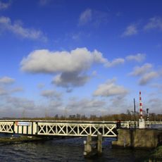
Merwede canal, Navigational waterway between Utrecht and Gorinchem, Netherlands

The Merwede Canal is a shipping route that runs from Utrecht to Gorinchem and passes through multiple provinces. This waterway links the Amsterdam-Rhine Canal with the Upper Merwede and serves as a key commercial passage for inland vessels.

Work on the canal began in 1881 under Minister Klerck's direction and reused sections of the older Keulse Vaart. When it opened in 1892, it established an important new connection between two major river systems.

Along the canal banks in Utrecht, numerous stone buildings, including De Munt factory, represent the industrial heritage that shaped the region's development.

The waterway is passable for Class IV vessels and does not charge tolls for passing through bridges or locks. Boat operators should be familiar with local conditions and plan their route carefully.

Where the canal crosses the Amsterdam-Rhine Canal between Nieuwegein and Utrecht, two major shipping routes intersect at a notable junction. This spot serves as a key navigation landmark for boat operators traveling the region.

The community of curious travelers

AroundUs brings together thousands of curated places, local tips, and hidden gems, enriched daily by 60,000 contributors worldwide.

Start exploring
Location
Location
GPS coordinates
51.96194,5.06861
Latest update
December 8, 2025 13:41
Around this place
Nederlands Hervormde Kerk, Lexmond
Netherlands

Nederlands Hervormde Kerk, Lexmond

2.2 km
Bolgerijense Brug
Netherlands

Bolgerijense Brug

814 m
Hei- en Boeicopseweg 134, Hei- en Boeicop
Netherlands

Hei- en Boeicopseweg 134, Hei- en Boeicop

1.5 km
Gereformeerde Kerk Hoeksteen
Netherlands

Gereformeerde Kerk Hoeksteen

2.5 km
Nederlands Hervormde Kerk, Hei- en Boeicop
Netherlands

Nederlands Hervormde Kerk, Hei- en Boeicop

2.1 km
Hei- en Boeicopseweg 24, Hei- en Boeicop
Netherlands

Hei- en Boeicopseweg 24, Hei- en Boeicop

2.3 km
Hei- en Boeicopseweg 143, Hei- en Boeicop
Netherlands

Hei- en Boeicopseweg 143, Hei- en Boeicop

1.6 km
Huize Killestein
Netherlands

Huize Killestein

2 km
Hei- en Boeicopseweg 73, Hei- en Boeicop
Netherlands

Hei- en Boeicopseweg 73, Hei- en Boeicop

2 km
Hei- en Boeicopseweg 80, Hei- en Boeicop
Netherlands

Hei- en Boeicopseweg 80, Hei- en Boeicop

1.8 km
Hei- en Boeicopseweg 26, Hei- en Boeicop
Netherlands

Hei- en Boeicopseweg 26, Hei- en Boeicop

2.3 km
Helsdingse Achterweg 22, Vianen
Netherlands

Helsdingse Achterweg 22, Vianen

1.7 km
Hei- en Boeicopseweg 40, Hei- en Boeicop
Netherlands

Hei- en Boeicopseweg 40, Hei- en Boeicop

2.2 km
Hei- en Boeicopseweg 65, Hei- en Boeicop
Netherlands

Hei- en Boeicopseweg 65, Hei- en Boeicop

2 km
Hei- en Boeicopseweg 55, Hei- en Boeicop
Netherlands

Hei- en Boeicopseweg 55, Hei- en Boeicop

2.1 km
Hei- en Boeicopseweg 163, Hei- en Boeicop
Netherlands

Hei- en Boeicopseweg 163, Hei- en Boeicop

1.8 km
Hei- en Boeicopseweg 168, Hei- en Boeicop
Netherlands

Hei- en Boeicopseweg 168, Hei- en Boeicop

1.8 km
Dorpsstraat 65, Lexmond
Netherlands

Dorpsstraat 65, Lexmond

2.2 km
Hei- en Boeicopseweg 92, Hei- en Boeicop
Netherlands

Hei- en Boeicopseweg 92, Hei- en Boeicop

1.6 km
De Laak 27, Lexmond
Netherlands

De Laak 27, Lexmond

2.2 km
Kom Lekdijk 1, Lexmond
Netherlands

Kom Lekdijk 1, Lexmond

2.3 km
Hei- en Boeicopseweg 21, Hei- en Boeicop
Netherlands

Hei- en Boeicopseweg 21, Hei- en Boeicop

2.4 km
Kapel, verbouwd tot boerderij
Netherlands

Kapel, verbouwd tot boerderij

2 km
Hei- en Boeicopseweg 57, Hei- en Boeicop
Netherlands

Hei- en Boeicopseweg 57, Hei- en Boeicop

2 km
Hei- en Boeicopseweg 121, Hei- en Boeicop
Netherlands

Hei- en Boeicopseweg 121, Hei- en Boeicop

1.7 km
Hei- en Boeicopseweg 104-108, Hei- en Boeicop
Netherlands

Hei- en Boeicopseweg 104-108, Hei- en Boeicop

1.6 km
Schuur in Ambachtelijk-traditionele bouwtrant, als onderdeel van de boerderij
Netherlands

Schuur in Ambachtelijk-traditionele bouwtrant, als onderdeel van de boerderij

1.7 km
Schuur in Ambachtelijke-traditionele bouwtrant, als onderdeel van de boerderij
Netherlands

Schuur in Ambachtelijke-traditionele bouwtrant, als onderdeel van de boerderij

1.7 km
Show the full map
Reviews
Share your experience

No review yet

Discussions
Start a discussion...

No discussion yet

« Merwede canal - Navigational waterway between Utrecht and Gorinchem, Netherlands » is provided by Around Us (aroundus.com). Images and texts are derived from Wikimedia project under a Creative Commons license. You are allowed to copy, distribute, and modify copies of this page, under the conditions set by the license, as long as this note is clearly visible.

Discover hidden gems everywhere you go!

From secret cafés to breathtaking viewpoints, skip the crowded tourist spots and find places that match your style. Our app makes it easy with voice search, smart filtering, route optimization, and insider tips from travelers worldwide. Download now for the complete mobile experience.

Around Us App Screenshot

A unique approach to discovering new places

Le Figaro

All the places worth exploring

France Info

A tailor-made excursion in just a few clicks

20 Minutes

Around Us
Travel Guide & Maps
Download

Send to your phone

QR Code
1

Open the camera app on your mobile.

2

Point at the QR code with your camera. A notification will appear.

3

Tap the notification to open the link.