Enable Location

We need your location to show you interesting places around you

Discover nearby places

Find interesting locations and hidden gems around you

Precise directions

Get accurate directions and distances to places

Your location is never shared with other users. It's only used when you tap the location button.

Vliegveld Keent

Log in to your account

Start exploring — it's free

Trusted by 62,938 travelers worldwide

Continue with Google
Continue with Apple
or

We will send you a code to connect

By continuing, you accept our Terms and Conditions and our Privacy Policy

Check your inbox

We've sent a pincode in your inbox. Please enter the code below.

Vliegveld Keent
Discussion Reviews 1 Photos
1.2k Popularity

Vliegveld Keent, Former airfield in Oss, Netherlands.

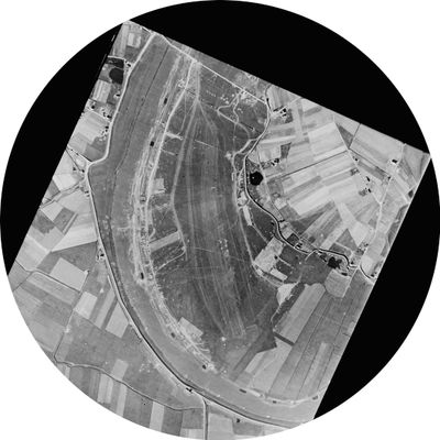
Vliegveld Keent is a former airfield near Oss situated on grassland beside the Meuse River, with a runway approximately 1200 meters long that once handled both civilian and military aircraft. The grounds retain the basic layout of this aviation infrastructure, though no longer in active use.

The airfield was established in 1933 through a partnership between KLM and a local flight training school. During World War II it served as Allied airstrip B82 during Operation Market Garden in 1944, supporting air operations across the region.

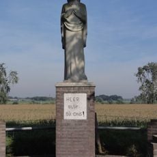
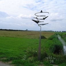
The site reflects its role during World War II through the layout of the grounds and the presence of commemorative markers placed by and for soldiers who passed through. Visitors can sense how this location connected different nations during wartime operations.

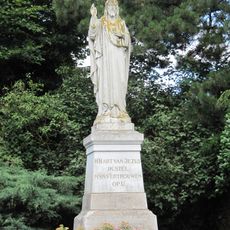
The site is readily accessible by road from Oss and forms part of the Liberation Route network marking World War II heritage across the region. A memorial monument established in 1995 serves as a clear landmark for visitors exploring the grounds.

In 1938 the canalization of the Meuse River isolated the airfield on an island, fundamentally changing its future and making civilian operations increasingly difficult. This physical transformation created the conditions that would eventually shift its role toward military aviation.

The community of curious travelers

AroundUs brings together thousands of curated places, local tips, and hidden gems, enriched daily by 60,000 contributors worldwide.

Start exploring
Location
Oss
GPS coordinates
51.76556,5.68722
Latest update
December 14, 2025 18:05
Reviews
Share your experience

No review yet

Discussions
Start a discussion...

No discussion yet

« Vliegveld Keent - Former airfield in Oss, Netherlands » is provided by Around Us (aroundus.com). Images and texts are derived from Wikimedia project under a Creative Commons license. You are allowed to copy, distribute, and modify copies of this page, under the conditions set by the license, as long as this note is clearly visible.

Discover hidden gems everywhere you go!

From secret cafés to breathtaking viewpoints, skip the crowded tourist spots and find places that match your style. Our app makes it easy with voice search, smart filtering, route optimization, and insider tips from travelers worldwide. Download now for the complete mobile experience.

Around Us App Screenshot

A unique approach to discovering new places

Le Figaro

All the places worth exploring

France Info

A tailor-made excursion in just a few clicks

20 Minutes

Around Us
Travel Guide & Maps
Download

Send to your phone

QR Code
1

Open the camera app on your mobile.

2

Point at the QR code with your camera. A notification will appear.

3

Tap the notification to open the link.