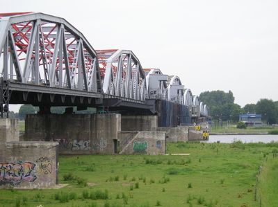
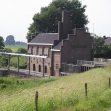
John S. Thompsonbrug, Steel bridge across Maas River in Grave, Netherlands.
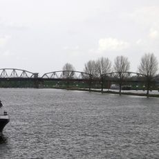
The John S. Thompsonbrug is a steel bridge crossing the Maas River and connecting the municipalities of Grave and Nederasselt. It features multiple traffic lanes alongside separate bicycle paths, serving both vehicles and cyclists.
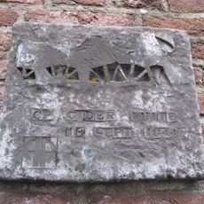
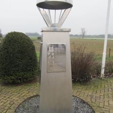
The bridge was built in 1929 and became strategically important in 1944 when it was secured by Lieutenant Thompson's unit during Operation Market Garden against German forces. This wartime action later inspired its naming in commemoration of his leadership.
The bridge serves as a key crossing point where cars and cyclists share the same structure, making it part of daily life for people moving between the two river banks. Its practical design reflects how the Dutch integrate transport needs into their landscape.
The bridge underwent comprehensive renovation in 2022 that strengthened its structure, refreshed its paint, and improved both the road surface and cycling paths. Visitors will find it in good condition for crossing on foot or by vehicle.
The bridge received its current name in 2004 to honor Lieutenant Thompson's bravery, with his widow attending the dedication ceremony. This personal tribute transforms it into something more than just an engineering structure.
Location: Grave
Official opening: 1929
Address: Rijksweg 321
GPS coordinates: 51.76917,5.73611
Latest update: December 11, 2025 18:02
Weir and lock complex Grave
30 m
Sint Elisabethskerk, Grave
1.1 km
Protestantse Kerk
1 km
Gemaal van Sasse
406 m
Maaspoort, Grave
1 km
Nederlands Hervormde Kerk
595 m
Mobilisatie-monument
1 km
Lage(n) Hoed
760 m
Maasstraat 18, Grave
1 km
Bagijnenstraat 5, Grave
1 km
Maasstraat 15, Grave
1.1 km
Maasstraat 6, Grave
1.1 km
Cider White
1.1 km
Maasstraat 8, Grave
1.1 km
Maasstraat 19, Grave
1.1 km
Hoeve op T-vormige plattegrond met woongedeelte onder strodak
611 m
Maasstraat 12, Grave
1.1 km
Maasstraat 14, Grave
1 km
Maasstraat 10, Grave
1.1 km
Kosterij
596 m
Maasstraat 21, Grave
1.1 km
Brugkazemat Grave Noord en Zuid
510 m
Voormalig wachthuis, thans benzinepompstation. Gebouwtje met dichtgemetselde bogen, waarvan de aanzetten en sluitstenen in natuursteen. In de vulwanden later weer vensters en een deur uitgebroken.
1 km
Hoofdwagt 3, Grave
1.1 km
Monument aan de Hoofdwagt
1.1 km
Monument aan de Maaskade
1 km
Bevrijdingsteken
329 m
Bagijnenstraat 1A, Grave
1 kmVisited this place? Tap the stars to rate it and share your experience / photos with the community! Try now! You can cancel it anytime.
Discover hidden gems everywhere you go!
From secret cafés to breathtaking viewpoints, skip the crowded tourist spots and find places that match your style. Our app makes it easy with voice search, smart filtering, route optimization, and insider tips from travelers worldwide. Download now for the complete mobile experience.
A unique approach to discovering new places❞
— Le Figaro
All the places worth exploring❞
— France Info
A tailor-made excursion in just a few clicks❞
— 20 Minutes