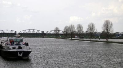
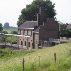
Weir and lock complex Grave, Weir and lock complex in North Brabant, Netherlands.
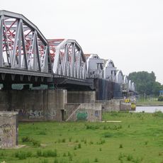
The weir and lock complex on the Meuse River controls water levels and allows vessels to pass between different heights through multiple chamber sections. The John S. Thompson bridge runs nearby, providing road connection across the waterway.
The complex developed as part of major transformations to the Meuse River course that reshaped water transportation and management in the Netherlands over many generations. These changes significantly improved inland navigation capabilities.
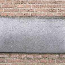
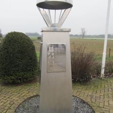
The complex holds status as a protected Dutch heritage monument, reflecting the nation's commitment to preserving engineering achievements in water management. Walking around the site, you can observe how the structure integrates with the river landscape and supports ongoing maritime activities.
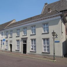
Access to the site is generally straightforward, though viewing is best from public areas around the facility. Parking and walkways are available for visitors who want to observe the structure up close.
The complex sits exactly at the border between two Dutch provinces, making it a point where infrastructure serves both regions equally. This boundary location shows how water management projects connect and benefit multiple areas at once.
Location: Grave
Location: Heumen
Location: Gelderland
Location: North Brabant
Part of: Meuse channeling
GPS coordinates: 51.76917,5.73655
Latest update: December 12, 2025 07:57
John S. Thompsonbrug
30 m
Sint Elisabethskerk, Grave
1.1 km
Protestantse Kerk
1 km
Gemaal van Sasse
436 m
Maaspoort, Grave
1 km
Nederlands Hervormde Kerk
566 m
Mobilisatie-monument
993 m
Bagijnenstraat 5, Grave
1 km
Maasstraat 18, Grave
1 km
Maasstraat 15, Grave
1.1 km
Maasstraat 6, Grave
1.1 km
Lage(n) Hoed
731 m
Maasstraat 19, Grave
1.1 km
Cider White
1.1 km
Maasstraat 8, Grave
1.1 km
Hoeve op T-vormige plattegrond met woongedeelte onder strodak
602 m
Hoofdwagt 3, Grave
1.1 km
Maasstraat 14, Grave
1 km
Maasstraat 12, Grave
1 km
Maasstraat 10, Grave
1.1 km
Kosterij
567 m
Maasstraat 21, Grave
1 km
Brugkazemat Grave Noord en Zuid
532 m
Voormalig wachthuis, thans benzinepompstation. Gebouwtje met dichtgemetselde bogen, waarvan de aanzetten en sluitstenen in natuursteen. In de vulwanden later weer vensters en een deur uitgebroken.
1 km
Monument aan de Hoofdwagt
1.1 km
Monument aan de Maaskade
1 km
Bevrijdingsteken
356 m
Bagijnenstraat 1A, Grave
1 kmVisited this place? Tap the stars to rate it and share your experience / photos with the community! Try now! You can cancel it anytime.
Discover hidden gems everywhere you go!
From secret cafés to breathtaking viewpoints, skip the crowded tourist spots and find places that match your style. Our app makes it easy with voice search, smart filtering, route optimization, and insider tips from travelers worldwide. Download now for the complete mobile experience.
A unique approach to discovering new places❞
— Le Figaro
All the places worth exploring❞
— France Info
A tailor-made excursion in just a few clicks❞
— 20 Minutes