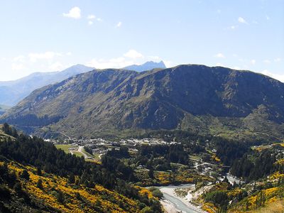
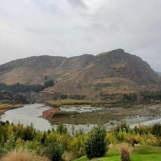
Queenstown Hill, Summit at 907 meters in Otago Region, New Zealand
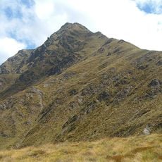
Queenstown Hill is a mountain rising over 900 meters in Otago Region, New Zealand. The slopes are covered with dense forests of douglas fir and larch trees that give way to native tussock grassland near the top.
The area was home to Māori people before becoming a focus during the gold rush boom of the 1860s. Panels along the walking route document these key periods in the region's past.
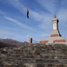
A sculpture at the summit incorporates local materials and designs reflecting the connection between the land and those who live here. This artwork expresses how the community relates to the landscape surrounding Queenstown.
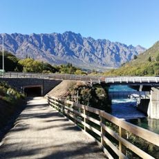
The walking track begins at Belfast Terrace and takes about three hours for a round trip. Dogs on leashes are permitted for the first half of the route.
A flock of about 1800 sheep grazes on the mountainside, continuing farming practices that began in the 1960s. This long-standing agricultural use shapes how the mountain looks today.
Location: Otago Region
Elevation above the sea: 907 m
GPS coordinates: -45.00867,168.69242
Latest update: December 6, 2025 17:42
New Zealand provides photographic subjects ranging from the Southern Alps to sand beaches on both coastlines. The landscape includes thermal springs in Rotorua, glaciers like Franz Josef and Tasman, and fjords in Fiordland. Mount Cook dominates the alpine region while the Coromandel Peninsula holds beaches including Hot Water Beach and Cathedral Cove. The Tongariro Alpine Crossing traverses volcanic terrain and Mount Taranaki rises above Taranaki. Coastal formations like the Moeraki Boulders, Split Apple Rock and Nugget Point demonstrate geological variety. Natural waterfalls including Purakaunui Falls and Whangarei Falls sit among native forests. Cultural sites complement the natural geography. The Hobbiton Movie Set near Matamata displays the film location from the Tolkien adaptation. Larnach Castle near Dunedin represents colonial architecture. Te Puia and Wai-O-Tapu demonstrate geothermal activity with geysers and colored pools. Waitomo Caves contains glowworm caverns. Lake Tekapo offers clear night skies for stargazing. Viewpoints like Roy's Peak near Wanaka and Queenstown Hill sit above lake landscapes. Remote regions including Cape Reinga at the northern tip and Cape Palliser in the Wairarapa show different coastal environments. The Forgotten World Highway crosses historic mountain country on the North Island.
Coronet Peak
11 km
Ben Lomond
6.1 km
Queenstown Gardens
4.1 km
Lake Alta
11.1 km
Edith Cavell bridge
2.8 km
Eichardt's Hotel
3.7 km
Skycity Queenstown
3.6 km
Kiwi Park
3.5 km
Hulbert House
3.2 km
St Joseph's Church
3.3 km
Arrowtown Powder Magazine
13 km
Patersons Pass
10.6 km
Woodrow Bakers and Confectioners
3.6 km
Lake Lodge of Ophir
3.7 km
Courthouse
3.4 km
Kawarau Falls Dam
3.9 km
House
3.2 km
Coronation Bath House
3.7 km
Arrowtown and Districts War Memorial
13.2 km
Sew Hoys Big Beach Claim Historic Area
3.1 km
The Stable, Queenstown
3.7 km
Stone-lined Channel
3.3 km
Lake County Council Chambers
3.4 km
Queenstown Library and Reading Room
3.4 km
Boyne’s General Store
3.6 km
St Peter's Vicarage
3.6 km
Forresters Lodge
3.4 km
Ballarat St Bridge
3.5 kmReviews
Visited this place? Tap the stars to rate it and share your experience / photos with the community! Try now! You can cancel it anytime.
Discover hidden gems everywhere you go!
From secret cafés to breathtaking viewpoints, skip the crowded tourist spots and find places that match your style. Our app makes it easy with voice search, smart filtering, route optimization, and insider tips from travelers worldwide. Download now for the complete mobile experience.
A unique approach to discovering new places❞
— Le Figaro
All the places worth exploring❞
— France Info
A tailor-made excursion in just a few clicks❞
— 20 Minutes