Enable Location

We need your location to show you interesting places around you

Discover nearby places

Find interesting locations and hidden gems around you

Precise directions

Get accurate directions and distances to places

Your location is never shared with other users. It's only used when you tap the location button.

Pozuzo District

Log in to your account

Start exploring — it's free

Trusted by 62,869 travelers worldwide

Continue with Google
Continue with Apple
or

We will send you a code to connect

By continuing, you accept our Terms and Conditions and our Privacy Policy

Check your inbox

We've sent a pincode in your inbox. Please enter the code below.

Pozuzo District

Pozuzo District, German-Austrian settlement district in Oxapampa Province, Peru

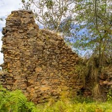
Pozuzo District is an administrative area in Oxapampa Province in eastern Peru. The territory covers hilly land with thick vegetation at elevations between roughly 700 and 1000 meters.

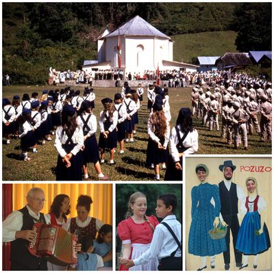
The district was established when European settlers from Tyrol and Prussia arrived in 1857 and settled there starting in 1859. The community kept its isolated location and European identity for many generations.

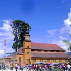
Local residents still speak German at home and keep European traditions alive through daily practices and celebrations. You can see this in wooden houses with pitched roofs and in festivals that reflect the heritage of their ancestors.

The area has mild weather with temperatures between roughly 19 and 30 degrees Celsius year-round. Rain falls regularly and heavily, so bring rain gear and expect wet paths and muddy ground.

The district was completely cut off from the outside world until 1976, when the first road to nearby Oxapampa was built. This long isolation helped the community preserve its original German-speaking culture to this day.

The community of curious travelers

AroundUs brings together thousands of curated places, local tips, and hidden gems, enriched daily by 60,000 contributors worldwide.

Start exploring
Capital city
Pozuzo
Elevation above the sea
1,000 m
Shares border with
Palcazu, Huancabamba, Huachón, Ticlacayán, Panao District, Chaglla District, Codo del Pozuzo District
GPS coordinates
-10.06961,-75.55068
Latest update
December 22, 2025 21:32
« Pozuzo District - German-Austrian settlement district in Oxapampa Province, Peru » is provided by Around Us (aroundus.com). Images and texts are derived from Wikimedia project under a Creative Commons license. You are allowed to copy, distribute, and modify copies of this page, under the conditions set by the license, as long as this note is clearly visible.

Discover hidden gems everywhere you go!

From secret cafés to breathtaking viewpoints, skip the crowded tourist spots and find places that match your style. Our app makes it easy with voice search, smart filtering, route optimization, and insider tips from travelers worldwide. Download now for the complete mobile experience.

Around Us App Screenshot

A unique approach to discovering new places

Le Figaro

All the places worth exploring

France Info

A tailor-made excursion in just a few clicks

20 Minutes

Around Us
Travel Guide & Maps
Download

Send to your phone

QR Code
1

Open the camera app on your mobile.

2

Point at the QR code with your camera. A notification will appear.

3

Tap the notification to open the link.