Basco, Administrative center in Batanes, Philippines
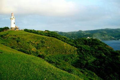
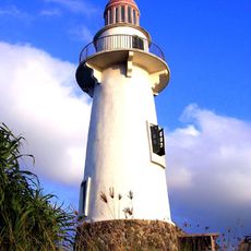
Basco sits on Batan Island and consists of mountainous terrain, coastline, and traditional stone structures spread across several districts. The town blends natural geography with settled areas where buildings integrate into the landscape.
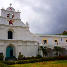
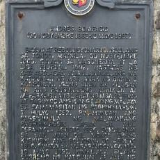
Spanish Governor Jose Basco founded this settlement in 1783, bringing organized administration and Christian influences to the remote northern islands. This founding marked a turning point for the island community.
The Ivatan people maintain their heritage through stone house construction, fishing traditions, and shared agricultural practices that shape community life. These customs remain visible in how the town is built and how people spend their days.
The airport in Basco connects to Manila and mainland cities, while getting around locally depends on small vehicles navigating hilly terrain. Roads go through varied landscapes, so allowing extra time for travel is wise.
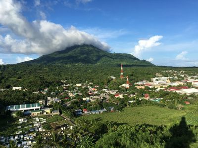
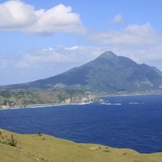
Mount Iraya rises over 1000 meters and creates a microclimate that brings unusually cool temperatures to this tropical region. This geographical feature makes the area feel different from most other Philippine settlements.
Location: Batanes
Elevation above the sea: 23.4 m
Reference: 0200901000
Shares border with: Itbayat, Mahatao
GPS coordinates: 20.45000,121.96667
Latest update: December 20, 2025 14:31
Mount Iraya
5 km
Basco Lighthouse
313 m
San Carlos Borromeo Parish Church
4.3 km
Kenan Aman Dangat historical marker
303 m
Jose Rizal historical marker
233 m
Church of Mahatao historical marker
4.3 km
Church of Basco historical marker
290 m
Batanes High School historical marker
137 m
Andres Bonifacio historical marker
10 km
Church of Ivana historical marker
10.8 km
Casa Real historical marker
326 mRacuh a Idi
6.1 kmMaydangob
6.1 kmNovita House
612 mSongsong Ruins
10.4 kmJapanese Tunnel
1.5 kmNakamaya Burial Grounds
3.5 kmRakuh-a-idi Spring
4.8 kmPlaya de Diura
5.4 kmImnajbu Beach
8.5 kmNur Ubian
10.4 kmValugan Boulder Beach
2.6 kmVayang Rolling Hills
1.7 kmAlapad Rock Formation
9.2 kmNaidi Hills
427 mScenic viewpoint
10.8 kmScenic viewpoint
2.2 kmIvana Port
10.9 kmVisited this place? Tap the stars to rate it and share your experience / photos with the community! Try now! You can cancel it anytime.
Discover hidden gems everywhere you go!
From secret cafés to breathtaking viewpoints, skip the crowded tourist spots and find places that match your style. Our app makes it easy with voice search, smart filtering, route optimization, and insider tips from travelers worldwide. Download now for the complete mobile experience.
A unique approach to discovering new places❞
— Le Figaro
All the places worth exploring❞
— France Info
A tailor-made excursion in just a few clicks❞
— 20 Minutes