Enable Location

We need your location to show you interesting places around you

Discover nearby places

Find interesting locations and hidden gems around you

Precise directions

Get accurate directions and distances to places

Your location is never shared with other users. It's only used when you tap the location button.

Mount Iraya

Log in to your account

Start exploring — it's free

Trusted by 62,090 travelers worldwide

Continue with Google
Continue with Apple
or

We will send you a code to connect

By continuing, you accept our Terms and Conditions and our Privacy Policy

Check your inbox

We've sent a pincode in your inbox. Please enter the code below.

Mount Iraya

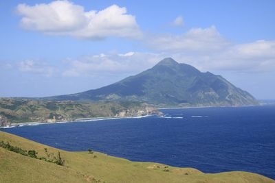
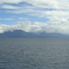
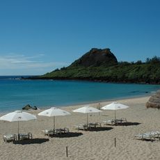
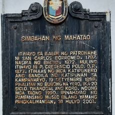
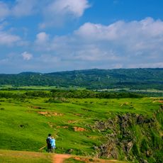
Mount Iraya, Stratovolcano in Batan Island, Philippines.

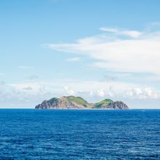
Mount Iraya is a stratovolcano on Batan Island that rises to 1,009 meters with a base diameter of roughly 5,500 meters. The mountain's distinctive cone shape dominates the island's landscape and is visible from various points around it.

The last recorded volcanic eruption of this mountain occurred in 1454, marking a significant moment in the region's geological history. Since then, it has remained geologically active but without major eruptions.

The Ivatan people view this mountain as sacred, with local stories describing it as a protective maternal figure for the communities below. This spiritual connection shapes how residents interact with and regard the landscape around them.

Visitors access this mountain through guided tours departing from Basco and should bring proper hiking equipment while checking weather conditions before climbing. Conditions on the mountain can change quickly, making good preparation essential.

This mountain is the northernmost active volcano in the Philippines, positioned within the Luzon-Taiwan Arc volcanic belt. Its location at this geological frontier makes it scientifically significant for understanding the region's volcanic system.

The community of curious travelers

AroundUs brings together thousands of curated places, local tips, and hidden gems, enriched daily by 60,000 contributors worldwide.

Start exploring
Location
Location
Location
Location
Elevation above the sea
1,009 m
GPS coordinates
20.46668,122.01159
Latest update
December 7, 2025 19:24
« Mount Iraya - Stratovolcano in Batan Island, Philippines » is provided by Around Us (aroundus.com). Images and texts are derived from Wikimedia project under a Creative Commons license. You are allowed to copy, distribute, and modify copies of this page, under the conditions set by the license, as long as this note is clearly visible.

Discover hidden gems everywhere you go!

From secret cafés to breathtaking viewpoints, skip the crowded tourist spots and find places that match your style. Our app makes it easy with voice search, smart filtering, route optimization, and insider tips from travelers worldwide. Download now for the complete mobile experience.

Around Us App Screenshot

A unique approach to discovering new places

Le Figaro

All the places worth exploring

France Info

A tailor-made excursion in just a few clicks

20 Minutes

Around Us
Travel Guide & Maps
Download

Send to your phone

QR Code
1

Open the camera app on your mobile.

2

Point at the QR code with your camera. A notification will appear.

3

Tap the notification to open the link.