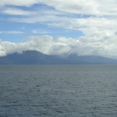
Smith Volcano, Active volcano in Babuyan Islands, Philippines
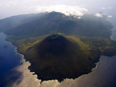
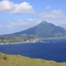
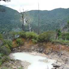
Smith Volcano is an active mountain on Babuyan Island in the Philippines, rising 688 meters (2257 feet) above sea level and forming a cinder cone with a base diameter of roughly 4.5 kilometers (2.8 miles). The summit shows signs of ongoing fumarolic activity, with occasional steam and sulfur gases emerging from several openings in the crater area.
The first recorded eruption took place in 1652, when Spanish chroniclers documented ash falls and thunder sounds on neighboring islands. The last major outbreak occurred in 1924, ending a series of six documented events across the centuries.
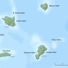
Residents of the Calayan municipality call the mountain Mount Babuyan, after the island's former name, and watch for smoke plumes and sulfur smells to detect changes in activity. Fishers from the region use the cone's outline as a navigation reference when moving through the waters north of Luzon.
Reaching the island requires permission from authorities in Calayan and a boat crossing that depends on weather and wave conditions. The climb itself demands good physical fitness, as the trail passes over loose rock and steep sections with no permanent infrastructure.
The cone is built from five geological centers that developed from the Pleistocene to the Holocene, forming a complex mosaic of overlapping lava flows. This structure is visible in the varied weathering colors of the rock layers along the flanks.
The community of curious travelers
AroundUs brings together thousands of curated places, local tips, and hidden gems, enriched daily by 60,000 contributors worldwide.