Enable Location

We need your location to show you interesting places around you

Discover nearby places

Find interesting locations and hidden gems around you

Precise directions

Get accurate directions and distances to places

Your location is never shared with other users. It's only used when you tap the location button.

Magapit Protected Landscape

Log in to your account

Start exploring — it's free

Trusted by 62,077 travelers worldwide

Continue with Google
Continue with Apple
or

We will send you a code to connect

By continuing, you accept our Terms and Conditions and our Privacy Policy

Check your inbox

We've sent a pincode in your inbox. Please enter the code below.

Magapit Protected Landscape

Magapit Protected Landscape, Protected landscape in Cagayan Valley, Philippines

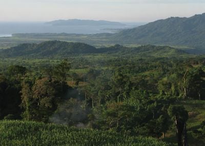
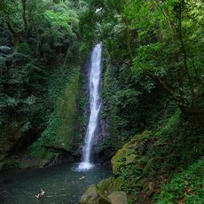
The Magapit Protected Landscape is a forested area spanning limestone hills and grasslands situated between Lal-lo and Gattaran in Cagayan Valley on northern Luzon. The terrain contains mixed forest types that grow across different geological formations, creating varied habitats throughout the zone.

The area was established as a game refuge and bird sanctuary in 1947 under President Manuel Roxas to protect the natural environment. This early conservation effort reflected the recognition of the landscape's ecological value for future generations.

The protected zone contains ancient shell midden sites at Lal-lo and Gattaran where visitors can observe traces of human settlement spanning many centuries. These archaeological locations reveal how communities once lived and gathered resources in this landscape.

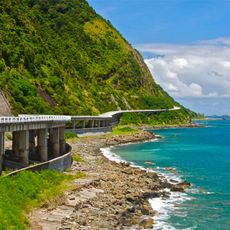
Access to the area is via Santa Ana Road from Port San Vicente or through the Pan-Philippine Highway using the Magapit Suspension Bridge. Visitors should prepare for changing terrain conditions and wear sturdy footwear when exploring the natural landscape.

The landscape harbors rare tree species including tanguile, white lauan, red lauan, and natural stands of narek across its limestone formations. This forest composition makes the area botanically significant for preserving these species.

The community of curious travelers

AroundUs brings together thousands of curated places, local tips, and hidden gems, enriched daily by 60,000 contributors worldwide.

Start exploring
Inception
1947
GPS coordinates
18.20140,121.66400
Latest update
December 14, 2025 09:41
« Magapit Protected Landscape - Protected landscape in Cagayan Valley, Philippines » is provided by Around Us (aroundus.com). Images and texts are derived from Wikimedia project under a Creative Commons license. You are allowed to copy, distribute, and modify copies of this page, under the conditions set by the license, as long as this note is clearly visible.

Discover hidden gems everywhere you go!

From secret cafés to breathtaking viewpoints, skip the crowded tourist spots and find places that match your style. Our app makes it easy with voice search, smart filtering, route optimization, and insider tips from travelers worldwide. Download now for the complete mobile experience.

Around Us App Screenshot

A unique approach to discovering new places

Le Figaro

All the places worth exploring

France Info

A tailor-made excursion in just a few clicks

20 Minutes

Around Us
Travel Guide & Maps
Download

Send to your phone

QR Code
1

Open the camera app on your mobile.

2

Point at the QR code with your camera. A notification will appear.

3

Tap the notification to open the link.