Rosales, Municipality in Pangasinan, Philippines
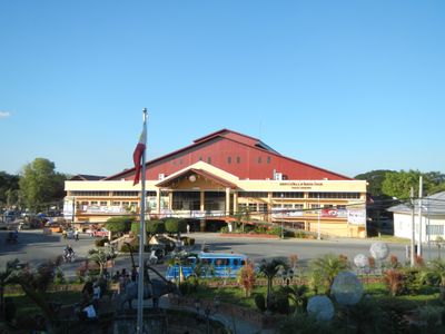
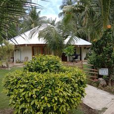
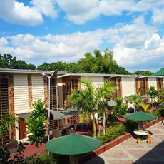
Rosales is a municipality in Pangasinan province with territory divided into multiple barangays that mix agricultural areas with residential neighborhoods. The landscape lies at a relatively low elevation and supports both farming and community settlements.
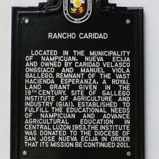
The municipality was established in 1852 through a royal decree during Spanish colonial administration. This founding shaped the settlement pattern and institutional framework that exist today.
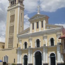
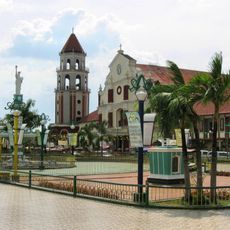
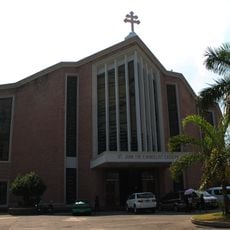
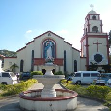
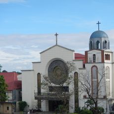
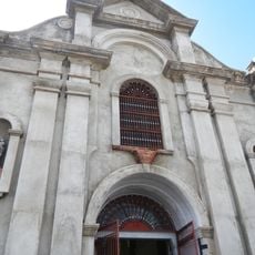
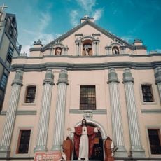
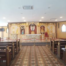
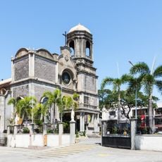
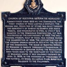
The St. Anthony of Padua Parish Church remains central to community life and reflects the religious traditions that shape local customs. You can observe how people gather here for celebrations and daily spiritual practices.
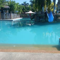
The municipality is accessible via the Tarlac-Pangasinan-La Union Expressway or MacArthur Highway, offering flexible routes for travelers. Temperatures remain warm year-round in this tropical region.
Excavations in 2010 uncovered an ancient unfinished wooden boat near the Lagasit River. This discovery suggests that maritime activities once played an important role in this primarily agricultural area.
Location: Pangasinan
Inception: March 16, 1852
Elevation above the sea: 39 m
Part of: Pangasinan
Shares border with: Villasis, Cuyapo, San Manuel
Website: http://rosales.gov.ph
GPS coordinates: 15.89444,120.63278
Latest update: December 7, 2025 10:08
Our Lady of Manaoag
22.7 km
Manaoag Church
22.7 km
St. Vincent Ferrer Statue
22 km
Apung Mamacalulu
30.9 km
Saint Dominic de Guzman Parish Church
30.8 km
Metropolitan Cathedral of St. John the Evangelist
35.9 km
Urdaneta Cathedral
11.3 km
Saint Ildephonse of Seville Parish Church
23.6 km
Dagupan Church
35.9 km
Bayambang Plaza
21.1 km
Daniel Maramba historical marker
27.4 km
Cuyapo, Nueva Ecija historical marker
13 km
Villa Luisa Resort
32.9 km
Sierra Vista Beach Resort
36.4 km
Silverconcha Wavepool Resort
24.5 km
Saint Vincent Ferrer Prayer Park
21.9 km
Cathedral of Saint Joseph the Worker
39.9 km
Dagupan City Museum
36 km
City of San Carlos historical marker
30.8 km
Central Luzon State University historical marker
36.7 km
Rancho Caridad historical marker
17.4 km
Church of Nuestra Señora de Manaoag historical marker
22.7 km
Gerona Plaza
32.3 km
Seat of the Revolutionary Government of the Philippines historical marker
21.1 km
Church of San Carlos historical marker
30.8 km
Carlos P. Romulo historical marker
32.9 km
Eugenio Perez y Padlan historical marker
24.3 km
Church of Dagupan historical marker
35.9 kmVisited this place? Tap the stars to rate it and share your experience / photos with the community! Try now! You can cancel it anytime.
Discover hidden gems everywhere you go!
From secret cafés to breathtaking viewpoints, skip the crowded tourist spots and find places that match your style. Our app makes it easy with voice search, smart filtering, route optimization, and insider tips from travelers worldwide. Download now for the complete mobile experience.
A unique approach to discovering new places❞
— Le Figaro
All the places worth exploring❞
— France Info
A tailor-made excursion in just a few clicks❞
— 20 Minutes