Enable Location

We need your location to show you interesting places around you

Discover nearby places

Find interesting locations and hidden gems around you

Precise directions

Get accurate directions and distances to places

Your location is never shared with other users. It's only used when you tap the location button.

Coron Island

Log in to your account

Start exploring — it's free

Trusted by 62,070 travelers worldwide

Continue with Google
Continue with Apple
or

We will send you a code to connect

By continuing, you accept our Terms and Conditions and our Privacy Policy

Check your inbox

We've sent a pincode in your inbox. Please enter the code below.

Coron Island

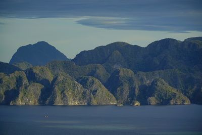
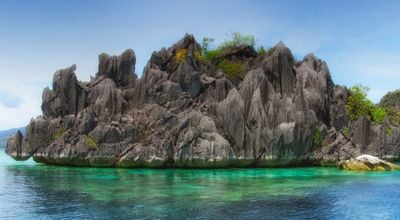
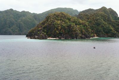
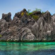
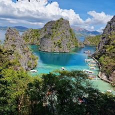
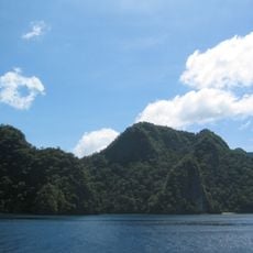
Coron Island, Tentative World Heritage island in Palawan, Philippines.

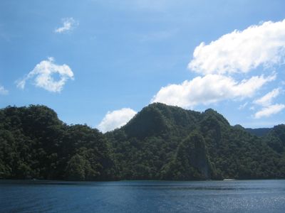
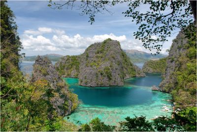
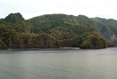
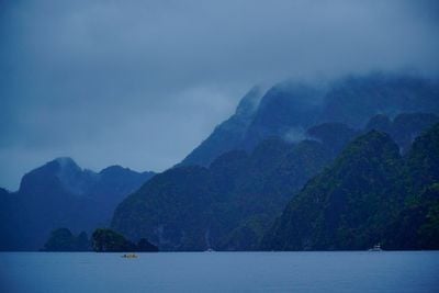
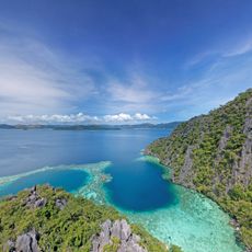
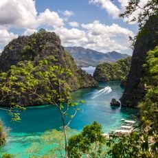
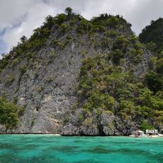
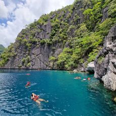
Coron Island is an island off Palawan's coast in the Philippines known for its steep limestone formations rising sharply above the sea. The place contains multiple freshwater lakes and draws visitors interested in diving and snorkeling to explore its waters and surroundings.

Japanese naval vessels sank in these waters during World War II combat operations, leaving wrecks on the seafloor below. These sunken ships now attract divers interested in exploring the underwater sites.

The Tagbanua community has called this island home for generations and shapes daily life here through their customs and way of living. Their connection to the land is visible in how locals interact with the environment and move through the space.

Visitors reach the island by boat from Coron Town, where diving and snorkeling gear is available for rent. Water conditions are most favorable during warmer months when the sea is calmer and visibility improves.

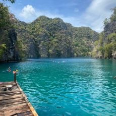
The island contains more than a dozen inland lakes fed by natural springs and filtration, creating unusually clear water. Kayangan Lake, the largest, captivates visitors with its deep blue color and steep limestone banks.

The community of curious travelers

AroundUs brings together thousands of curated places, local tips, and hidden gems, enriched daily by 60,000 contributors worldwide.

Start exploring
Location
Elevation above the sea
600 m
Part of
Calamian Islands
GPS coordinates
11.92000,120.24000
Latest update
December 14, 2025 19:40
Natural landmarks of the Philippines for photography

The Philippines display rice terraces in Ifugao mountains, coral reefs in Tubbataha National Park, and cave systems in Samar. Mayon Volcano shows its geometric shape, while Chocolate Hills of Bohol extend across the landscape. White sand beaches line the coasts of Boracay and Palawan.

The most beautiful sites of the Philippines

The Philippines is an archipelago where nature shows off in every direction. Each island has its own character. You can find white sandy beaches that stretch for kilometers, coral reefs teeming with colorful fish, and lagoons where the water is so transparent you can see straight to the bottom. The...

« Coron Island - Tentative World Heritage island in Palawan, Philippines » is provided by Around Us (aroundus.com). Images and texts are derived from Wikimedia project under a Creative Commons license. You are allowed to copy, distribute, and modify copies of this page, under the conditions set by the license, as long as this note is clearly visible.

Discover hidden gems everywhere you go!

From secret cafés to breathtaking viewpoints, skip the crowded tourist spots and find places that match your style. Our app makes it easy with voice search, smart filtering, route optimization, and insider tips from travelers worldwide. Download now for the complete mobile experience.

Around Us App Screenshot

A unique approach to discovering new places

Le Figaro

All the places worth exploring

France Info

A tailor-made excursion in just a few clicks

20 Minutes

Around Us
Travel Guide & Maps
Download

Send to your phone

QR Code
1

Open the camera app on your mobile.

2

Point at the QR code with your camera. A notification will appear.

3

Tap the notification to open the link.