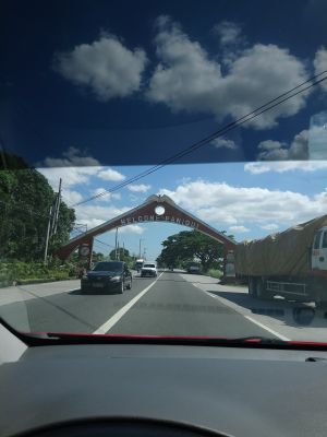
Paniqui, municipality of the Philippines in the province of Tarlac
Paniqui is a municipality in Tarlac Province situated between six neighboring municipalities at an elevation of 21 meters (70 feet). The area is home to about 103,000 residents and divided into administrative divisions that deliver local services to the population.
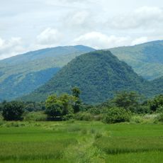
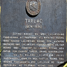
The settlement began in 1712 when the Pangasinan provincial government established local administration in a place called Manggang Marikit. This location was notable for its numerous caves inhabited by bats.
The municipality is organized into 35 barangays where residents gather for traditional Filipino celebrations and participate in local affairs together. These neighborhoods form the backbone of daily life and shape how people interact within their communities.
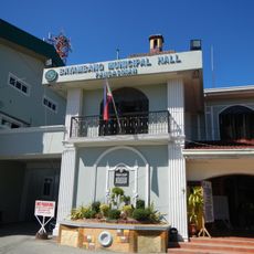
The local government operates service offices that provide assistance with housing and health matters, along with administrative centers for official documents. Visitors will find the services organized in the typical way for Philippine municipalities, making it easy to locate what is needed.
The name derives from the word Pampaniki, which means bat in the Ilocano language and references the caves that once defined the landscape. This linguistic root reflects the natural features that shaped the place.
Location: Tarlac
Elevation above the sea: 21 m
Shares border with: Moncada, Gerona
Address: Paniqui, Tarlac, Philippines
Website: http://paniqui.gov.ph
GPS coordinates: 15.66806,120.57889
Latest update: December 10, 2025 16:02
Officer Candidate School – Philippines
34.4 kmMonasterio de Tarlac
30.2 km
St. Vincent Ferrer Statue
22.2 km
Apung Mamacalulu
30.1 km
Tarlac Cathedral
20.1 kmUrdaneta Philippines Temple
34.3 km
Manleluag Spring Protected Landscape
32 km
Urdaneta Cathedral
34 km
Saint Ildephonse of Seville Parish Church
33.1 km
Bayambang Plaza
20.5 km
Cuyapo, Nueva Ecija historical marker
15.7 km
Francisco Makabulos historical marker
20.8 km
Diwa ng Tarlac
20.7 km
Villa Luisa Resort
7.5 km
House of Makabulos historical marker
30.1 km
Saint Vincent Ferrer Prayer Park
22.3 km
Jose Rizal historical marker
20.1 km
Makabulos House
30.1 km
Rancho Caridad historical marker
10.1 km
Francisco Makabulos historical marker
30 km
Gerona Plaza
7.2 km
Capital of the Republic of the Philippines historical marker
20.3 km
Corazon C. Aquino historical marker
20.2 km
Seat of the Revolutionary Government of the Philippines historical marker
20.6 km
Cathedral of Tarlac historical marker
20.1 km
Carlos P. Romulo historical marker
17.7 km
Eugenio Perez y Padlan historical marker
27.5 km
Tarlac historical marker
20.3 kmVisited this place? Tap the stars to rate it and share your experience / photos with the community! Try now! You can cancel it anytime.
Discover hidden gems everywhere you go!
From secret cafés to breathtaking viewpoints, skip the crowded tourist spots and find places that match your style. Our app makes it easy with voice search, smart filtering, route optimization, and insider tips from travelers worldwide. Download now for the complete mobile experience.
A unique approach to discovering new places❞
— Le Figaro
All the places worth exploring❞
— France Info
A tailor-made excursion in just a few clicks❞
— 20 Minutes