Mount Banahaw, Sacred volcano in Luzon, Philippines
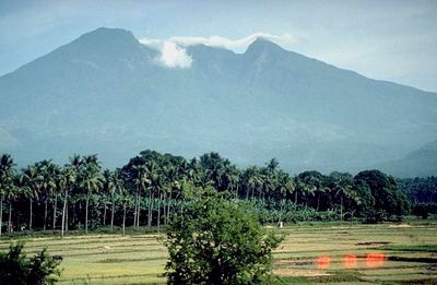
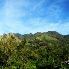
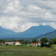
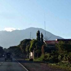
Banahaw is a volcano in the southern part of Luzon that stretches across the border between Laguna and Quezon. The summit sits at 2170 meters (roughly 7120 feet) elevation and opens to a wide crater with steep forested slopes below.
The 1730 eruption sent mud and debris downslope, burying parts of the coastal town of Sariaya. Since then, the mountain has shown only minor activity, though geologists continue to monitor it for signs of movement.
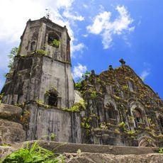
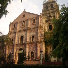
The volcano draws Filipino families on spiritual retreats during Holy Week, when groups climb to water sources considered healing by local tradition. Wooden crosses and small shrines appear along the paths, left by pilgrims who return year after year.
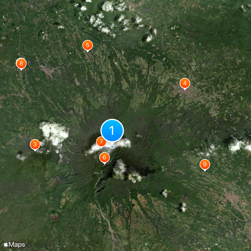
The Cristalino and Tatlong Tangke trails wind through dense forest to the crater rim, with walking time between 5 and 9 hours. Waterproof clothing and sturdy footwear are necessary, as the ground becomes slippery and weather can shift quickly.
Rare orchids grow on the upper slopes, found only in this part of Luzon. Local guides sometimes point out the plants during slow ascents in early spring blooming season.
Location: Laguna
Elevation above the sea: 2,158 m
GPS coordinates: 14.06753,121.49232
Latest update: December 5, 2025 16:36
Nagcarlan Underground Cemetery
11 km
San Cristobal
7.1 km
Lucban Church
8.5 km
Majayjay Church
9 km
Mounts Banahaw–San Cristobal Protected Landscape
1.7 km
Parco nazionale di Mounts-Banahaw-San-Cristobal
975 m
NHCP Museo ng Libingan sa Ilalim ng Lupa ng Nagcarlan
10.9 km
Nawawalang Paraiso
8.8 km
Nagcarlan Municipal Hall
11.1 km
Dalitiwan Resort
8.8 km
Apolinario de la Cruz historical marker
10.3 km
Casa de Comunidad de Tayabas historical marker
11.7 km
Lucban Municipal Hall
8.5 km
La Doña Ana
8.5 km
Casa Comunidad of Tayabas
11.7 km
Liliw Municipal Hall
9.3 km
Nagcarlan Underground Cemetery historical marker
11 km
Macario Sakay historical marker
7.6 km
La Casa de Doña Ana historical marker
8.6 km
The Church of Tayabas historical marker
11.6 km
The Government Building of Nagcarlan historical marker
11.1 km
The Town of Liliw historical marker
9.3 km
Lucban historical marker
8.5 km
Church of Majayjay historical marker
9.1 km
Church of Lilio historical marker
9.3 km
Majayjay historical marker
9 km
Tayabas historical marker
11.8 km
Church of Lucban historical marker
8.5 kmReviews
Visited this place? Tap the stars to rate it and share your experience / photos with the community! Try now! You can cancel it anytime.
Discover hidden gems everywhere you go!
From secret cafés to breathtaking viewpoints, skip the crowded tourist spots and find places that match your style. Our app makes it easy with voice search, smart filtering, route optimization, and insider tips from travelers worldwide. Download now for the complete mobile experience.
A unique approach to discovering new places❞
— Le Figaro
All the places worth exploring❞
— France Info
A tailor-made excursion in just a few clicks❞
— 20 Minutes