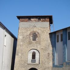
Łazy, Municipality in Silesian Voivodeship, Poland
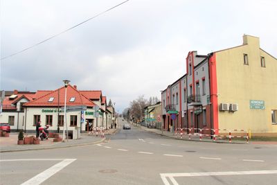
Łazy is a municipality in Silesian Voivodeship located in Zawiercie County in the Upper Silesian region. The settlement consists of residential neighborhoods and is served by local administrative facilities that handle day-to-day community needs.
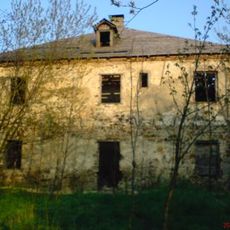
The settlement formed in the late 18th century and experienced significant growth following the construction of the Warsaw-Vienna railway in the mid-19th century. This rail connection transformed economic development in the region.
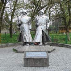
The population of 6,591 residents maintains local traditions through municipal events and participates in the development of their Silesian community.
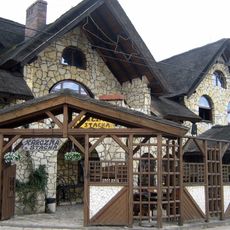
The place is accessible by car or public transportation and uses postal code 42-450 for mail delivery. Visitors will find basic services and infrastructure suitable for a brief or extended visit.
The current municipality territory formed from the merger of five medieval settlements called Grabowa, Niegowonice, Wiesiolka, Wysoka, and Ciagowice. These separate communities came together to create the modern town.
Location: Gmina Łazy
GPS coordinates: 50.42769,19.39465
Latest update: December 7, 2025 19:31
Browar na Jurze
7.2 km
Collegiate in Zawiercie
7 km
Szymański Palace in Zawiercie
7.2 km
Church of the Transfiguration of Jesus in Ogrodzieniec
9.8 km
Nature reserve Góra Chełm
8.1 km
Pomnik Wdzięczności w Dąbrowie Górniczej
9.6 km
Cmentarz żydowski w Zawierciu-Kromołowie
9.5 km
1000th-Anniversary of Polish State Stadium
7.2 km
Church of Archangel Michael in Łazy
628 m
Wieża wyciągowa w Porębie
7.8 km
Kościół poewangelicki w Zawierciu
7.4 km
Cmentarz wojenny w Łazach
973 m
Manor in Ciągowice
3.6 km
Saint Mark church in Rodaki
10 km
Exaltation of the Holy Cross church in Dąbrowa Górnicza Łosień
9.6 km
Dwór w Zawierciu-Bzowie
9.8 km
Saint Joseph church in Poręba
7.9 km
Miejska i Powiatowa Biblioteka Publiczna im. Stanisława Szymańskiego w Zawierciu
7.2 km
Cognor S.A. Oddział Ferrostal Łabędy w Zawierciu
7.2 km
Virgin Mary Queen of Poland church in Zawiercie
6.6 km
Saint Albert Chmielowski church in Zawiercie
6.1 km
Church of the Visitation and Saint Stanislaus in Chruszczobród
5.9 km
Wieża wyciągowa do transportu wsadu wielkopiecowego
7.9 km
Resursa
7.3 km
Łaźnia
7.3 km
Dom Ludowy
7.5 km
Osiedla robotniczego TAZ (ob. osiedle Marchlewskiego III)
7.4 km
Szkoła (ob. Gimnazjum nr 2)
7.4 kmVisited this place? Tap the stars to rate it and share your experience / photos with the community! Try now! You can cancel it anytime.
Discover hidden gems everywhere you go!
From secret cafés to breathtaking viewpoints, skip the crowded tourist spots and find places that match your style. Our app makes it easy with voice search, smart filtering, route optimization, and insider tips from travelers worldwide. Download now for the complete mobile experience.
A unique approach to discovering new places❞
— Le Figaro
All the places worth exploring❞
— France Info
A tailor-made excursion in just a few clicks❞
— 20 Minutes