Enable Location

We need your location to show you interesting places around you

Discover nearby places

Find interesting locations and hidden gems around you

Precise directions

Get accurate directions and distances to places

Your location is never shared with other users. It's only used when you tap the location button.

Gmina Kąty Wrocławskie

Log in to your account

Start exploring — it's free

Trusted by 62,408 travelers worldwide

Continue with Google
Continue with Apple
or

We will send you a code to connect

By continuing, you accept our Terms and Conditions and our Privacy Policy

Check your inbox

We've sent a pincode in your inbox. Please enter the code below.

Gmina Kąty Wrocławskie, Urban-rural municipality in Lower Silesian Voivodeship, Poland.

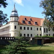
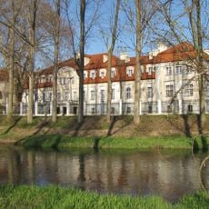
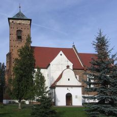
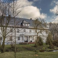
Gmina Kąty Wrocławskie is an urban-rural municipality in Lower Silesian Voivodeship consisting of a main town and numerous surrounding villages. The area is organized around a river valley that has shaped settlement patterns for centuries.

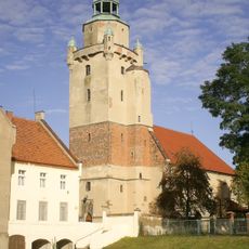
The settlement gained town rights in 1297 from Duke Bolko I and developed as a trading center because of its location at a river crossing. The area's growth depended on this strategic position for trade and travel.

The municipality maintains active international partnerships with communities in France, Germany, and Ukraine, fostering exchanges between residents and organizing joint cultural programs throughout the year.

The municipality has direct access to the A4 highway and railway connections to Wrocław, making travel straightforward for visitors and residents. These transport links mean the area is easy to reach from the regional capital.

The municipality received national recognition in 2008 by securing first place in the Rzeczpospolita local government ranking for its administrative excellence and economic development initiatives.

The community of curious travelers

AroundUs brings together thousands of curated places, local tips, and hidden gems, enriched daily by 60,000 contributors worldwide.

Start exploring
Location
Capital city
Kąty Wrocławskie
Shares border with
Gmina Kobierzyce, Gmina Kostomłoty, Gmina Mietków, Gmina Miękinia, Gmina Sobótka, Wrocław
GPS coordinates
51.03333,16.76667
Latest update
December 10, 2025 16:25
« Gmina Kąty Wrocławskie - Urban-rural municipality in Lower Silesian Voivodeship, Poland » is provided by Around Us (aroundus.com). Images and texts are derived from Wikimedia project under a Creative Commons license. You are allowed to copy, distribute, and modify copies of this page, under the conditions set by the license, as long as this note is clearly visible.

Discover hidden gems everywhere you go!

From secret cafés to breathtaking viewpoints, skip the crowded tourist spots and find places that match your style. Our app makes it easy with voice search, smart filtering, route optimization, and insider tips from travelers worldwide. Download now for the complete mobile experience.

Around Us App Screenshot

A unique approach to discovering new places

Le Figaro

All the places worth exploring

France Info

A tailor-made excursion in just a few clicks

20 Minutes

Around Us
Travel Guide & Maps
Download

Send to your phone

QR Code
1

Open the camera app on your mobile.

2

Point at the QR code with your camera. A notification will appear.

3

Tap the notification to open the link.