Miedzianka, Mountain summit in Świętokrzyskie Mountains, Poland.
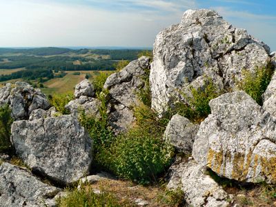
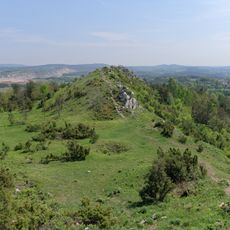
Miedzianka is a mountain summit in the Swietokrzyskie Mountains featuring three distinct peaks that create an interesting profile. The highest point rises 354 meters above sea level and offers views across the wider Lysogory range toward Kielce city.
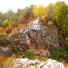
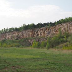
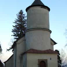
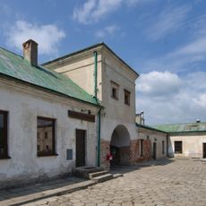
Copper mining on this mountain began in the 14th century and shaped its development over generations. By the 16th century, mining had become more organized with formal regulations governing extraction practices.
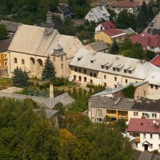
The name Miedzianka comes from copper mining that shaped the region for centuries. Walking here, you notice how mining left marks on the landscape that locals and visitors continue to experience today.
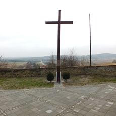
Marked trails lead from the parking area to the summit, taking roughly 15 to 20 minutes on foot to reach the top. The routes are well signposted and manageable for visitors of different fitness levels, with a steady climb throughout.
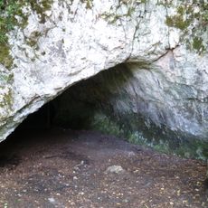
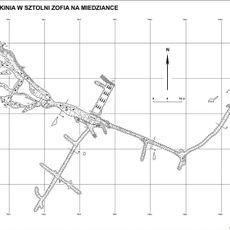
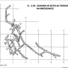
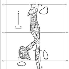
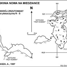
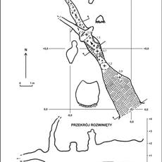
Beneath the surface lies the Zofia Cave system, extending 715 meters underground and created through both natural geological processes and centuries of mining work. This hidden network reveals how natural forces and human activity combined to shape the mountain.
GPS coordinates: 50.84720,20.35890
Latest update: December 10, 2025 20:10
Jaskinia Piekło pod Skibami
5.4 km
Rezerwat przyrody Góra Miedzianka
0 m
Rezerwat przyrody Góra Zelejowa
7.8 km
Rezerwat przyrody Góra Rzepka
8.4 km
Church of the Nativity of the Virgin Mary in Piekoszów
8.4 km
Church of the Assumption in Małogoszcz
7.8 km
Jaskinia w Sztolni Zofia na Miedziance
88 m
Jaskinia w Sztolni Teresa na Miedziance
388 m
Jaskinia Psia
388 m
Jaskinia Nowa na Miedziance
64 m
Former Holy Spirit church in Chęciny
8.6 km
Monastery of Bernardine Sisters in Chęciny
8.7 km
Jewish cemetery in Małogoszcz
8.6 km
Piekło pod Małogoszczem
3.6 km
Church of Saint Stanislaus in Małogoszcz
8.3 km
Cmentarz kościelny - otoczenie w granicach ogrodzenia
4.2 km
Budynek bramny, lata 1620-1638
8.7 km
Dawny kościół i przytułek Św. Ducha, obecnie dom mieszkalny, poł. XIX w.
8.7 km
Kościół Narodzenia NMP w Bolminiu
4.2 km
Parish cemetery in Chęciny
8 km
World War I cemetery in Gnieździska
8.3 km
Budynek gospodarczy, lata 1628-1638
8.7 km
Zespół kościoła Narodzenia NMP w Bolminiu
4.2 km
58 Małogoska Street in Chęciny
8.5 km
Manor in Bolmin
4 km
Plebania
7.8 km
Dzwonnica w Bolminiu
4.2 km
52 Małogoska Street in Chęciny
8.5 kmVisited this place? Tap the stars to rate it and share your experience / photos with the community! Try now! You can cancel it anytime.
Discover hidden gems everywhere you go!
From secret cafés to breathtaking viewpoints, skip the crowded tourist spots and find places that match your style. Our app makes it easy with voice search, smart filtering, route optimization, and insider tips from travelers worldwide. Download now for the complete mobile experience.
A unique approach to discovering new places❞
— Le Figaro
All the places worth exploring❞
— France Info
A tailor-made excursion in just a few clicks❞
— 20 Minutes