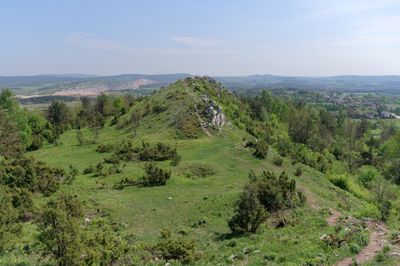
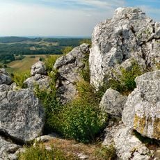
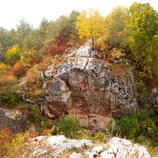
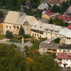
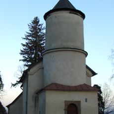
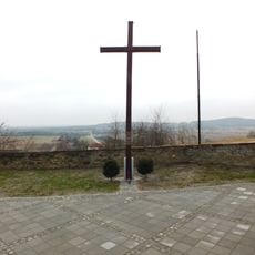
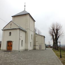
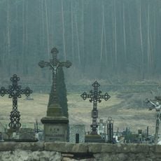
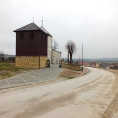
Rezerwat przyrody Góra Miedzianka, Nature reserve in Świętokrzyskie Mountains, Poland.
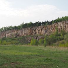
Rezerwat przyrody Góra Miedzianka is a protected natural area within the Heiligkreuzberge range featuring distinctive limestone outcrops and mineral-bearing rock formations. The reserve encompasses slopes with exposed geological layers showing traces of copper, azure, and chrysocolla minerals throughout its terrain.
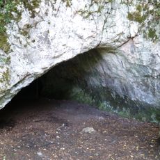
Copper extraction at this location began in the 14th century and became a major economic activity for the surrounding region. The long mining history eventually led to the establishment of the reserve to protect the geological and natural heritage.
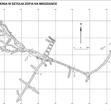
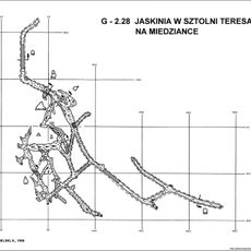
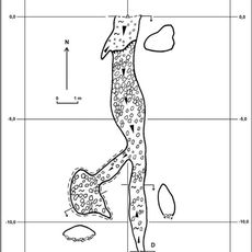
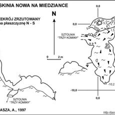
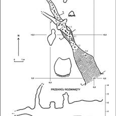
The underground network includes tunnels named Antoni, Teresa, Zofia, and Austrian II, extending approximately 4 kilometers beneath the mountain surface.
The area is best explored on foot with sturdy footwear recommended due to uneven terrain and rocky slopes. Local information centers can provide guidance about current trail conditions and safe routes through the reserve.
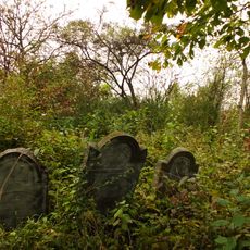
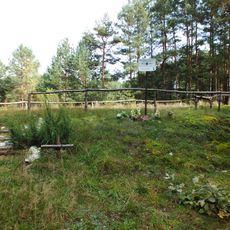
An extensive tunnel network created during centuries of mining runs beneath the mountain with several named shafts extending several kilometers underground. These underground spaces now serve as winter refuges for bat species that depend on such sheltered environments.
GPS coordinates: 50.84720,20.35890
Latest update: December 14, 2025 14:23
Miedzianka
0 m
Jaskinia Piekło pod Skibami
5.4 km
Rezerwat przyrody Góra Zelejowa
7.8 km
Rezerwat przyrody Góra Rzepka
8.4 km
Church of the Nativity of the Virgin Mary in Piekoszów
8.4 km
Church of the Assumption in Małogoszcz
7.8 km
Jaskinia w Sztolni Zofia na Miedziance
88 m
Jaskinia w Sztolni Teresa na Miedziance
388 m
Jaskinia Psia
388 m
Jaskinia Nowa na Miedziance
64 m
Former Holy Spirit church in Chęciny
8.6 km
Monastery of Bernardine Sisters in Chęciny
8.7 km
Jewish cemetery in Małogoszcz
8.6 km
Piekło pod Małogoszczem
3.6 km
Church of Saint Stanislaus in Małogoszcz
8.3 km
Cmentarz kościelny - otoczenie w granicach ogrodzenia
4.2 km
Budynek bramny, lata 1620-1638
8.7 km
Dawny kościół i przytułek Św. Ducha, obecnie dom mieszkalny, poł. XIX w.
8.7 km
Budynek administracyjny klasztoru franciszkanów w Chęcinach
8.7 km
World War I cemetery in Gnieździska
8.3 km
Kościół Narodzenia NMP w Bolminiu
4.2 km
Parish cemetery in Chęciny
8 km
58 Małogoska Street in Chęciny
8.5 km
Zespół kościoła Narodzenia NMP w Bolminiu
4.2 km
Budynek gospodarczy, lata 1628-1638
8.7 km
Manor in Bolmin
4 km
Plebania
7.8 km
Dzwonnica w Bolminiu
4.2 kmVisited this place? Tap the stars to rate it and share your experience / photos with the community! Try now! You can cancel it anytime.
Discover hidden gems everywhere you go!
From secret cafés to breathtaking viewpoints, skip the crowded tourist spots and find places that match your style. Our app makes it easy with voice search, smart filtering, route optimization, and insider tips from travelers worldwide. Download now for the complete mobile experience.
A unique approach to discovering new places❞
— Le Figaro
All the places worth exploring❞
— France Info
A tailor-made excursion in just a few clicks❞
— 20 Minutes