Romuald Traugutt Park in Warsaw, Urban park in New Town, Warsaw, Poland
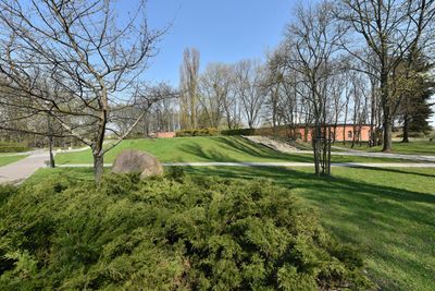
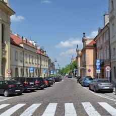
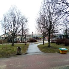
Romuald Traugutt Park is a green space in Warsaw's New Town, stretching between Slominski Street and Zakroczymska Street. The grounds offer walking paths, benches, and landscaped areas designed for strolling and rest.
The park opened in 1925, designed by Leon Danielewicz and Stanisław Zadora-Życieński, and received its name the following year. The naming honored a military leader whose legacy remains tied to Warsaw's story.
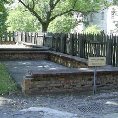
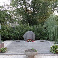
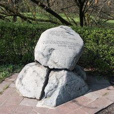
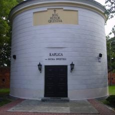
The park bears the name of Romuald Traugutt, a Polish military leader whose legacy shaped the identity of this green space. Visitors encounter a memorial cross and inscription stone that speak to the site's connection with Polish history.
The grounds are flat and easy to navigate, with a well-developed network of paths connecting different areas. Visitors will find seating throughout, and should note that an athletic facility with football and sports equipment occupies the northeastern section.
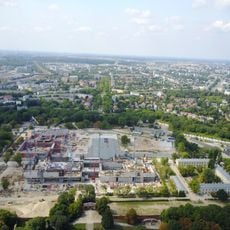
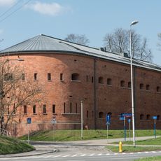
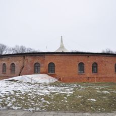
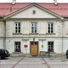
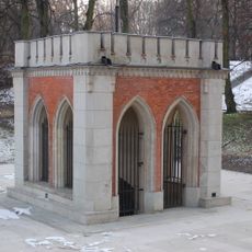
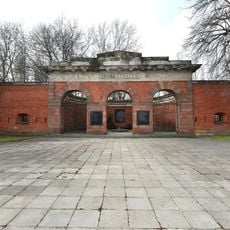
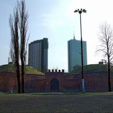
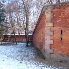
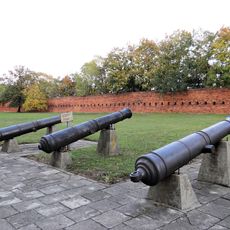
The park grounds contain two preserved 19th-century military structures, the Traugutt Fort built in 1847 and the Fort of the Legions built in 1853. These architectural remains speak to an era when military installations shaped the city's development.
Location: Warsaw
GPS coordinates: 52.26070,21.00300
Latest update: December 12, 2025 17:47
Warsaw Citadel
520 m
Warsaw Fortress
509 m
Gdański Bridge
420 m
Xth Pavilion of the Citadel Warsaw
690 m
Citadel Rail Bridge
423 m
Katyń Museum
178 m
Vladimir Fort in Warsaw
456 m
Aleksej Fort rotunda
479 m
Zakroczymska Street
569 m
Sierakowski Palace
632 m
Pomnik żołnierzy AK poległych w ataku na Dworzec Gdański w Warszawie
685 m
Polish History Museum
500 m
Pomnik Nauczycieli w Warszawie
505 m
Royal Spring in Warsaw
276 m
Gate of Executions of Citadel in Warsaw
480 m
Aleksej Fort in Warsaw
469 m
Dom przy ulicy Zakroczymskiej 7
714 m
Kaplica klasztorna pijarów św. Ducha, ob. nieużytkowana
192 m
Budynek szkolny przy ulicy Słomińskiego 1
317 m
Cytadela z murami, bramami i umocnieniami
531 m
Zespół Cytadeli
470 m
Budynki klasztorne pijarów, ob. biura, mieszkania
156 m
D. Koszary Sierakowskie
632 m
Zespół d. Koszar Sierakowskich
615 m
Dom przy ulicy Zakroczymskiej 5
729 m
Dom przy ulicy Zakroczymskiej 9
701 m
Dom przy ulicy Zakroczymskiej 9a
683 m
Square Batalionu AK „Czata 49”
670 mVisited this place? Tap the stars to rate it and share your experience / photos with the community! Try now! You can cancel it anytime.
Discover hidden gems everywhere you go!
From secret cafés to breathtaking viewpoints, skip the crowded tourist spots and find places that match your style. Our app makes it easy with voice search, smart filtering, route optimization, and insider tips from travelers worldwide. Download now for the complete mobile experience.
A unique approach to discovering new places❞
— Le Figaro
All the places worth exploring❞
— France Info
A tailor-made excursion in just a few clicks❞
— 20 Minutes