
Cemetery in Radomierzyce
Location: Radomierzyce
Inception: 18 century
GPS coordinates: 51.05807,14.97039
Latest update: March 2, 2025 22:58
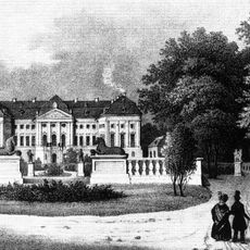
Pałac Radomierzyce
418 m
Bagger 1452
1.4 km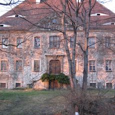
Water Castle Tauchritz
2.1 km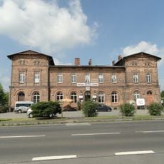
Hagenwerder
1.6 km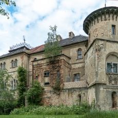
Pałac w Łomnicy
2.4 km
Kościół Świętych Apostołów Piotra i Pawła w Radomierzycach
8 m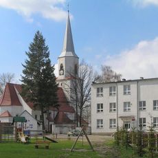
Kościół Narodzenia NMP w Osieku Łużyckim
3.1 km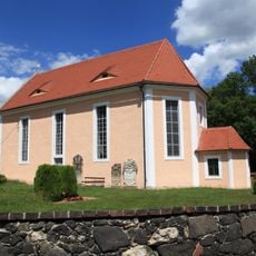
Dorfkirche Tauchritz
2.1 km
Saints Peter and Paul church in Radomierzyce
27 m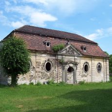
Mausoleum Radomierzyce
34 m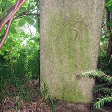
Grenzstein 15 KS KP
2.3 km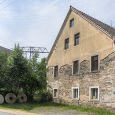
Wassermühle Tauchritz
2.3 km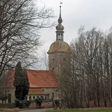
Kościół ewangelicki, ob. rzym.-kat. Matki Boskiej Anielskiej
2.4 km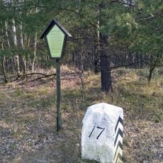
Sächsisch-Preußischer Grenzstein: Pilar Nr. 17 (rechtselbisch)
3.7 km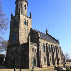
Nikolaikirche
2.5 km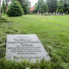
Cmentarz w Radomierzycach
0 m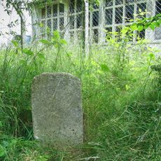
Grenzstein 7 KS KP
511 m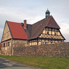
Herrenhaus mit Anbau, westliches und östliches Wirtschaftsgebäude, der östliche Teil einer Scheune sowie die Reste der Einfriedungsmauer des einstigen Rittergutes Nikrisch Thomas-Müntzer-Straße 10
1.5 km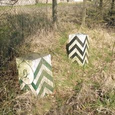
Sächsisch-Preußischer Grenzstein: Pilarpaar Nr. 9 (rechtselbisch)
1 km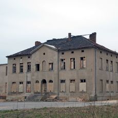
Gut mit Herrenhaus, Stallanlagen und Scheune mit tonnengewölbtem Keller und Resten der Einfriedung (Oberhof; Gut Oberdeutschossig) Strandpromenade 72 (ehemals Zittauer Straße 72)
4.3 km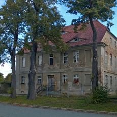
Pfarrhof mit Pfarrhaus und Scheune Strandpromenade 61 (ehemals Zittauer Straße 61)
4.6 km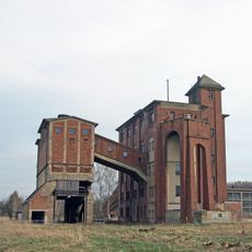
Einrichtungen im Braunkohlentagebau Berzdorf: Hochbunker (ehemaliges Siebgebäude), Schrägbandförderer, Grabenbunker mit Fördergeräten, Grabenschöpfgerät B300, Skipschachtanlage mit Förderturm, Fördermaschinenhaus mit Fördermaschine (Gemarku
2.9 km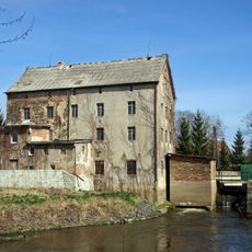
Watermill in Radomierzyce
187 m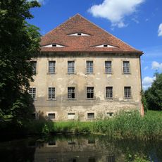
Exterior of Wasserschloss Tauchritz
2.1 km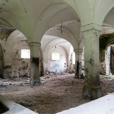
Zabudowania gospodarcze
2.4 km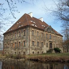
Rittergut Tauchritz (Sachgesamtheit) Kirchplatz 12
2.1 km
Sächsisch-Preußischer Grenzstein: Pilarpaar Nr. 11 (rechtselbisch)
2.5 km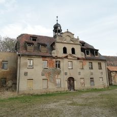
Vierseithof mit Herrenhaus, Gesindehaus, Scheune, Stall und Lagerhaus, dazu zwei Baumreihen und ein Solitärbaum (Mittelhof; Gut Mitteldeutschossig) Strandpromenade 63 (ehemals Zittauer Straße 63)
4.5 kmReviews
Visited this place? Tap the stars to rate it and share your experience / photos with the community! Try now! You can cancel it anytime.
Discover hidden gems everywhere you go!
From secret cafés to breathtaking viewpoints, skip the crowded tourist spots and find places that match your style. Our app makes it easy with voice search, smart filtering, route optimization, and insider tips from travelers worldwide. Download now for the complete mobile experience.

A unique approach to discovering new places❞
— Le Figaro
All the places worth exploring❞
— France Info
A tailor-made excursion in just a few clicks❞
— 20 Minutes