Santo Tirso, Municipality in Porto Metropolitan Area, Portugal.
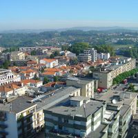
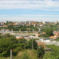
Santo Tirso is a municipality in northern Portugal's Porto Metropolitan Area, blending urban neighborhoods with rural countryside across its territory. The Ave River runs through the landscape, creating a natural structure that connects residential areas, commercial zones, and green spaces.
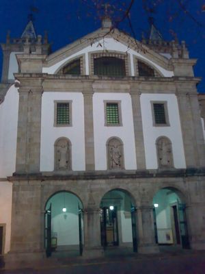
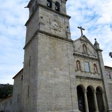
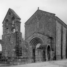
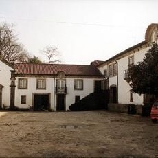
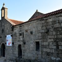
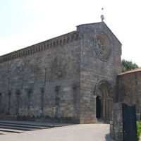
Santo Tirso originated around a Benedictine monastery founded in the late 10th century, which became a major religious center for the region. This monastery defined the place for centuries and eventually gave its name to the settlement that grew beside it.
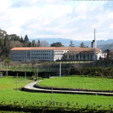
Textile manufacturing shaped the identity of Santo Tirso for generations, and this heritage remains visible in the factory buildings scattered throughout the municipality. The trade created strong bonds between local communities and industrial work that defined daily life for many families.
Regular train connections and the A3 motorway link Santo Tirso quickly to Porto and surrounding areas. The city center is easy to navigate on foot once you arrive, with most shops and services within walking distance.
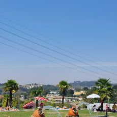
The Parque Urbano de Rabada offers an amphitheater, lake, and walking trails along the Ave River where locals gather to spend time outdoors. This recreational space often goes unnoticed by those passing through quickly but provides a pleasant break from the busier parts of town.
Location: Metropolitan Area of Porto
Location: Porto
Shares border with: Valongo, Maia, Trofa, Vila Nova de Famalicão, Guimarães, Vizela, Lousada, Paços de Ferreira
Phone: +351252830400
Email: santotirso@cm-stirso.pt
Website: https://cm-stirso.pt
GPS coordinates: 41.34250,-8.47750
Latest update: December 6, 2025 22:07
Citânia de Sanfins
7.9 km
Abbaye de Singeverga
9.1 km
Casa-Museu de Camilo Castelo Branco
6.2 km
Santo Tirso Monastery
538 m
Mosteiro de Landim
4.3 km
Igreja de São Salvador de Ferreira
14.2 km
Ponte de Lagoncinha
3.6 km
Castro de Monte Padrão
4.1 km
Museu dos Caminhos de Ferro de Lousado
4.3 km
Torre dos Alcoforados
11.9 km
Caldas da Saúde
2.9 km
Igreja de São Miguel de Vilarinho
12.3 km
Casa e Quinta de Dinis de Cima
2.4 km
Estação arqueológica de São João de Perrelos
7.7 km
Igreja e antigo Mosteiro de Santo Estêvão de Vilela
14.1 km
Árvore isolada em Cemitério de Agrela
9.5 km
Câmara Municipal de Paços de Ferreira
11.3 km
Teatro Narciso Ferreira
8.6 km
Árvore isolada em Carvalheira
5 km
Edifício da Serra Hidráulica de Pereiras
4.8 km
Mamoa do Taio
10.7 km
Igreja Paroquial de Riba de Ave
9.7 km
Câmara Municipal de Santo Tirso
404 m
Pelourinho de Louredo
16.4 km
Paço de Gominhães
13.8 km
Serra da Agrela - Monte Pilar
7.2 km
Santuário de Nossa Senhora da Assunção
3.2 km
Igreja Paroquial de Moreira de Cónegos
12.4 kmVisited this place? Tap the stars to rate it and share your experience / photos with the community! Try now! You can cancel it anytime.
Discover hidden gems everywhere you go!
From secret cafés to breathtaking viewpoints, skip the crowded tourist spots and find places that match your style. Our app makes it easy with voice search, smart filtering, route optimization, and insider tips from travelers worldwide. Download now for the complete mobile experience.
A unique approach to discovering new places❞
— Le Figaro
All the places worth exploring❞
— France Info
A tailor-made excursion in just a few clicks❞
— 20 Minutes