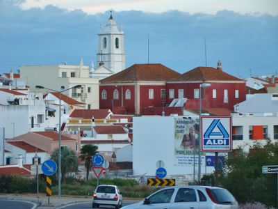
Alcantarilha, Historical parish town in Silves, Portugal.
Alcantarilha is a settlement in central Algarve that extends along the EN125 road with narrow streets and traditional Portuguese buildings. The older quarter preserves its historical character through low-rise architecture and local construction methods typical of the region.
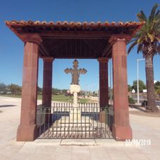
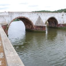
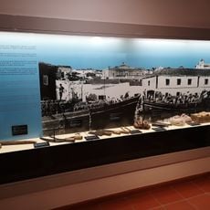
The name Alcantarilha comes from Arabic al-quanTarâ meaning bridge or aqueduct, reflecting early water infrastructure in the area. Archaeological evidence shows people have lived here since prehistoric times.
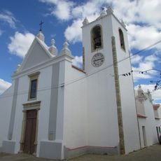
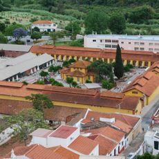
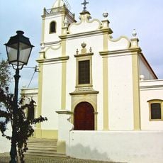
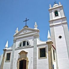
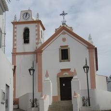
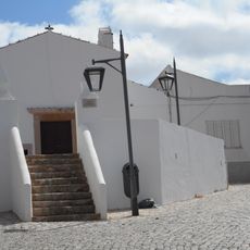
The Church of Nossa Senhora da Conceição shows how different architectural styles developed alongside local religious practices over time. You can observe how the building reflects the community's spiritual traditions through its various design periods and artistic choices.
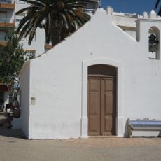
The bone chapel behind the church displays human remains and is open daily to visitors without entrance fees. You can walk through at your own pace and spend time examining this historical space without time pressure.
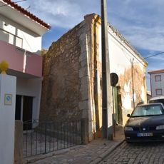
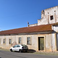
A 17th-century dwelling retains original garden walls with arrow slits that served as defense mechanisms against intruders. These uncommon features reveal how residents historically designed their homes for protection.
Location: Alcantarilha e Pêra
GPS coordinates: 37.16014,-8.35713
Latest update: December 12, 2025 09:05
Praia da Senhora da Rocha
7.6 km
Algoz
5.1 km
Fort of Nossa Senhora da Rocha
7.6 km
Cruz de Portugal
7.7 km
Fábrica do Inglês
7.7 km
Castle of Alcantarilha
3.7 km
Ponte Velha de Silves
7.8 km
Igreja Paroquial de Porches
5.4 km
Fortaleza de Armação de Pera
6.5 km
Beijinhos beach
6.8 km
Chapel of Nossa Senhora do Pilar
5 km
Casa da Coroa
3.5 km
Capela de Santo António (Armação de Pêra)
6.5 km
Igreja paroquial de Alcantarilha
3.5 km
Solar com capela e lagar de azeite na Quinta da Cruz
3.2 km
Casa do Mirante
3.3 km
Lavadouro Municipal de Alcantarilha
3.5 km
Silves Archaeological Museum
7.9 km
Praia da Cova Redonda
7.2 km
Igreja Matriz da Guia
6.4 km
Igreja de São Francisco
4.9 km
Imóvel denominado "Casas Grandes"
7.9 km
Capela de São Sebastião
6.5 km
Poço-cisterna árabe de Silves
7.9 km
Ermida de Nossa Senhora da Guia
6.2 km
Casa n.º 18 do Largo D. Jerónimo Osório
7.9 km
Necrópole do Poço dos Mouros
1.8 km
Junta de Freguesia da Guia
6.4 kmVisited this place? Tap the stars to rate it and share your experience / photos with the community! Try now! You can cancel it anytime.
Discover hidden gems everywhere you go!
From secret cafés to breathtaking viewpoints, skip the crowded tourist spots and find places that match your style. Our app makes it easy with voice search, smart filtering, route optimization, and insider tips from travelers worldwide. Download now for the complete mobile experience.
A unique approach to discovering new places❞
— Le Figaro
All the places worth exploring❞
— France Info
A tailor-made excursion in just a few clicks❞
— 20 Minutes