Castro ou Castelo de Vermoim
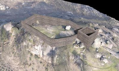
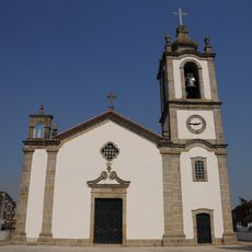
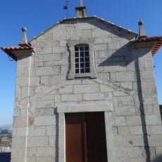
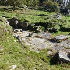
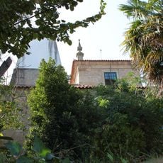
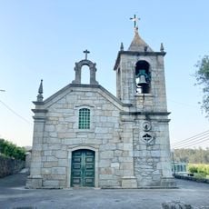
Castro ou Castelo de Vermoim, Medieval castle and Iron Age hillfort in Vermoim, Portugal.
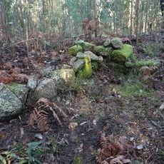
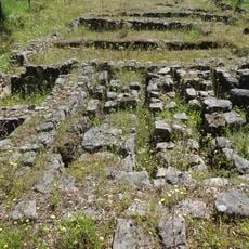
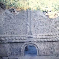
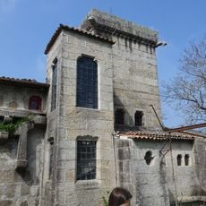
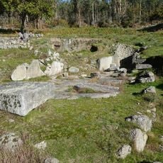
Castro ou Castelo de Vermoim is an archaeological site on a hilltop containing remains from two distinct periods: an Iron Age settlement and a medieval fortification. The surviving walls and foundations reveal different building techniques that were used across these separate centuries.
The site was first established as a Celtic settlement and later developed into a fortified castle during the medieval period. An attack in the 11th century marked a turning point in the location's importance to regional power structures.
The name Castro refers to the ancient Celtic settlement that once occupied this hilltop, while Castelo marks the medieval fortress built later on the same ground. This layering of two distinct periods shapes how locals understand the site's role in their regional heritage.
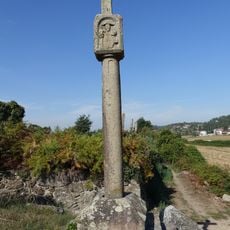
The site is accessible from Vermoim's center by following marked pathways, with information panels explaining the different archaeological periods. Visitors should wear sturdy shoes as the terrain is hilly and some paths can be uneven underfoot.
Archaeological excavations in the 1980s uncovered pottery and building remains that provide clues about the daily activities of Iron Age residents. These artifacts help archaeologists understand how people lived in this region more than 2000 years ago.
Location: Vermoim
Part of: Conjunto Arqueológico das Eiras
GPS coordinates: 41.42931,-8.45128
Latest update: December 9, 2025 12:27
Casa-Museu de Camilo Castelo Branco
3.8 km
Mosteiro de Landim
5.7 km
Igreja de Santiago de Antas
5.8 km
Church of Vermoim
1.5 km
Castro de Monte Redondo
5 km
Capela de Nossa Senhora do Rosário
5.8 km
Estação arqueológica de São João de Perrelos
3.9 km
Castro das Eiras
1.1 km
New Church of Santiago de Antas
5.6 km
Casa, quinta e mata de Pindela
4.3 km
Igreja Paroquial de Escudeiros
5.7 km
Igreja Paroquial de Vermil
5.6 km
Igreja Paroquial de Requião
3.3 km
Igreja Paroquial de Guisande
5.9 km
Cadeia da Comarca de Vila Nova de Famalicão
6.1 km
Conjunto Arqueológico das Eiras
732 m
Solar das Lameiras
6 km
Mercado Municipal de Vila Nova de Famalicão
6.1 km
Igreja Paroquial de Ronfe
5.6 km
Igreja Paroquial de São Pedro de Oliveira
5.6 km
Igreja Paroquial de Oleiros
5.4 km
Balneário do Alto das Eiras
739 m
Cruzeiro do Lugar da Quinta
5.9 km
Casa de Vila Boa
3.7 km
Capela de Santo António (Vila Nova de Famalicão)
6.1 km
Capela do Senhor do Padrão
5.8 km
Capela de São Bento (Oliveira)
5.8 km
Capela da Senhora do Campo
5.6 kmVisited this place? Tap the stars to rate it and share your experience / photos with the community! Try now! You can cancel it anytime.
Discover hidden gems everywhere you go!
From secret cafés to breathtaking viewpoints, skip the crowded tourist spots and find places that match your style. Our app makes it easy with voice search, smart filtering, route optimization, and insider tips from travelers worldwide. Download now for the complete mobile experience.
A unique approach to discovering new places❞
— Le Figaro
All the places worth exploring❞
— France Info
A tailor-made excursion in just a few clicks❞
— 20 Minutes