Enable Location

We need your location to show you interesting places around you

Discover nearby places

Find interesting locations and hidden gems around you

Precise directions

Get accurate directions and distances to places

Your location is never shared with other users. It's only used when you tap the location button.

Tula

Log in to your account

Start exploring — it's free

Trusted by 61,550 travelers worldwide

Continue with Google
Continue with Apple
or

We will send you a code to connect

By continuing, you accept our Terms and Conditions and our Privacy Policy

Check your inbox

We've sent a pincode in your inbox. Please enter the code below.

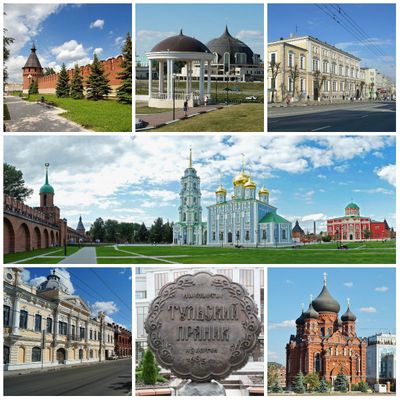
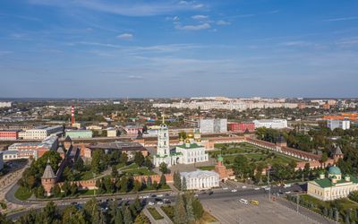
Tula, Industrial center in Tula Oblast, Russia

Description

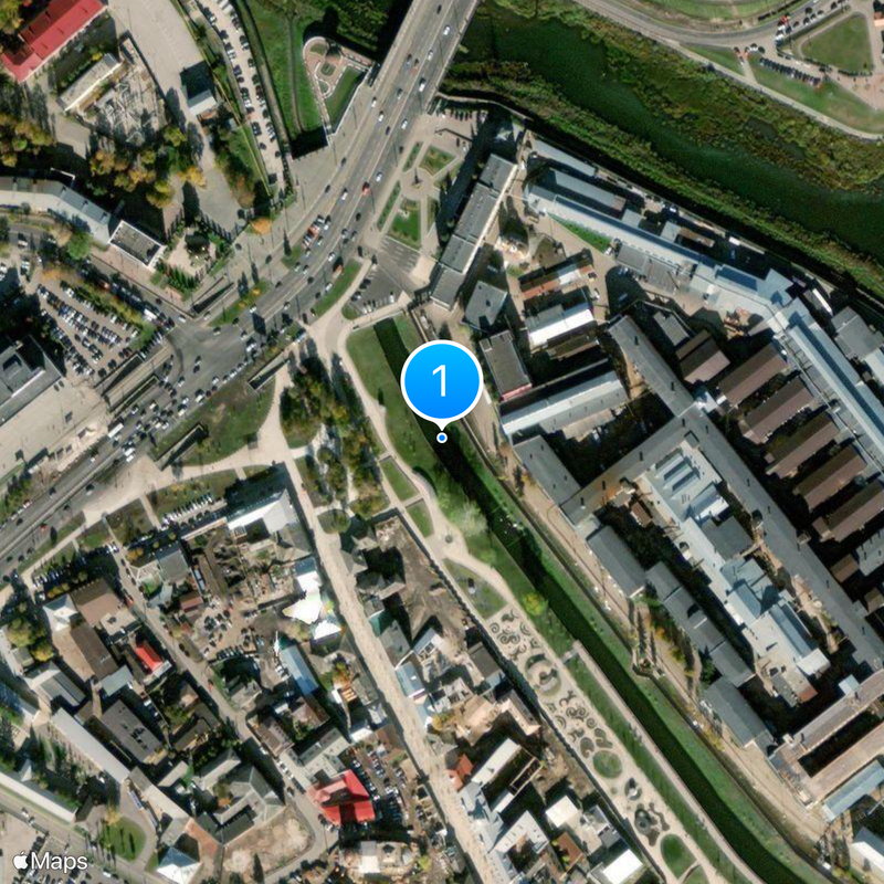
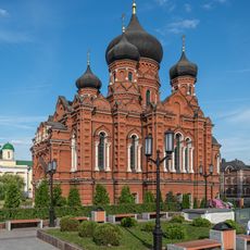
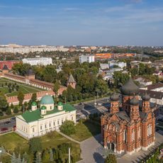
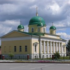
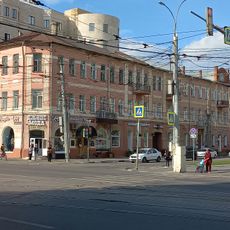
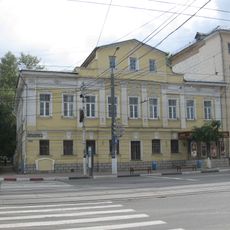
Tula is a city in western central Russia, situated about 193 kilometers (120 miles) south of Moscow along the banks of the Upa River. The central streets are arranged around the old fortress, while newer residential areas spread across the surrounding hills of the Central Russian Upland.

History

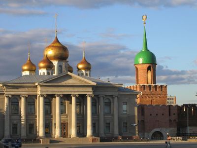
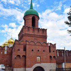
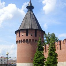
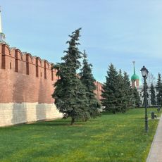
The fortress was built in stone in 1530 to protect the southern borders of the Muscovite state from raids. In 1552, it withstood a prolonged siege by Tatar forces, which confirmed its strategic importance.

Culture

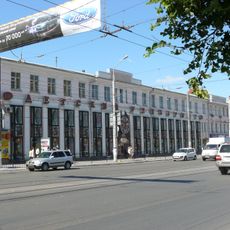
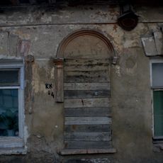
The city remains a center for craftsmanship, particularly metalwork, and visitors can observe artisans practicing traditional techniques in workshops around the old town. On weekends, locals gather in the central squares, where markets sell regional specialties including pryaniki, a form of gingerbread that has been baked here for centuries.

Practical

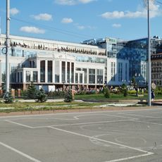
Trams, trolleybuses, and regular bus lines connect the various districts with each other and with the main railway station, which offers train services to Moscow. The central area can be explored on foot, as most points of interest are clustered near the old fortress walls.

Did you know?

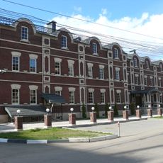
The arms plant was founded in 1712 by Peter I and remains the oldest facility of its kind in the country, still operating today. One of the buildings houses a museum that guides visitors through exhibition halls displaying weapons from different eras.

Inception
January 1, 1146
Elevation above the sea
170 m
Website
GPS coordinates
54.19303,37.61754
Latest update
December 15, 2025 00:13

AroundUs brings together thousands of curated places, local tips, and hidden gems, enriched daily by 60,000 contributors worldwide. Discover all places nearby (Municipal Formation of the City of Tula).

Around this place
Cathedral of the Dormition at Uspensky Convent
Russian Federation

Cathedral of the Dormition at Uspensky Convent

127 m
Tula State Museum of Samovar
Russian Federation

Tula State Museum of Samovar

166 m
Tower of Odoevsky Gate
Russian Federation

Tower of Odoevsky Gate

179 m
Гостиный двор
Russian Federation

Гостиный двор

165 m
Uspensky Convent
Russian Federation

Uspensky Convent

140 m
Tula Oblast Local History Museum
Russian Federation

Tula Oblast Local History Museum

229 m
Church of the Transfiguration
Russian Federation

Church of the Transfiguration

149 m
Spasskaya Tower of Tula Kremlin
Russian Federation

Spasskaya Tower of Tula Kremlin

232 m
Beloborodov Museum
Russian Federation

Beloborodov Museum

221 m
Russian Federation

Место, где 21 октября 1905 г. членами рабочей боевой дружины при комитете РСДРП были построены баррикады (Тула)

232 m
Andreev's-Beloborodov House
Russian Federation

Andreev's-Beloborodov House

155 m
Statue of Lenin in Tula
Russian Federation

Statue of Lenin in Tula

43 m
Жилой дом купца Аксенова (Тула)
Russian Federation

Жилой дом купца Аксенова (Тула)

214 m
Uspensky Convent
Russian Federation

Uspensky Convent

173 m
Жилой дом Ломова (Тула)
Russian Federation

Жилой дом Ломова (Тула)

162 m
Дом В.Р. Гречихина (Тула)
Russian Federation

Дом В.Р. Гречихина (Тула)

245 m
Место вооруженного столкновения боевой дружины при комитете РСДРП с черносотенцами 21 октября 1905 г. (Тула)
Russian Federation

Место вооруженного столкновения боевой дружины при комитете РСДРП с черносотенцами 21 октября 1905 г. (Тула)

80 m
Russian Federation

Бюст Карла Маркса (Тула)

182 m
Общественное здание (Тула)
Russian Federation

Общественное здание (Тула)

147 m
Russian Federation

Жилой дом Струковой (Тула)

177 m
Пекарня и булочная Д.И. Филиппова
Russian Federation

Пекарня и булочная Д.И. Филиппова

209 m
Жилой дом купца И.Г. Белобородова (мещанская управа) (Тула)
Russian Federation

Жилой дом купца И.Г. Белобородова (мещанская управа) (Тула)

225 m
Дом жилой (Тула)
Russian Federation

Дом жилой (Тула)

215 m
Стены и башни Тульского кремля (Тула)
Russian Federation

Стены и башни Тульского кремля (Тула)

203 m
Russian Federation

Дом имени Александра II

160 m
Russian Federation

Здесь находились баррикады 21 октября 1905, построенные членами рабочей боевой дружины

232 m
Russian Federation

К. Марксу

181 m
Russian Federation

Тульский пряник

74 m
Show the full map
« Tula - Industrial center in Tula Oblast, Russia » is provided by Around Us (aroundus.com). Images and texts are derived from Wikimedia project under a Creative Commons license. You are allowed to copy, distribute, and modify copies of this page, under the conditions set by the license, as long as this note is clearly visible.

Discover hidden gems everywhere you go!

From secret cafés to breathtaking viewpoints, skip the crowded tourist spots and find places that match your style. Our app makes it easy with voice search, smart filtering, route optimization, and insider tips from travelers worldwide. Download now for the complete mobile experience.

Around Us App Screenshot

A unique approach to discovering new places

Le Figaro

All the places worth exploring

France Info

A tailor-made excursion in just a few clicks

20 Minutes

Around Us
Travel Guide & Maps
Download

Send to your phone

QR Code
1

Open the camera app on your mobile.

2

Point at the QR code with your camera. A notification will appear.

3

Tap the notification to open the link.