Chest opened
+${chestReward.xp} XP
Explorer
NOUVEAU ×${chestReward.collectible.quantity}
tapez pour fermer
Chest locked

Open chests in the app

Around Us is built for your phone — chests unlock when you walk, explore and capture nearby places.

Enable Location

We need your location to show you interesting places around you

Discover nearby places

Find interesting locations and hidden gems around you

Precise directions

Get accurate directions and distances to places

Your location is never shared with other users. It's only used when you tap the location button.

Log in to your account

Start exploring — it's free

Trusted by 72,885 travelers worldwide

Continue with Google
Continue with Apple
or

We will send you a code to connect

By continuing, you accept our Terms and Conditions and our Privacy Policy

Check your inbox

We've sent a pincode in your inbox. Please enter the code below.

Kotovo
Discussion Reviews Photo
18.1k Popularity

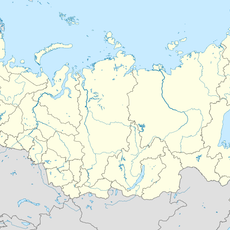
Kotovo, human settlement in Kotovsky District, Volgograd Oblast, Russia

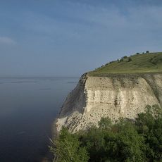
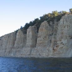
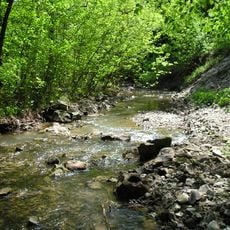
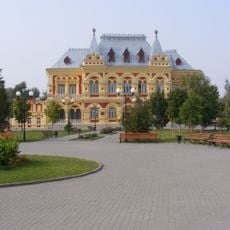
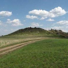
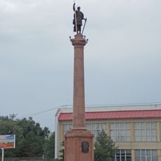
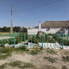
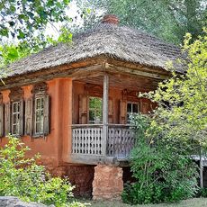
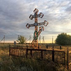
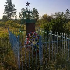
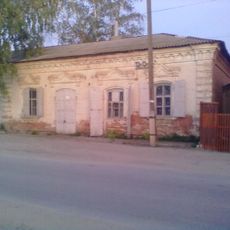
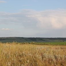
Kotovo is a small town in Volgograd Oblast with simple streets and buildings from different eras. The center features a memorial square with a monument dedicated to war victims, while the surrounding area is marked by fields and farms.

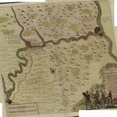
The town was founded in 1807 by settlers who brought traditions from Ukraine. After a major oil field was discovered in 1952, the town developed into a petroleum industry hub with significant industrial growth in the following decades.

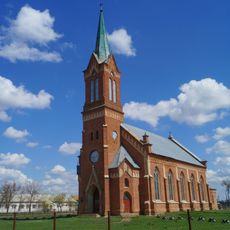
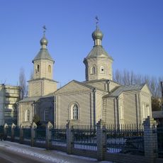
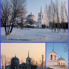
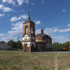
The Church of Archangel Michael stands at the heart of the town and reflects the residents' connection to their heritage. The local community gathers at public spaces and keeps traditions alive through annual celebrations and memorial events.

The best way to explore the town is on foot through the quiet streets and central area. Buses and minibuses connect the town to nearby cities, and the nearest railway station is located about 10 miles (16 km) away.

A former Olympic athlete from the town, sportsperson Olga Bondarenko, achieved major success on the international stage. The Neftyanik stadium built in 1962 reflects the sporting passion of residents and remains a place where local talent develops.

The community of curious travelers

AroundUs brings together thousands of curated places, local tips, and hidden gems, enriched daily by 60,000 contributors worldwide.

Start exploring
Inception
1710
Elevation above the sea
150 m
GPS coordinates
50.31667,44.80000
Latest update
February 17, 2026 00:00
Around this place
Stepan Razin Cliff
Russian Federation

Stepan Razin Cliff

68.9 km
Petrov Val canal
Russian Federation

Petrov Val canal

36.6 km
Alexander Graben
Russian Federation

Alexander Graben

96.4 km
Belogorsky Kamennobrodsky Monastery
Russian Federation

Belogorsky Kamennobrodsky Monastery

63.7 km
Пион тонколистный
Russian Federation

Пион тонколистный

48.3 km
Patriarch Oak
Russian Federation

Patriarch Oak

140.2 km
Stolbichi
Russian Federation

Stolbichi

73.1 km
Щербаковская балка
Russian Federation

Щербаковская балка

67.7 km
Zemstvo of Kamyshin
Russian Federation

Zemstvo of Kamyshin

51 km
Камышинские горы Уши и Лоб
Russian Federation

Камышинские горы Уши и Лоб

42.5 km
Lutheran church, Verkhny Eruslan
Russian Federation

Lutheran church, Verkhny Eruslan

123.8 km
Holy Ascension Monastery Kremensky
Russian Federation

Holy Ascension Monastery Kremensky

126.2 km
Большой Каменный овраг
Russian Federation

Большой Каменный овраг

76.7 km
Նիկոլսկի մայր տաճար
Russian Federation

Նիկոլսկի մայր տաճար

50.7 km
Კამიშინის დიმიტრი თესალონიკელის ძეგლი
Russian Federation

Კამიშინის დიმიტრი თესალონიკელის ძეგლი

50.6 km
Church of Dmitry Donskoy in Ilovlya
Russian Federation

Church of Dmitry Donskoy in Ilovlya

127.2 km
Church of Nativity, Nizhnay Dobrinka
Russian Federation

Church of Nativity, Nizhnay Dobrinka

58.4 km
Church of Saint John the Baptist (Lysye Gory)
Russian Federation

Church of Saint John the Baptist (Lysye Gory)

138.1 km
Церковь Дмитрия Солунского (Меловатка)
Russian Federation

Церковь Дмитрия Солунского (Меловатка)

62.9 km
Mass grave in khutor Shurupovsky
Russian Federation

Mass grave in khutor Shurupovsky

101.8 km
Moskovskaya Street, 7, Frolovo
Russian Federation

Moskovskaya Street, 7, Frolovo

102.6 km
Grave of Leonid Ivanovich Chernushkin
Russian Federation

Grave of Leonid Ivanovich Chernushkin

67.1 km
Museum of Cossack life, Ilovlya
Russian Federation

Museum of Cossack life, Ilovlya

123.5 km
The grave of A.M. Zherebtsov
Russian Federation

The grave of A.M. Zherebtsov

67.2 km
Graves of Sergey Timofeyev
Russian Federation

Graves of Sergey Timofeyev

74.7 km
Budenny street, 71, Ilovlya
Russian Federation

Budenny street, 71, Ilovlya

127.5 km
Sinyaya Mountain
Russian Federation

Sinyaya Mountain

56 km
Prud Zherebtsov
Russian Federation

Prud Zherebtsov

56.8 km
Show the full map
Reviews
Share your experience

No review yet

Discussions
Start a discussion...

No discussion yet

« Kotovo - human settlement in Kotovsky District, Volgograd Oblast, Russia » is provided by Around Us (aroundus.com). Images and texts are derived from Wikimedia project under a Creative Commons license. You are allowed to copy, distribute, and modify copies of this page, under the conditions set by the license, as long as this note is clearly visible.

Discover hidden gems everywhere you go!

From secret cafés to breathtaking viewpoints, skip the crowded tourist spots and find places that match your style. Our app makes it easy with voice search, smart filtering, route optimization, and insider tips from travelers worldwide. Download now for the complete mobile experience.

Around Us App Screenshot

A unique approach to discovering new places

Le Figaro

All the places worth exploring

France Info

A tailor-made excursion in just a few clicks

20 Minutes

Around Us
Travel Guide & Maps
Download

Send to your phone

QR Code
1

Open the camera app on your mobile.

2

Point at the QR code with your camera. A notification will appear.

3

Tap the notification to open the link.