Coffre ${chestReward.rarityLabel}
+${chestReward.xp} XP
Explorer
NOUVEAU ×${chestReward.collectible.quantity}
tapez pour fermer
Chest locked

Open chests in the app

Around Us is built for your phone — chests unlock when you walk, explore and capture nearby places.

Enable Location

We need your location to show you interesting places around you

Discover nearby places

Find interesting locations and hidden gems around you

Precise directions

Get accurate directions and distances to places

Your location is never shared with other users. It's only used when you tap the location button.

Karabash

Log in to your account

Start exploring — it's free

Trusted by 72,383 travelers worldwide

Continue with Google
Continue with Apple
or

We will send you a code to connect

By continuing, you accept our Terms and Conditions and our Privacy Policy

Check your inbox

We've sent a pincode in your inbox. Please enter the code below.

Discussion Reviews 5 Photos
83.7k Popularity

Karabash, Industrial mining city in Chelyabinsk Oblast, Russia

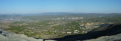
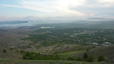
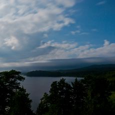
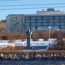
Karabash sits at 350 meters (1150 feet) elevation in the southern Urals, roughly 90 kilometers (56 miles) northwest of Chelyabinsk. The settlement spreads along a narrow valley surrounded by hills shaped by decades of industrial activity.

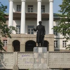
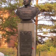
The settlement began in 1822 as a gold prospecting camp and grew quickly with ore discoveries nearby. The shift to copper extraction came in the early 20th century, and in 1933 the place officially gained town status.

The name combines two Turkic words meaning black and head, referring to the shape of a nearby mountain. Locals preserve this linguistic link to geography even though most residents today speak Russian.

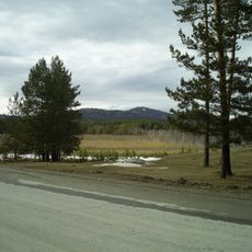
Access is mainly via a rural highway from Chelyabinsk, which can take several hours depending on weather. Visitors should expect a remote setting and plan basic supplies ahead.

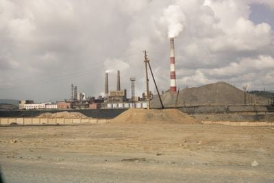
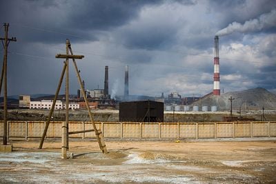
The terrain resembles a moonscape with bare orange earth created by sulfur dioxide and heavy metal deposits from copper smelting. Vegetation is completely absent across large areas, giving the place an otherworldly appearance.

The community of curious travelers

AroundUs brings together thousands of curated places, local tips, and hidden gems, enriched daily by 60,000 contributors worldwide.

Start exploring
Inception
1822
Elevation above the sea
350 m
GPS coordinates
55.48333,60.20000
Latest update
December 13, 2025 16:19
Around this place
Turgoyak
Russian Federation

Turgoyak

38.1 km
Taganai National Park
Russian Federation

Taganai National Park

35.8 km
Uvildy
Russian Federation

Uvildy

19.3 km
Taganay
Russian Federation

Taganay

35.8 km
Argazi Reservoir
Russian Federation

Argazi Reservoir

15.7 km
White House, Kyshtym
Russian Federation

White House, Kyshtym

32.5 km
Gora Yurma
Russian Federation

Gora Yurma

13.5 km
Otkliknoy greben'
Russian Federation

Otkliknoy greben'

32.2 km
Sugomak
Russian Federation

Sugomak

30 km
Egoza
Russian Federation

Egoza

33.8 km
Russian Federation

Dolgobrodsk Reservoir

33.2 km
Kushtumga
Russian Federation

Kushtumga

41.1 km
Anbashskaya
Russian Federation

Anbashskaya

27.7 km
Paperclip Monument
Russian Federation

Paperclip Monument

37.5 km
Megaliths in the Urals
Russian Federation

Megaliths in the Urals

37.4 km
Church of the Nativity of Christ (Kyshtym)
Russian Federation

Church of the Nativity of Christ (Kyshtym)

33.2 km
Фонтан у «Белого дома», перенсен с предзаводской площади (Кыштым)
Russian Federation

Фонтан у «Белого дома», перенсен с предзаводской площади (Кыштым)

32.6 km
Palace of Culture and Technology "Prometheus"
Russian Federation

Palace of Culture and Technology "Prometheus"

37.1 km
Памятник М.И. Калинину (Кыштым)
Russian Federation

Памятник М.И. Калинину (Кыштым)

32.6 km
Церковь Святого Духа (Кыштым)
Russian Federation

Церковь Святого Духа (Кыштым)

32.2 km
House of culture in Tatysh
Russian Federation

House of culture in Tatysh

35.5 km
Бюст дважды Героя Советского Союза В.С. Архипова (Губернское)
Russian Federation

Бюст дважды Героя Советского Союза В.С. Архипова (Губернское)

25.7 km
Церковь Николая Чудотворца (Кыштым)
Russian Federation

Церковь Николая Чудотворца (Кыштым)

36.2 km
Французская горка (развалины (руины) бельгийской фактории) (Наилы)
Russian Federation

Французская горка (развалины (руины) бельгийской фактории) (Наилы)

22.2 km
Мечеть (Кулуево)
Russian Federation

Мечеть (Кулуево)

38.3 km
Ограда с воротами (Кыштым)
Russian Federation

Ограда с воротами (Кыштым)

32.7 km
Памятник воинам-землякам, павшим в годы Великой Отечественной войны 1941-1945 гг. (Аргаяш)
Russian Federation

Памятник воинам-землякам, павшим в годы Великой Отечественной войны 1941-1945 гг. (Аргаяш)

42.9 km
Дмитриевский собор (Губернское)
Russian Federation

Дмитриевский собор (Губернское)

25.7 km
Show the full map
Reviews
Share your experience

No review yet

Discussions
Start a discussion...

No discussion yet

« Karabash - Industrial mining city in Chelyabinsk Oblast, Russia » is provided by Around Us (aroundus.com). Images and texts are derived from Wikimedia project under a Creative Commons license. You are allowed to copy, distribute, and modify copies of this page, under the conditions set by the license, as long as this note is clearly visible.

Discover hidden gems everywhere you go!

From secret cafés to breathtaking viewpoints, skip the crowded tourist spots and find places that match your style. Our app makes it easy with voice search, smart filtering, route optimization, and insider tips from travelers worldwide. Download now for the complete mobile experience.

Around Us App Screenshot

A unique approach to discovering new places

Le Figaro

All the places worth exploring

France Info

A tailor-made excursion in just a few clicks

20 Minutes

Around Us
Travel Guide & Maps
Download

Send to your phone

QR Code
1

Open the camera app on your mobile.

2

Point at the QR code with your camera. A notification will appear.

3

Tap the notification to open the link.