Enable Location

We need your location to show you interesting places around you

Discover nearby places

Find interesting locations and hidden gems around you

Precise directions

Get accurate directions and distances to places

Your location is never shared with other users. It's only used when you tap the location button.

Kalach-na-Donu

Log in to your account

Start exploring — it's free

Trusted by 62,292 travelers worldwide

Continue with Google
Continue with Apple
or

We will send you a code to connect

By continuing, you accept our Terms and Conditions and our Privacy Policy

Check your inbox

We've sent a pincode in your inbox. Please enter the code below.

Kalach-na-Donu, Administrative center on Don River, Russia

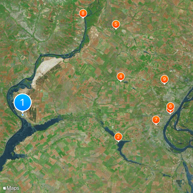
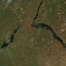
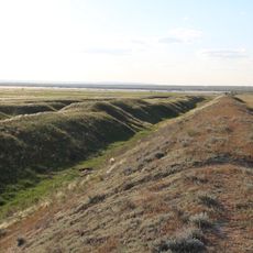
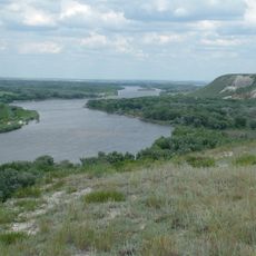
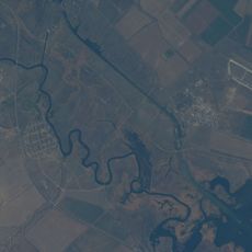
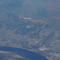
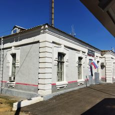
Kalach-na-Donu is a town situated along the Don River roughly 70 kilometers west of Volgograd in Russia. The settlement sits on elevated ground above the riverbank and functions as a regional hub connected by federal highway and the Volga-Don Canal.

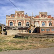
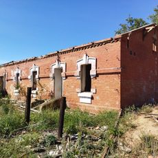
The town began as a Cossack settlement in 1708 and gained importance after the Volga-Don Railway was built in 1862. This transportation link transformed it into a significant hub for commerce between two major river systems.

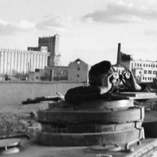
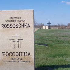
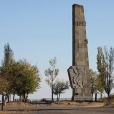
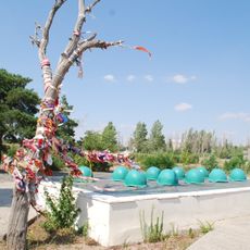
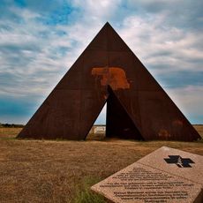
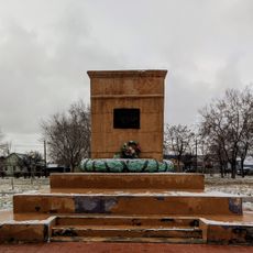
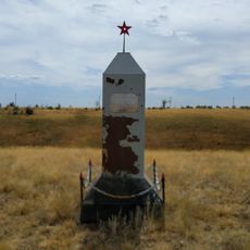
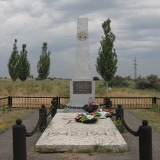
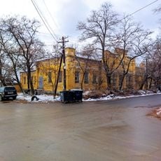
The town earned the honorary title City of Military Glory in 2010 for its role during the Battle of Stalingrad. This recognition reflects how the place remains connected to regional memory and identity today.

Federal highway A260 provides easy road access to neighboring regions and nearby cities. The Volga-Don Canal also offers a water route option for those exploring the river network.

The Don River displays a strong seasonal pattern with most of its annual water flow occurring during spring months. This shapes the landscape and water levels noticeably throughout the year.

The community of curious travelers

AroundUs brings together thousands of curated places, local tips, and hidden gems, enriched daily by 60,000 contributors worldwide.

Start exploring
Inception
1708
Elevation above the sea
40 m
GPS coordinates
48.68333,43.53333
Latest update
December 14, 2025 21:14
Around this place
Volga–Don Canal
Russian Federation

Volga–Don Canal

47.1 km
Volgograd Grain Elevator
Russian Federation

Volgograd Grain Elevator

69.8 km
Deutscher Soldatenfriedhof Rossoschka
Russian Federation

Deutscher Soldatenfriedhof Rossoschka

48.9 km
Tsaritsin guard line
Russian Federation

Tsaritsin guard line

59.8 km
Kazan Cathedral in Volgograd
Russian Federation

Kazan Cathedral in Volgograd

69.9 km
Lysaya Gora
Russian Federation

Lysaya Gora

63.3 km
Natural Park Donskoy
Russian Federation

Natural Park Donskoy

53.8 km
Soldatskoye Pole
Russian Federation

Soldatskoye Pole

68.6 km
Church of St. Paraskeva Pyatnitsa in Volgograd
Russian Federation

Church of St. Paraskeva Pyatnitsa in Volgograd

66.5 km
Karpovskoye Vodokhranilishche
Russian Federation

Karpovskoye Vodokhranilishche

11.5 km
Zelonoye koltso
Russian Federation

Zelonoye koltso

64.9 km
Spine
Russian Federation

Spine

58.1 km
Konny
Russian Federation

Konny

62.5 km
Trinity Church
Russian Federation

Trinity Church

59.5 km
Инга (разъезд)
Russian Federation

Инга (разъезд)

61.4 km
Connection of fronts monument
Russian Federation

Connection of fronts monument

6.6 km
Radomsky square
Russian Federation

Radomsky square

68.5 km
Железнодорожный вокзал станции Канальная (бывшая Тундутово)
Russian Federation

Железнодорожный вокзал станции Канальная (бывшая Тундутово)

69.1 km
Maximov brothers plant - plant management
Russian Federation

Maximov brothers plant - plant management

68.7 km
Maximov brothers plant - heating plant
Russian Federation

Maximov brothers plant - heating plant

68.8 km
Residential house
Russian Federation

Residential house

69.8 km
The grave of Nikolai Cheprakov
Russian Federation

The grave of Nikolai Cheprakov

49.6 km
Mass grave on Lysaya Gora
Russian Federation

Mass grave on Lysaya Gora

64 km
Elshanskaya Street, 130, Volgograd
Russian Federation

Elshanskaya Street, 130, Volgograd

68.5 km
Водонапорная башня станции Канальная (бывшая Тундутово)
Russian Federation

Водонапорная башня станции Канальная (бывшая Тундутово)

69.1 km
Residential buildings
Russian Federation

Residential buildings

69.1 km
Elshanskaya, 132, Volgograd
Russian Federation

Elshanskaya, 132, Volgograd

68.4 km
Bereslavskoye Vodokhranilishche
Russian Federation

Bereslavskoye Vodokhranilishche

42.3 km
Show the full map
« Kalach-na-Donu - Administrative center on Don River, Russia » is provided by Around Us (aroundus.com). Images and texts are derived from Wikimedia project under a Creative Commons license. You are allowed to copy, distribute, and modify copies of this page, under the conditions set by the license, as long as this note is clearly visible.

Discover hidden gems everywhere you go!

From secret cafés to breathtaking viewpoints, skip the crowded tourist spots and find places that match your style. Our app makes it easy with voice search, smart filtering, route optimization, and insider tips from travelers worldwide. Download now for the complete mobile experience.

Around Us App Screenshot

A unique approach to discovering new places

Le Figaro

All the places worth exploring

France Info

A tailor-made excursion in just a few clicks

20 Minutes

Around Us
Travel Guide & Maps
Download

Send to your phone

QR Code
1

Open the camera app on your mobile.

2

Point at the QR code with your camera. A notification will appear.

3

Tap the notification to open the link.