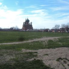
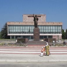
Prokhladny, Administrative center in Kabardino-Balkaria, Russia
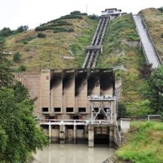
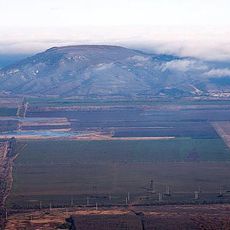
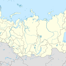
Prokhladny is a city in Kabardino-Balkaria located in the North Caucasus region at an elevation of about 214 meters in the northern foothills of the Caucasus Mountains. It spreads across relatively flat terrain approximately 52 kilometers northwest of the regional capital, Nalchik.
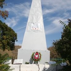
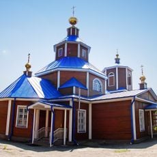
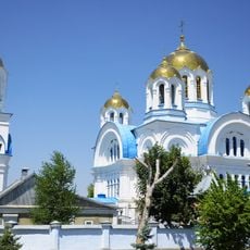
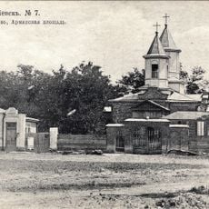
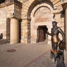
The settlement began in 1765 as a Zaporozhian Cossack outpost during Russia's expansion into the South Caucasus region. It later became a key military stronghold that helped protect Russia's southern border in this strategic area.
The city is home to people from various North Caucasus ethnic groups who maintain their traditions through local events and celebrations that happen regularly throughout the year. This cultural mix shapes how the community lives and interacts in everyday life.
The city is connected by bus services to nearby towns and has basic facilities like schools, hospitals, and administrative offices. Visitors should check on local transportation options before arriving, since services may be limited outside main routes.
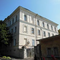
The city changed its administrative status in 1898 when it separated from the Pyatigorsky administrative unit and became an independent urban district. This shift marked the beginning of its development as a separate administrative center within the region.
Location: Prokhladny Urban Okrug
Inception: 1765
Elevation above the sea: 214 m
Website: http://admprohladnyi.ru
GPS coordinates: 43.75750,44.02972
Latest update: December 6, 2025 15:00
Lake Proval
81.3 km
Chegem Waterfalls
75.6 km
City of Angels
76.5 km
Lake Tambukan
73.3 km
Tree of Sadness
76.5 km
Baksan hydroelectric power station
52.2 km
Lermontov Grotto
81.9 km
Nalchik Mosque
44.8 km
Operetta Theatre of Stavropol Krai
82 km
Lysaya
75.7 km
Mass grave of Soviet soldiers fallen in WWII, Malgobek
54 km
Victims of Deportation Memorial
50.1 km
Holy Ascension Cathedral
81.6 km
Saint Nicholas Church, Georgievsk
61.5 km
Mozdok Museum of Regional Studies
51.1 km
St. Nicholas Cathedral
2.2 km
Церковь Успения Пресвятой Богородицы (Пятигорск)
80.1 km
Surb Poghos-Petros Armenian church in Georgievsk
66.2 km
Церковь Архангела Михаила (Незлобная, Георгиевский район)
65.3 km
Zhabo-Kala
81.5 km
Tatartup
50.7 km
Château Erken
24.9 km
State Musical Theatre
45.6 km
Zol'skiy Kar'yer
44.9 km
Chegem Gorge
73.8 km
House for poor officers
82.1 km
Ostap Bender statue in Pyatigorsk
81.3 km
Officers' department of infirmary
82 kmReviews
Visited this place? Tap the stars to rate it and share your experience / photos with the community! Try now! You can cancel it anytime.
Discover hidden gems everywhere you go!
From secret cafés to breathtaking viewpoints, skip the crowded tourist spots and find places that match your style. Our app makes it easy with voice search, smart filtering, route optimization, and insider tips from travelers worldwide. Download now for the complete mobile experience.
A unique approach to discovering new places❞
— Le Figaro
All the places worth exploring❞
— France Info
A tailor-made excursion in just a few clicks❞
— 20 Minutes