Enable Location

We need your location to show you interesting places around you

Discover nearby places

Find interesting locations and hidden gems around you

Precise directions

Get accurate directions and distances to places

Your location is never shared with other users. It's only used when you tap the location button.

White Sea – Baltic Canal

Log in to your account

Start exploring — it's free

Trusted by 61,684 travelers worldwide

Continue with Google
Continue with Apple
or

We will send you a code to connect

By continuing, you accept our Terms and Conditions and our Privacy Policy

Check your inbox

We've sent a pincode in your inbox. Please enter the code below.

White Sea – Baltic Canal

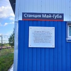
White Sea – Baltic Canal, 227-kilometer waterway system in Karelia, Russia.

Description

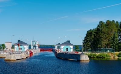
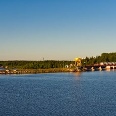
The White Sea – Baltic Canal runs 227 kilometers through Karelia, linking the Onega lake system with the White Sea via a series of constructed waterways and natural stretches. The route incorporates 19 locks that regulate the water level as the passage moves through forests, rivers and open water.

History

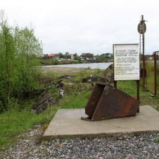
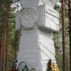
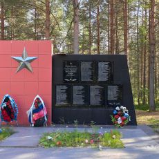
Construction took place between 1931 and 1933 using forced labor from Soviet prison camps. Thousands of workers died during the rapid completion, which finished in just 20 months under harsh conditions in the northern wilderness.

Culture

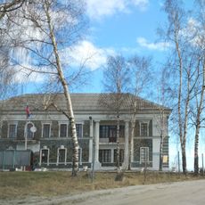
The canal represents a major engineering achievement of the Soviet era, transforming the transportation infrastructure of northern Russia and connecting regional communities.

Practical

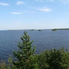
Navigation is possible from May through October, with passage limited to vessels drawing no more than 3.5 meters (about 11 feet) of water. Travelers can join small cruise ships that move along the waterway, passing through locks and forests as they cross the region.

Did you know?

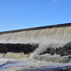
The southern lock sequence, known as the Povenets Stairs, lifts boats 103 meters (about 338 feet) above sea level through seven consecutive chambers. This arrangement forms one of the most noticeable engineering solutions along the entire waterway.

Location
Part of
Unified Deep Water System of European Russia
GPS coordinates
62.80000,34.80000
Latest update
December 14, 2025 19:48

AroundUs brings together thousands of curated places, local tips, and hidden gems, enriched daily by 60,000 contributors worldwide. Discover all places nearby (Karelia).

Around this place
Sandarmokh
Russian Federation

Sandarmokh

11.5 km
Belomorsk petroglyphs
Russian Federation

Belomorsk petroglyphs

189.1 km
Vygozero
Russian Federation

Vygozero

91 km
Voitsky Copper Mine
Russian Federation

Voitsky Copper Mine

122.4 km
Козацький хрест «Убієнним синам України»
Russian Federation

Козацький хрест «Убієнним синам України»

7.7 km
Russian Federation

Амбар (деревня Надвоицы)

122.2 km
Russian Federation

Дом жилой старших судопропускных (Посёлок при 8-м шлюзе ББК)

34.2 km
Братская могила советских воинов, погибших в боях с фашистскими захватчиками (Надвоицы)
Russian Federation

Братская могила советских воинов, погибших в боях с фашистскими захватчиками (Надвоицы)

124.2 km
Russian Federation

Могила Степана Ефимовича Льдинина (1905-1956), полного кавалера орденов Славы (Сегежа)

109.5 km
Plotina No. 26
Russian Federation

Plotina No. 26

160.1 km
Death place of V.P. Solunin
Russian Federation

Death place of V.P. Solunin

116.3 km
Memorial place of 1st World War  in Nadvoitsy
Russian Federation

Memorial place of 1st World War in Nadvoitsy

124.6 km
Russian Federation

Дом жилой судопропускных (Повенец)

9 km
Russian Federation

Кладбище (Сухое)

182 km
Russian Federation

Жилой дом (Повенец)

7.8 km
Russian Federation

Дом жилой начальника шлюза (Посёлок при 8-м шлюзе ББК)

34.3 km
Russian Federation

Казначейство (Повенец)

5.7 km
Административное здание управления НКВД (Надвоицы)
Russian Federation

Административное здание управления НКВД (Надвоицы)

121.6 km
NKVD Belbaltlag administration building
Russian Federation

NKVD Belbaltlag administration building

21 km
Братская могила жертв иностранной интервенции 1918—1920 гг. и комплекс захоронений советских воинов (Медвежьегорск)
Russian Federation

Братская могила жертв иностранной интервенции 1918—1920 гг. и комплекс захоронений советских воинов (Медвежьегорск)

21.1 km
Russian Federation

Памятник партизанам, погибшим в годы Великой Отечественной войны 1941-1945 гг. (Сегежа)

108.2 km
Memorial sign in honor of Kalinin in park of Povenets
Russian Federation

Memorial sign in honor of Kalinin in park of Povenets

5.7 km
Russian Federation

Могила поэта Б.М. Смоленского (Падун)

31.6 km
Russian Federation

Дом жилой судопропускных (Повенец)

9.1 km
Shavan spillway dam
Russian Federation

Shavan spillway dam

130.9 km
Russian Federation

Дом жилой старших судопропускных (Посёлок при 8-м шлюзе ББК)

34.2 km
Russian Federation

Дом жилой судопропускных (Надвоицы)

122.5 km
Russian Federation

Дом жилой для семей служащих НКВД (Надвоицы)

121.9 km
Show the full map
« White Sea – Baltic Canal - 227-kilometer waterway system in Karelia, Russia » is provided by Around Us (aroundus.com). Images and texts are derived from Wikimedia project under a Creative Commons license. You are allowed to copy, distribute, and modify copies of this page, under the conditions set by the license, as long as this note is clearly visible.

Discover hidden gems everywhere you go!

From secret cafés to breathtaking viewpoints, skip the crowded tourist spots and find places that match your style. Our app makes it easy with voice search, smart filtering, route optimization, and insider tips from travelers worldwide. Download now for the complete mobile experience.

Around Us App Screenshot

A unique approach to discovering new places

Le Figaro

All the places worth exploring

France Info

A tailor-made excursion in just a few clicks

20 Minutes

Around Us
Travel Guide & Maps
Download

Send to your phone

QR Code
1

Open the camera app on your mobile.

2

Point at the QR code with your camera. A notification will appear.

3

Tap the notification to open the link.