Enable Location

We need your location to show you interesting places around you

Discover nearby places

Find interesting locations and hidden gems around you

Precise directions

Get accurate directions and distances to places

Your location is never shared with other users. It's only used when you tap the location button.

Bolshoy Cheremshan

Log in to your account

Start exploring — it's free

Trusted by 62,408 travelers worldwide

Continue with Google
Continue with Apple
or

We will send you a code to connect

By continuing, you accept our Terms and Conditions and our Privacy Policy

Check your inbox

We've sent a pincode in your inbox. Please enter the code below.

Bolshoy Cheremshan

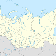
Bolshoy Cheremshan, Protected river system in Samara Oblast, Tatarstan, and Ulyanovsk Oblast, Russia

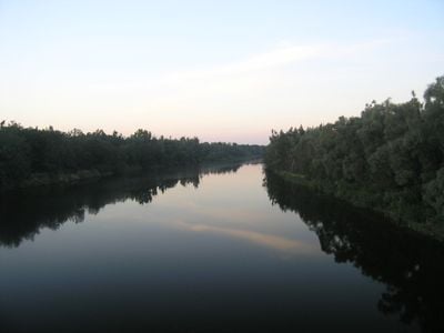
Bolshoy Cheremshan is a river system that flows about 336 kilometers through varied landscapes on its way to the Volga system. The waterway is shaped by wide meadows and a meandering course across three administrative regions.

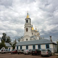
In the 1600s, military fortifications were built along the river to defend and control the region. These structures shaped the strategic importance of the area for generations afterward.

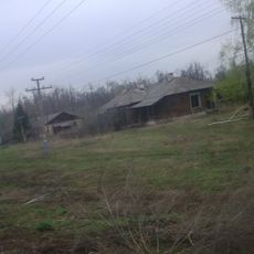
The river flows through lands of several peoples, and its names reflect the linguistic diversity found across the region. Local residents use the water for daily tasks, and the banks form part of the everyday landscape.

The river is generally accessible from several points where you can reach the banks. The best time to visit is outside the flood season, when water levels are more stable.

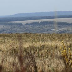
The river originates from hills in the south and draws water from a large drainage basin spread across multiple landscapes. Its connection to an artificial reservoir shows how this water system supports modern infrastructure today.

The community of curious travelers

AroundUs brings together thousands of curated places, local tips, and hidden gems, enriched daily by 60,000 contributors worldwide.

Start exploring
Location
Location
Location
Elevation above the sea
45 m
GPS coordinates
54.16944,49.54556
Latest update
December 10, 2025 15:48
Around this place
Russian Federation

Loyalty

70.4 km
Sengileevskie Mountains National Park
Russian Federation

Sengileevskie Mountains National Park

64.6 km
Свято-Троицкий храм (Ташла)
Russian Federation

Свято-Троицкий храм (Ташла)

53.5 km
Russian Federation

Genko's Forest Belt

33.1 km
A. N. Ostrovsky Drama Theatre
Russian Federation

A. N. Ostrovsky Drama Theatre

7.4 km
Dimitrovgrad Mosque
Russian Federation

Dimitrovgrad Mosque

7.4 km
Alexandro-Nevsky monastery
Russian Federation

Alexandro-Nevsky monastery

70.1 km
Church of the Transfiguration, Dimitrovgrad
Russian Federation

Church of the Transfiguration, Dimitrovgrad

7.3 km
Church of the Kazan Icon of the Mother of God (Verchnee Sancheleevo)
Russian Federation

Church of the Kazan Icon of the Mother of God (Verchnee Sancheleevo)

51.3 km
Тиинск (разъезд)
Russian Federation

Тиинск (разъезд)

15.4 km
Obamza
Russian Federation

Obamza

13.8 km
Sengiley mountains
Russian Federation

Sengiley mountains

62.7 km
Разсвєт (Ульяновська область)
Russian Federation

Разсвєт (Ульяновська область)

10.1 km
Амировка (роз'їзд, Ульяновська область)
Russian Federation

Амировка (роз'їзд, Ульяновська область)

40.4 km
Педер Хузангай музее
Russian Federation

Педер Хузангай музее

69.8 km
Markov Distillery, Dimitrovgrad
Russian Federation

Markov Distillery, Dimitrovgrad

7.3 km
The groats mill of the merchant F.V. Bechin
Russian Federation

The groats mill of the merchant F.V. Bechin

7 km
Church of the Icon of the Mother of God "Sporitelnitsa Khlebov"
Russian Federation

Church of the Icon of the Mother of God "Sporitelnitsa Khlebov"

69.4 km
Church of Kosma and Damian
Russian Federation

Church of Kosma and Damian

47.6 km
Church of Archangel Michael in Povolzhsky
Russian Federation

Church of Archangel Michael in Povolzhsky

66.1 km
Wooden Mansion in Dimitrovgrad
Russian Federation

Wooden Mansion in Dimitrovgrad

7.8 km
Храм во имя Архистратига Михаила
Russian Federation

Храм во имя Архистратига Михаила

61 km
Church of the Theotokos of Kazan
Russian Federation

Church of the Theotokos of Kazan

46.5 km
Church in the name of Archangel Michael
Russian Federation

Church in the name of Archangel Michael

69.4 km
Saints Cosmas and Damian Church
Russian Federation

Saints Cosmas and Damian Church

47.7 km
Church of Saint Demetrius of Thessaloniki
Russian Federation

Church of Saint Demetrius of Thessaloniki

48.7 km
Church of the Protection of the Theotokos
Russian Federation

Church of the Protection of the Theotokos

63.7 km
Chapel in the name of St. Nicholas
Russian Federation

Chapel in the name of St. Nicholas

61.9 km
Show the full map
« Bolshoy Cheremshan - Protected river system in Samara Oblast, Tatarstan, and Ulyanovsk Oblast, Russia » is provided by Around Us (aroundus.com). Images and texts are derived from Wikimedia project under a Creative Commons license. You are allowed to copy, distribute, and modify copies of this page, under the conditions set by the license, as long as this note is clearly visible.

Discover hidden gems everywhere you go!

From secret cafés to breathtaking viewpoints, skip the crowded tourist spots and find places that match your style. Our app makes it easy with voice search, smart filtering, route optimization, and insider tips from travelers worldwide. Download now for the complete mobile experience.

Around Us App Screenshot

A unique approach to discovering new places

Le Figaro

All the places worth exploring

France Info

A tailor-made excursion in just a few clicks

20 Minutes

Around Us
Travel Guide & Maps
Download

Send to your phone

QR Code
1

Open the camera app on your mobile.

2

Point at the QR code with your camera. A notification will appear.

3

Tap the notification to open the link.