Enable Location

We need your location to show you interesting places around you

Discover nearby places

Find interesting locations and hidden gems around you

Precise directions

Get accurate directions and distances to places

Your location is never shared with other users. It's only used when you tap the location button.

Vasilyevo, Zelenodolsky District, Republic of Tatarstan

Log in to your account

Start exploring — it's free

Trusted by 61,673 travelers worldwide

Continue with Google
Continue with Apple
or

We will send you a code to connect

By continuing, you accept our Terms and Conditions and our Privacy Policy

Check your inbox

We've sent a pincode in your inbox. Please enter the code below.

Vasilyevo, Zelenodolsky District, Republic of Tatarstan

Vasilyevo, Zelenodolsky District, Republic of Tatarstan, Urban settlement in Zelenodolsky District, Republic of Tatarstan, Russia.

Description

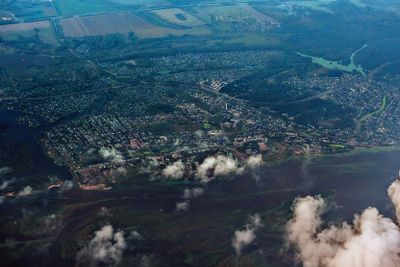
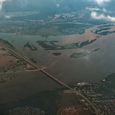
Vasilyevo is an urban-type settlement on the left bank of the Volga River near the Kuybyshev Reservoir, situated about 19 kilometers east of Zelenodolsk. The town spreads across residential areas with a population of around 16,953 people.

History

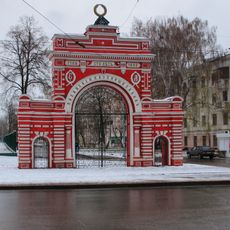
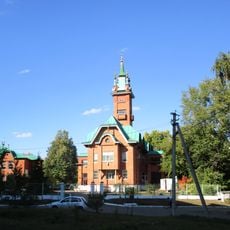
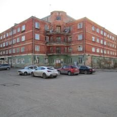
The settlement was founded in 1693 and became an urban-type locality in 1928, marking a shift in its administrative status and development. Industrial plants including a laboratory glassware factory and timber operations began to take shape after this transformation.

Culture

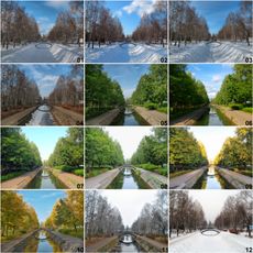
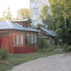
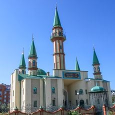
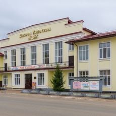
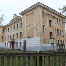
Russian and Tatar communities live side by side here, with their different traditions visible in local celebrations and the style of buildings throughout the settlement. This cultural mix shapes how the town looks and feels today.

Practical

The settlement has a railway station on the Kazan-Kanash line, providing transportation links to other towns and regions. Getting around is straightforward thanks to this connection, which also serves neighboring communities.

Did you know?

The settlement is the largest urban-type locality in Tatarstan by population and was once home to a significant laboratory glassware factory. This combination of size and specialized industrial production sets it apart in the region.

Location
Городское поселение посёлок городского типа Васильево
Inception
1693
GPS coordinates
55.83778,48.67889
Latest update
December 7, 2025 19:32

AroundUs brings together thousands of curated places, local tips, and hidden gems, enriched daily by 60,000 contributors worldwide. Discover all places nearby (Городское поселение посёлок городского типа Васильево).

Around this place
Temple of All Religions
Russian Federation

Temple of All Religions

19 km
Raifsky Bogoroditsky Monastery
Russian Federation

Raifsky Bogoroditsky Monastery

7.8 km
Assumption Cathedral, Sviyazhsk
Russian Federation

Assumption Cathedral, Sviyazhsk

7.7 km
Sviyazhsk History and Architectural Museum
Russian Federation

Sviyazhsk History and Architectural Museum

7.4 km
Zilantov monastery
Russian Federation

Zilantov monastery

24 km
Zelenodolsky bridge
Russian Federation

Zelenodolsky bridge

10.2 km
Cathedral of Saint John the Baptist
Russian Federation

Cathedral of Saint John the Baptist

7.6 km
Engelhardt Observatory
Russian Federation

Engelhardt Observatory

8.4 km
Uritskogo park, Kazan
Russian Federation

Uritskogo park, Kazan

24 km
Sviyazhskaya Makaryevskaya Poustinia
Russian Federation

Sviyazhskaya Makaryevskaya Poustinia

6.4 km
Zaymishche Bridge
Russian Federation

Zaymishche Bridge

11.6 km
Red Gates
Russian Federation

Red Gates

23.8 km
Krasnokokshayskaya street, Kazan
Russian Federation

Krasnokokshayskaya street, Kazan

24 km
Крестовоздвиженская церковь (Васильево)
Russian Federation

Крестовоздвиженская церковь (Васильево)

2.1 km
Часовня в посёлке Нижние Вязовые
Russian Federation

Часовня в посёлке Нижние Вязовые

10.5 km
Джамиг
Russian Federation

Джамиг

11.3 km
Rafikov Mosque
Russian Federation

Rafikov Mosque

23.4 km
Ramazan Mosque, Qazan
Russian Federation

Ramazan Mosque, Qazan

22.9 km
Holy Trinity Church
Russian Federation

Holy Trinity Church

7.6 km
Medical School Building, Volzhsk
Russian Federation

Medical School Building, Volzhsk

18.3 km
Women gymnasium, Malo-Moskovskaya street
Russian Federation

Women gymnasium, Malo-Moskovskaya street

24.2 km
Әфисәрләр җыелышы бинасы
Russian Federation

Әфисәрләр җыелышы бинасы

24.3 km
Gornaya Street 1, Volzhsk
Russian Federation

Gornaya Street 1, Volzhsk

18.3 km
Кече Мәскәү урамы, 30/13
Russian Federation

Кече Мәскәү урамы, 30/13

23.8 km
Mosque in Zelenodolsk
Russian Federation

Mosque in Zelenodolsk

9.3 km
Lenin Street 33, Volzhsk
Russian Federation

Lenin Street 33, Volzhsk

19.3 km
School 3, Volzhsk
Russian Federation

School 3, Volzhsk

18.1 km
Cinema "Rodina", Volzhsk
Russian Federation

Cinema "Rodina", Volzhsk

18.3 km
Show the full map
« Vasilyevo, Zelenodolsky District, Republic of Tatarstan - Urban settlement in Zelenodolsky District, Republic of Tatarstan, Russia » is provided by Around Us (aroundus.com). Images and texts are derived from Wikimedia project under a Creative Commons license. You are allowed to copy, distribute, and modify copies of this page, under the conditions set by the license, as long as this note is clearly visible.

Discover hidden gems everywhere you go!

From secret cafés to breathtaking viewpoints, skip the crowded tourist spots and find places that match your style. Our app makes it easy with voice search, smart filtering, route optimization, and insider tips from travelers worldwide. Download now for the complete mobile experience.

Around Us App Screenshot

A unique approach to discovering new places

Le Figaro

All the places worth exploring

France Info

A tailor-made excursion in just a few clicks

20 Minutes

Around Us
Travel Guide & Maps
Download

Send to your phone

QR Code
1

Open the camera app on your mobile.

2

Point at the QR code with your camera. A notification will appear.

3

Tap the notification to open the link.