Chest opened
+${chestReward.xp} XP
Explorer
NOUVEAU ×${chestReward.collectible.quantity}
tapez pour fermer
Chest locked

Open chests in the app

Around Us is built for your phone — chests unlock when you walk, explore and capture nearby places.

Enable Location

We need your location to show you interesting places around you

Discover nearby places

Find interesting locations and hidden gems around you

Precise directions

Get accurate directions and distances to places

Your location is never shared with other users. It's only used when you tap the location button.

Sarkel

Log in to your account

Start exploring — it's free

Trusted by 72,882 travelers worldwide

Continue with Google
Continue with Apple
or

We will send you a code to connect

By continuing, you accept our Terms and Conditions and our Privacy Policy

Check your inbox

We've sent a pincode in your inbox. Please enter the code below.

Discussion Reviews 1 Photos
37.8k Popularity

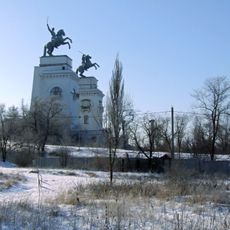
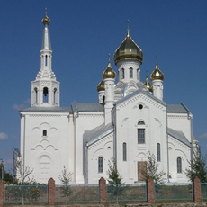
Sarkel, Fortress in Russia

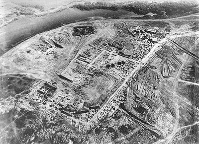
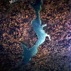
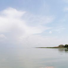
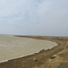
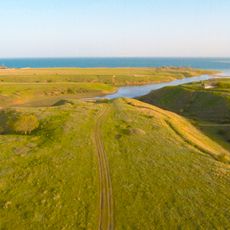
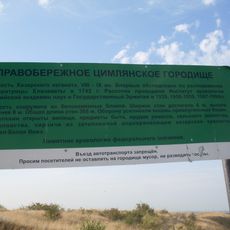
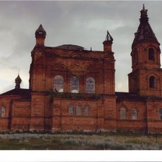
Sarkel was a limestone fortress on the lower Don River, now submerged beneath water. The ruins lie underwater and reveal the former structure of this important trading post.

The fortress was established when Khazars and Byzantine power collaborated to create an important trading stronghold. It played a role in regional control and commerce for centuries.

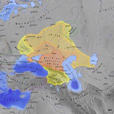
The site holds meaning for those studying Khazar and Slavic history. Researchers examine the remains to learn about these early civilizations.

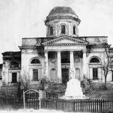
The site is difficult to access since the remains lie underwater, submerged by a reservoir created behind a dam. Visitors can learn about its history through museums and archaeological resources without visiting the location directly.

The name comes from the Khazar language and means 'White House,' referring to the bright limestone walls that once dominated the landscape. This linguistic connection offers insight into the culture of that era.

The community of curious travelers

AroundUs brings together thousands of curated places, local tips, and hidden gems, enriched daily by 60,000 contributors worldwide.

Start exploring
Location
Inception
834
GPS coordinates
47.70500,42.27306
Latest update
December 8, 2025 08:20
Around this place
Tsimlyansk Reservoir
Russian Federation

Tsimlyansk Reservoir

44.3 km
Veselovsky Reservoir
Russian Federation

Veselovsky Reservoir

115.4 km
Proletarskoe Reservoir
Russian Federation

Proletarskoe Reservoir

121 km
Peaceful Atom
Russian Federation

Peaceful Atom

21.2 km
Volgodonsk Arboretum
Russian Federation

Volgodonsk Arboretum

23.7 km
Цимлянск (заказник)
Russian Federation

Цимлянск (заказник)

31 km
Правобережное Цимлянское городище
Russian Federation

Правобережное Цимлянское городище

8.2 km
Cathedral of the Nativity, Volgodonsk
Russian Federation

Cathedral of the Nativity, Volgodonsk

20.6 km
Парк Перемоги (Волгодонськ)
Russian Federation

Парк Перемоги (Волгодонськ)

22.9 km
Tulips peninsula
Russian Federation

Tulips peninsula

93 km
Church of the Ascension, Susat
Russian Federation

Church of the Ascension, Susat

121.9 km
Cossacks
Russian Federation

Cossacks

20.7 km
Ethnographic Museum, Razdorskaya
Russian Federation

Ethnographic Museum, Razdorskaya

123.1 km
Church of the Intercession
Russian Federation

Church of the Intercession

89.8 km
Николай Чудотворец сиркәүе
Russian Federation

Николай Чудотворец сиркәүе

89.2 km
Museum of Local History of Volgodonsk District
Russian Federation

Museum of Local History of Volgodonsk District

42.1 km
Ang Simbahan Sa Pagpangamuyo Sa Bulahan Nga Birhen Maria
Russian Federation

Ang Simbahan Sa Pagpangamuyo Sa Bulahan Nga Birhen Maria

90.3 km
Крымское городище (Ростовская область)
Russian Federation

Крымское городище (Ростовская область)

113.7 km
St. Nicholas' Church, Tsimlyansk
Russian Federation

St. Nicholas' Church, Tsimlyansk

14.9 km
Volgodonsk Ecological and Historical Museum
Russian Federation

Volgodonsk Ecological and Historical Museum

23.3 km
Church of the Nativity of the Blessed Virgin Mary
Russian Federation

Church of the Nativity of the Blessed Virgin Mary

119.1 km
Simbahan Sa Mga Pangagpas Sa Bulahan Nga Birhen Maria
Russian Federation

Simbahan Sa Mga Pangagpas Sa Bulahan Nga Birhen Maria

107.1 km
Бекрен исемендәге Изге Николай монастыры
Russian Federation

Бекрен исемендәге Изге Николай монастыры

41.6 km
Ang Simbahan Ni Belen Sa Bulahan Nga Birhen Maria
Russian Federation

Ang Simbahan Ni Belen Sa Bulahan Nga Birhen Maria

92.8 km
Ilyinskaya church
Russian Federation

Ilyinskaya church

104.4 km
Holy Trinity Church, Bolshaya Martynovka
Russian Federation

Holy Trinity Church, Bolshaya Martynovka

65.8 km
Богоявленская церковь (Кумшацкая)
Russian Federation

Богоявленская церковь (Кумшацкая)

21.6 km
Дуб черешчатый (Ростовская область)
Russian Federation

Дуб черешчатый (Ростовская область)

84.9 km
Show the full map
Reviews
Share your experience

No review yet

Discussions
Start a discussion...

No discussion yet

« Sarkel - Fortress in Russia » is provided by Around Us (aroundus.com). Images and texts are derived from Wikimedia project under a Creative Commons license. You are allowed to copy, distribute, and modify copies of this page, under the conditions set by the license, as long as this note is clearly visible.

Discover hidden gems everywhere you go!

From secret cafés to breathtaking viewpoints, skip the crowded tourist spots and find places that match your style. Our app makes it easy with voice search, smart filtering, route optimization, and insider tips from travelers worldwide. Download now for the complete mobile experience.

Around Us App Screenshot

A unique approach to discovering new places

Le Figaro

All the places worth exploring

France Info

A tailor-made excursion in just a few clicks

20 Minutes

Around Us
Travel Guide & Maps
Download

Send to your phone

QR Code
1

Open the camera app on your mobile.

2

Point at the QR code with your camera. A notification will appear.

3

Tap the notification to open the link.