Chest opened
+${chestReward.xp} XP
Explorer
NOUVEAU ×${chestReward.collectible.quantity}
tapez pour fermer
Chest locked

Open chests in the app

Around Us is built for your phone — chests unlock when you walk, explore and capture nearby places.

Enable Location

We need your location to show you interesting places around you

Discover nearby places

Find interesting locations and hidden gems around you

Precise directions

Get accurate directions and distances to places

Your location is never shared with other users. It's only used when you tap the location button.

Shumerlinsky District

Log in to your account

Start exploring — it's free

Trusted by 72,962 travelers worldwide

Continue with Google
Continue with Apple
or

We will send you a code to connect

By continuing, you accept our Terms and Conditions and our Privacy Policy

Check your inbox

We've sent a pincode in your inbox. Please enter the code below.

Shumerlinsky District
Discussion Reviews 1 Photos
4.8k Popularity

Shumerlinsky District, Municipal district in Chuvash Republic, Russia

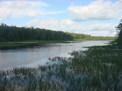
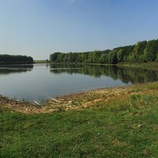
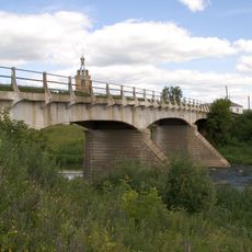
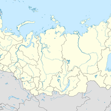
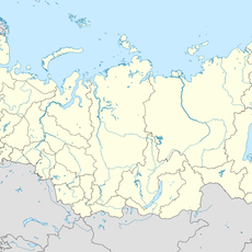
Shumerlinsky District is a municipal area in the Chuvash Republic, located in western Russia along the border with Nizhny Novgorod Oblast. The Sura River forms part of its boundary, and the town of Shumerlya serves as the administrative center.

The district was established in 1935 as part of the Chuvash Autonomous Soviet Socialist Republic. After the Soviet Union ended, its administrative status was updated to reflect the new structure of the Chuvash Republic.

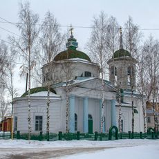
The Chuvash language is still heard in everyday life across the villages, spoken alongside Russian in markets and family gatherings. Traditional crafts like embroidery and weaving are part of local life and can be seen during visits to the villages.

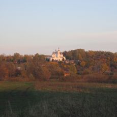
The area is best visited in summer or early autumn, when roads are dry and the paths to villages are easy to travel. Public transport in the rural parts is limited, so having your own vehicle makes getting around much easier.

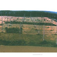
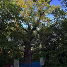
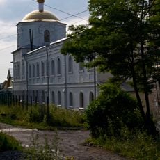
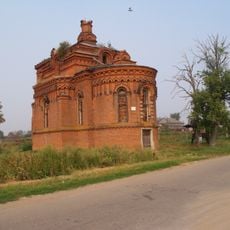
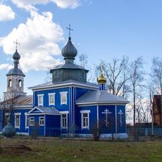
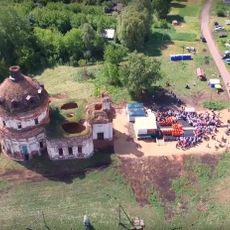
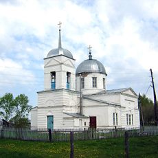
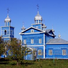
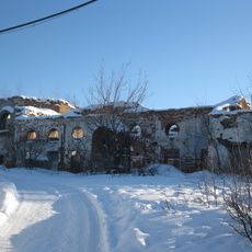
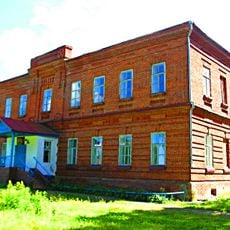
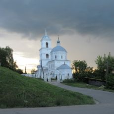
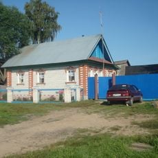
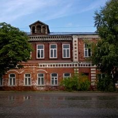
The district is made up almost entirely of small villages, with no notable urban development across its territory. This means that everyday life here has stayed closely tied to farming and the forest for decades, with little outside influence shaping the local pace.

The community of curious travelers

AroundUs brings together thousands of curated places, local tips, and hidden gems, enriched daily by 60,000 contributors worldwide.

Start exploring
Location
Inception
1935
Capital city
Shumerlya
GPS coordinates
55.53333,46.41667
Latest update
March 3, 2026 08:13
Around this place
Sura Ionospheric Heating Facility
Russian Federation

Sura Ionospheric Heating Facility

69.5 km
Holy Trinity monastery, Alatyr
Russian Federation

Holy Trinity monastery, Alatyr

76.4 km
Tikhvinsky convent
Russian Federation

Tikhvinsky convent

76.5 km
Ancient Chuvash Oak
Russian Federation

Ancient Chuvash Oak

76.9 km
Kievo-Nikolaevsky monastery, Alatyr
Russian Federation

Kievo-Nikolaevsky monastery, Alatyr

76.9 km
Hill Mari Michael the Archangel Monastery
Russian Federation

Hill Mari Michael the Archangel Monastery

66 km
Sjutkul Lake
Russian Federation

Sjutkul Lake

42.3 km
Მაროვსკის ჯვართამაღლების მონასტერი
Russian Federation

Მაროვსკის ჯვართამაღლების მონასტერი

77.5 km
Peter and Paul Church, Poretskoye
Russian Federation

Peter and Paul Church, Poretskoye

38.5 km
Успенская церковь (Бортсурманы)
Russian Federation

Успенская церковь (Бортсурманы)

40.2 km
Никольский собор
Russian Federation

Никольский собор

77.2 km
Церковь Рождества Христова
Russian Federation

Церковь Рождества Христова

74.6 km
Category:Holy Trinity church (Zhdanovo)
Russian Federation

Category:Holy Trinity church (Zhdanovo)

35.2 km
Красний Май
Russian Federation

Красний Май

61.3 km
Çĕрпӳ кĕперĕ
Russian Federation

Çĕрпӳ кĕперĕ

76.4 km
Transfiguration church, Kudeikha
Russian Federation

Transfiguration church, Kudeikha

34.5 km
Храм Покрова Пресвятой Богородицы
Russian Federation

Храм Покрова Пресвятой Богородицы

54.6 km
Nativity Church, Alatyr
Russian Federation

Nativity Church, Alatyr

76.7 km
Введенский Вершино-Сумский монастырь
Russian Federation

Введенский Вершино-Сумский монастырь

68.3 km
Николаевский Стародевичий монастырь
Russian Federation

Николаевский Стародевичий монастырь

76.2 km
Revolution village
Russian Federation

Revolution village

68.3 km
Храм Спаса Нерукотворного Образа
Russian Federation

Храм Спаса Нерукотворного Образа

68.1 km
Цигановський
Russian Federation

Цигановський

70 km
Янгличи (Канашан кӀошт)
Russian Federation

Янгличи (Канашан кӀошт)

58.5 km
Первое Мая (Чуваши)
Russian Federation

Первое Мая (Чуваши)

56 km
Васильевка (Чуваши)
Russian Federation

Васильевка (Чуваши)

74.5 km
Kumashka
Russian Federation

Kumashka

11.8 km
Алатырь
Russian Federation

Алатырь

76.8 km
Show the full map
Reviews
Share your experience

No review yet

Discussions
Start a discussion...

No discussion yet

« Shumerlinsky District - Municipal district in Chuvash Republic, Russia » is provided by Around Us (aroundus.com). Images and texts are derived from Wikimedia project under a Creative Commons license. You are allowed to copy, distribute, and modify copies of this page, under the conditions set by the license, as long as this note is clearly visible.

Discover hidden gems everywhere you go!

From secret cafés to breathtaking viewpoints, skip the crowded tourist spots and find places that match your style. Our app makes it easy with voice search, smart filtering, route optimization, and insider tips from travelers worldwide. Download now for the complete mobile experience.

Around Us App Screenshot

A unique approach to discovering new places

Le Figaro

All the places worth exploring

France Info

A tailor-made excursion in just a few clicks

20 Minutes

Around Us
Travel Guide & Maps
Download

Send to your phone

QR Code
1

Open the camera app on your mobile.

2

Point at the QR code with your camera. A notification will appear.

3

Tap the notification to open the link.