Chest opened
+${chestReward.xp} XP
Explorer
NOUVEAU ×${chestReward.collectible.quantity}
tapez pour fermer
Chest locked

Open chests in the app

Around Us is built for your phone — chests unlock when you walk, explore and capture nearby places.

Enable Location

We need your location to show you interesting places around you

Discover nearby places

Find interesting locations and hidden gems around you

Precise directions

Get accurate directions and distances to places

Your location is never shared with other users. It's only used when you tap the location button.

Log in to your account

Start exploring — it's free

Trusted by 73,069 travelers worldwide

Continue with Google
Continue with Apple
or

We will send you a code to connect

By continuing, you accept our Terms and Conditions and our Privacy Policy

Check your inbox

We've sent a pincode in your inbox. Please enter the code below.

Кыласовское сельское поселение
Discussion Reviews Photo
1.2k Popularity

Кыласовское сельское поселение, Rural settlement in Kungursky District, Russia

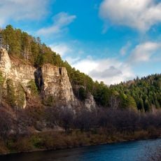
Kylasovo rural settlement is a municipal formation in Kungursky District comprising 37 populated areas spread across the landscape. These communities are located along the right bank of the Babka River in Perm Krai and together form the administrative unit.

The area was established in 1623 as Krylasovo village and developed over time as a rural community. Administrative reorganization occurred in 2004 when it became a formally recognized municipal formation within Kungursky District.

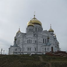
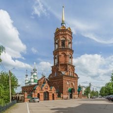
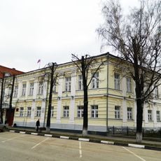
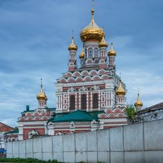
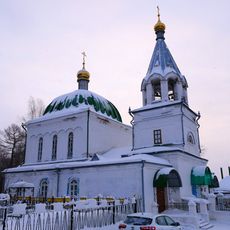
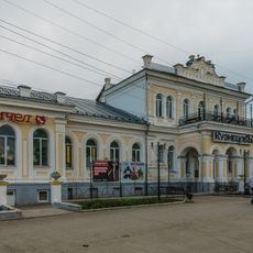
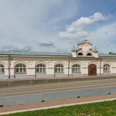
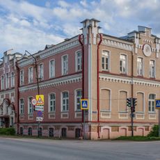
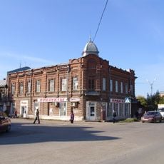
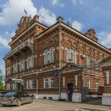
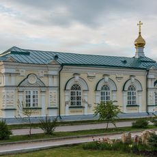
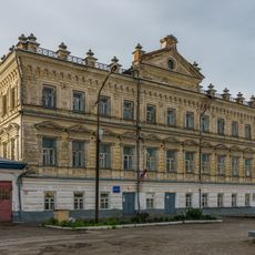
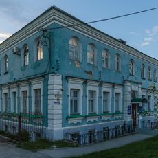
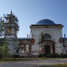
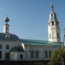
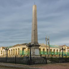
The settlement serves as a community hub where residents gather at the library and cultural venues for daily activities and celebrations. The Orthodox church and cultural center are spaces where local traditions continue to shape how people spend their time together.

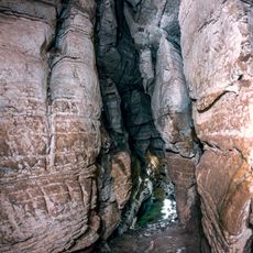
Visitors should consider the seasons when planning a trip, as the climate varies significantly between warm summers and cold winters. The better time to visit is during warmer months when paths are more accessible and weather is more favorable for exploration.

The settlement maintained its own administrative center in Kylasovo village until 2022, when it merged into the larger Kungursky District. This consolidation changed local governance but the 37 communities preserved their geographic identity and separateness.

The community of curious travelers

AroundUs brings together thousands of curated places, local tips, and hidden gems, enriched daily by 60,000 contributors worldwide.

Start exploring
GPS coordinates
57.56970,56.70257
Latest update
December 14, 2025 18:01
Around this place
Kungur Ice Cave
Russian Federation

Kungur Ice Cave

23.2 km
Belogorsky Monastery
Russian Federation

Belogorsky Monastery

34.5 km
Navel of the World Monument in Kungur
Russian Federation

Navel of the World Monument in Kungur

21.1 km
Yermak Stone
Russian Federation

Yermak Stone

32.7 km
Church of the Theotokos of Tikhvin
Russian Federation

Church of the Theotokos of Tikhvin

21.5 km
Особняк Щербакова
Russian Federation

Особняк Щербакова

21.4 km
Saint Nicholas Church
Russian Federation

Saint Nicholas Church

22.1 km
Kungur Local Museum
Russian Federation

Kungur Local Museum

21.4 km
Gostiny Dvor, Kungur
Russian Federation

Gostiny Dvor, Kungur

21.3 km
Кунгурское техническое училище Губкина
Russian Federation

Кунгурское техническое училище Губкина

19.7 km
All Saints Church
Russian Federation

All Saints Church

20.8 km
Church of the Transfiguration
Russian Federation

Church of the Transfiguration

21.2 km
Kuznetsov Mansion
Russian Federation

Kuznetsov Mansion

20.6 km
Kungur Mosque
Russian Federation

Kungur Mosque

22.2 km
Дом Грибушина
Russian Federation

Дом Грибушина

20.3 km
Small Gostiny Dvor, Kungur
Russian Federation

Small Gostiny Dvor, Kungur

21.3 km
Елизаветинская рукодельная школа
Russian Federation

Елизаветинская рукодельная школа

20.1 km
Bolshaya Mechkinskaya Cave
Russian Federation

Bolshaya Mechkinskaya Cave

6.7 km
Дом Ануфриевой
Russian Federation

Дом Ануфриевой

21.7 km
Dubinin's estate
Russian Federation

Dubinin's estate

21.4 km
Saint Alexius Church (Kungur)
Russian Federation

Saint Alexius Church (Kungur)

21.3 km
Old City Hall
Russian Federation

Old City Hall

21.2 km
Художественный музей
Russian Federation

Художественный музей

21.5 km
Храм Вознесения Господня
Russian Federation

Храм Вознесения Господня

23.3 km
Кунгурское городское четырёхклассное училище
Russian Federation

Кунгурское городское четырёхклассное училище

20.7 km
Храм Вознесения Господня (Берёзовка, Берёзовского района Пермского края)
Russian Federation

Храм Вознесения Господня (Берёзовка, Берёзовского района Пермского края)

36.3 km
Особняк Софронова
Russian Federation

Особняк Софронова

21.2 km
Kungur Obelisk
Russian Federation

Kungur Obelisk

21.3 km
Show the full map
Reviews
Share your experience

No review yet

Discussions
Start a discussion...

No discussion yet

« Кыласовское сельское поселение - Rural settlement in Kungursky District, Russia » is provided by Around Us (aroundus.com). Images and texts are derived from Wikimedia project under a Creative Commons license. You are allowed to copy, distribute, and modify copies of this page, under the conditions set by the license, as long as this note is clearly visible.

Discover hidden gems everywhere you go!

From secret cafés to breathtaking viewpoints, skip the crowded tourist spots and find places that match your style. Our app makes it easy with voice search, smart filtering, route optimization, and insider tips from travelers worldwide. Download now for the complete mobile experience.

Around Us App Screenshot

A unique approach to discovering new places

Le Figaro

All the places worth exploring

France Info

A tailor-made excursion in just a few clicks

20 Minutes

Around Us
Travel Guide & Maps
Download

Send to your phone

QR Code
1

Open the camera app on your mobile.

2

Point at the QR code with your camera. A notification will appear.

3

Tap the notification to open the link.