Enable Location

We need your location to show you interesting places around you

Discover nearby places

Find interesting locations and hidden gems around you

Precise directions

Get accurate directions and distances to places

Your location is never shared with other users. It's only used when you tap the location button.

Log in to your account

Start exploring — it's free

Trusted by 63,116 travelers worldwide

Continue with Google
Continue with Apple
or

We will send you a code to connect

By continuing, you accept our Terms and Conditions and our Privacy Policy

Check your inbox

We've sent a pincode in your inbox. Please enter the code below.

Ортинское городище
Discussion Reviews Photo
1.9k Popularity

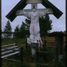
Ортинское городище, Archaeological site in Nenets Autonomous Okrug, Russia.

Ortinskoye Settlement is an archaeological site featuring the remains of a rectangular wooden fortress with earthen ramparts and ditches built along the Pechora River's right bank. The site preserves the original layout of this medieval settlement in the Arctic region.

This fortified settlement was established between the 6th and 10th centuries as a tribal center for the ancient Arctic Sirtya people before Nenets groups arrived in the region. The fortress represents a significant period in early northern Arctic habitation.

Archaeological excavations at the site revealed 1500 artifacts, including metal objects, bone arrowheads, and bronze animal figurines in distinct local artistic styles.

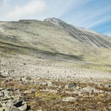
This site is located roughly 90 kilometers downstream from Naryan-Mar and benefits from advance planning before arrival. Visitors should expect limited accommodation and food options in this remote location.

The fortress walls were built using vertically positioned logs, demonstrating skilled construction methods typical of medieval northern settlements. This building approach was specifically adapted to withstand the harsh climate of the Arctic region.

The community of curious travelers

AroundUs brings together thousands of curated places, local tips, and hidden gems, enriched daily by 60,000 contributors worldwide.

Start exploring
GPS coordinates
68.05519,54.12822
Latest update
December 9, 2025 12:24
Around this place
Mount Narodnaya
Russian Federation

Mount Narodnaya

427.8 km
Polar Ural
Russian Federation

Polar Ural

458.8 km
Subpolar Ural
Russian Federation

Subpolar Ural

434.8 km
Manaraga
Russian Federation

Manaraga

417.4 km
Nenets Nature Reserve
Russian Federation

Nenets Nature Reserve

63.9 km
Богоявленский собор
Russian Federation

Богоявленский собор

66 km
Malye Karmakuly
Russian Federation

Malye Karmakuly

483.6 km
Памятник Яку-7Б (Нарьян-Мар)
Russian Federation

Памятник Яку-7Б (Нарьян-Мар)

66.1 km
Inta water tower
Russian Federation

Inta water tower

343.6 km
Dvorets Kultury Shakterov
Russian Federation

Dvorets Kultury Shakterov

421.8 km
Ненецький краєзнавчий музей
Russian Federation

Ненецький краєзнавчий музей

65.8 km
Здание почты (Нарьян-Мар)
Russian Federation

Здание почты (Нарьян-Мар)

66 km
Здание администрации Ненецкого автономного округа
Russian Federation

Здание администрации Ненецкого автономного округа

66.1 km
Russian Federation

Обелиск Победы в Нарьян-Маре

66 km
Дом культуры речников (Печора)
Russian Federation

Дом культуры речников (Печора)

353.6 km
Дом Шевелевых
Russian Federation

Дом Шевелевых

65.9 km
Памятник Нарьян-Марским портовикам
Russian Federation

Памятник Нарьян-Марским портовикам

65.8 km
Kaninsky lighthouse
Russian Federation

Kaninsky lighthouse

449.2 km
Преображенская церковь (Ижма)
Russian Federation

Преображенская церковь (Ижма)

339.2 km
Gorky Cinema
Russian Federation

Gorky Cinema

351 km
Обетный крест (Кимжа)
Russian Federation

Обетный крест (Кимжа)

499.9 km
Matveev Island Lighthouse
Russian Federation

Matveev Island Lighthouse

237.7 km
Дом П.С.Водыниной (Погорелец)
Russian Federation

Дом П.С.Водыниной (Погорелец)

494.1 km
Odigitry church, Kimzha
Russian Federation

Odigitry church, Kimzha

499.9 km
Церковь Николая Чудотворца — первый православный самоедский (ненецкий) храм в Большеземельской тундре (Колва)
Russian Federation

Церковь Николая Чудотворца — первый православный самоедский (ненецкий) храм в Большеземельской тундре (Колва)

271.3 km
Дом священника и церковно-приходская школа (Колва)
Russian Federation

Дом священника и церковно-приходская школа (Колва)

271.2 km
Памятник В.И. Ленину (Инта)
Russian Federation

Памятник В.И. Ленину (Инта)

343.3 km
Windmill in Kimzha
Russian Federation

Windmill in Kimzha

499.6 km
Show the full map
Reviews
Share your experience

No review yet

Discussions
Start a discussion...

No discussion yet

« Ортинское городище - Archaeological site in Nenets Autonomous Okrug, Russia » is provided by Around Us (aroundus.com). Images and texts are derived from Wikimedia project under a Creative Commons license. You are allowed to copy, distribute, and modify copies of this page, under the conditions set by the license, as long as this note is clearly visible.

Discover hidden gems everywhere you go!

From secret cafés to breathtaking viewpoints, skip the crowded tourist spots and find places that match your style. Our app makes it easy with voice search, smart filtering, route optimization, and insider tips from travelers worldwide. Download now for the complete mobile experience.

Around Us App Screenshot

A unique approach to discovering new places

Le Figaro

All the places worth exploring

France Info

A tailor-made excursion in just a few clicks

20 Minutes

Around Us
Travel Guide & Maps
Download

Send to your phone

QR Code
1

Open the camera app on your mobile.

2

Point at the QR code with your camera. A notification will appear.

3

Tap the notification to open the link.