Enable Location

We need your location to show you interesting places around you

Discover nearby places

Find interesting locations and hidden gems around you

Precise directions

Get accurate directions and distances to places

Your location is never shared with other users. It's only used when you tap the location button.

Log in to your account

Start exploring — it's free

Trusted by 68,026 travelers worldwide

Continue with Google
Continue with Apple
or

We will send you a code to connect

By continuing, you accept our Terms and Conditions and our Privacy Policy

Check your inbox

We've sent a pincode in your inbox. Please enter the code below.

Jelanski
Discussion Reviews Photo
10.8k Popularity

Jelanski, Rural settlement in Kamyshlovsky District, Russia

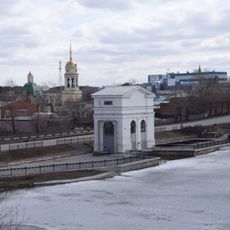
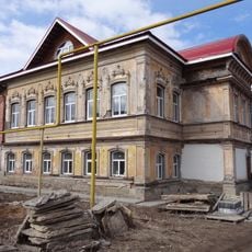
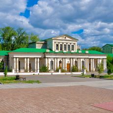
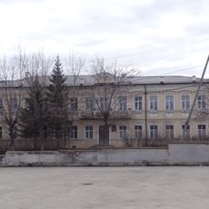
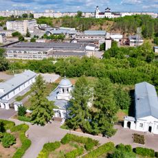
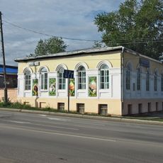
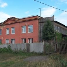
Jelanski is a rural settlement in Kamyshlovsky District, located in Sverdlovsk Oblast. The village sits at an elevation of around 130 meters and consists of scattered houses, farmland, and small roads connecting to neighboring communities.

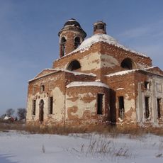
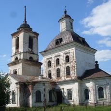
The settlement developed as farming communities expanded into this area and later became formally established. Its growth was tied to the economic shifts that shaped the broader Sverdlovsk region over the past century.

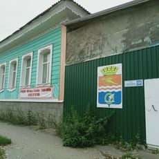
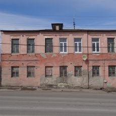
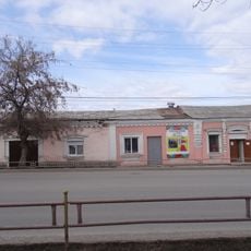
The settlement shows signs of rural life through local farming practices and the way residents use the surrounding lands. Daily activities and traditions are woven into the community's connection to the region.

The settlement sits roughly 115 kilometers southeast of Yekaterinburg and can be reached by road. Visitors should know this is a small rural community with few tourist facilities, so you will need to be self-sufficient while exploring.

The nearby Beloyarsk Nuclear Power Station, located around 70 kilometers away, has shaped the energy supply of this region in ways residents know well. Many depend on this distant facility without giving it much thought in their daily lives.

The community of curious travelers

AroundUs brings together thousands of curated places, local tips, and hidden gems, enriched daily by 60,000 contributors worldwide.

Start exploring
Location
Калиновське сільське поселення (Комишловський район)
GPS coordinates
56.84417,62.48611
Latest update
December 10, 2025 15:52
Around this place
Reftinsky Reservoir
Russian Federation

Reftinsky Reservoir

53.6 km
Kamensk-Uralsky Cannon
Russian Federation

Kamensk-Uralsky Cannon

59.9 km
Rail Bridge over the Iset River, Kamensk-Uralsky
Russian Federation

Rail Bridge over the Iset River, Kamensk-Uralsky

59.5 km
Drama Number Three
Russian Federation

Drama Number Three

60 km
Savior Transfiguration monastery
Russian Federation

Savior Transfiguration monastery

59.4 km
Tri sestry rock
Russian Federation

Tri sestry rock

24.5 km
Dam on the Kamenka river
Russian Federation

Dam on the Kamenka river

59.7 km
Bridge over Kamenka river
Russian Federation

Bridge over Kamenka river

59.7 km
Pisany Stone
Russian Federation

Pisany Stone

59 km
Merchant Kosyakov’s manor house
Russian Federation

Merchant Kosyakov’s manor house

59.7 km
St. Nicholas Church, Novopyshminskoe
Russian Federation

St. Nicholas Church, Novopyshminskoe

15.4 km
Molchanov Merchants’ Shop
Russian Federation

Molchanov Merchants’ Shop

59.8 km
House-Estate of the merchant Vorobyov
Russian Federation

House-Estate of the merchant Vorobyov

59.9 km
Warehouses Kamensky plant
Russian Federation

Warehouses Kamensky plant

59.6 km
Estate of the Caretaker of the Kamensk Plant
Russian Federation

Estate of the Caretaker of the Kamensk Plant

59.9 km
Tronin’s House
Russian Federation

Tronin’s House

59.8 km
Gerasimov Merchant’s Shop
Russian Federation

Gerasimov Merchant’s Shop

59.8 km
Church of the Entry of the Theotokos into the Temple
Russian Federation

Church of the Entry of the Theotokos into the Temple

53.6 km
Bureau Kamensky plant
Russian Federation

Bureau Kamensky plant

59.7 km
Orphanage building, Kamensk-Uralsky
Russian Federation

Orphanage building, Kamensk-Uralsky

59.9 km
St. Michael the Archangel's Church, Novopyshminskoye
Russian Federation

St. Michael the Archangel's Church, Novopyshminskoye

16 km
Gostiny Dvor, Kamensk-Uralsky
Russian Federation

Gostiny Dvor, Kamensk-Uralsky

59.8 km
Церковь иконы Божией Матери «Знамение» (городской округ Сухой Лог)
Russian Federation

Церковь иконы Божией Матери «Знамение» (городской округ Сухой Лог)

34.6 km
The Building of Men’s College, Kamensk-Uralsky
Russian Federation

The Building of Men’s College, Kamensk-Uralsky

59.8 km
The hospital building of Kamensk plant
Russian Federation

The hospital building of Kamensk plant

60.1 km
Holy Trinity Church
Russian Federation

Holy Trinity Church

59.8 km
Байновский мост
Russian Federation

Байновский мост

60 km
Baynovsky Waterfall
Russian Federation

Baynovsky Waterfall

28.7 km
Show the full map
Reviews
Share your experience

No review yet

Discussions
Start a discussion...

No discussion yet

« Jelanski - Rural settlement in Kamyshlovsky District, Russia » is provided by Around Us (aroundus.com). Images and texts are derived from Wikimedia project under a Creative Commons license. You are allowed to copy, distribute, and modify copies of this page, under the conditions set by the license, as long as this note is clearly visible.

Discover hidden gems everywhere you go!

From secret cafés to breathtaking viewpoints, skip the crowded tourist spots and find places that match your style. Our app makes it easy with voice search, smart filtering, route optimization, and insider tips from travelers worldwide. Download now for the complete mobile experience.

Around Us App Screenshot

A unique approach to discovering new places

Le Figaro

All the places worth exploring

France Info

A tailor-made excursion in just a few clicks

20 Minutes

Around Us
Travel Guide & Maps
Download

Send to your phone

QR Code
1

Open the camera app on your mobile.

2

Point at the QR code with your camera. A notification will appear.

3

Tap the notification to open the link.