Baljåsen, protected area
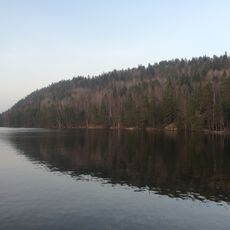
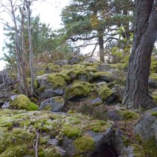
Baljåsen is a nature reserve in Åmål Municipality located in Dalsland and rises to 301 meters above sea level. The terrain features steep, nutrient-rich slopes covered by mixed forests of pine, spruce, and broadleaf trees including ash, lime, and maple.
The reserve was established in 1994 and became part of the European Natura 2000 network protecting sensitive habitats. This protected status was granted to safeguard rare plant species and woodpecker populations that depend on the varied forest structure.
A parking area near Petersborg provides easy access to marked hiking trails throughout the reserve. The site offers a shelter, basic toilet facilities, and is open year-round, though fires are prohibited and motor vehicles are restricted to designated paths.
All nine woodpecker species found in Sweden live here, with the white-backed woodpecker being particularly important, making this a special location for birdwatchers. The tapping sounds of these birds are clearly audible while walking through the forest and create a distinctive natural soundtrack.
The community of curious travelers
AroundUs brings together thousands of curated places, local tips, and hidden gems, enriched daily by 60,000 contributors worldwide.