Chest opened
+${chestReward.xp} XP
Explorer
NOUVEAU ×${chestReward.collectible.quantity}
tapez pour fermer

See the monuments around you in AR Open chests in the app

Around Us is built for your phone — point your camera at the streets and discover the monuments and places around you in augmented reality. Around Us is built for your phone — chests unlock when you walk, explore and capture nearby places.

•

Enable Location

We need your location to show you interesting places around you

Discover nearby places

Find interesting locations and hidden gems around you

Precise directions

Get accurate directions and distances to places

Your location is never shared with other users. It's only used when you tap the location button.

Cableway Tatranská Lomnica - Lomnický štít

Log in to your account

Start exploring — it's free

Trusted by 95,379 travelers worldwide

Continue with Google
Continue with Apple
or

We will send you a code to connect

By continuing, you accept our Terms and Conditions and our Privacy Policy

Check your inbox

We've sent a pincode in your inbox. Please enter the code below.

Cableway Tatranská Lomnica - Lomnický štít

Cableway Tatranská Lomnica - Lomnický štít, Aerial tramway in the High Tatras, Slovakia

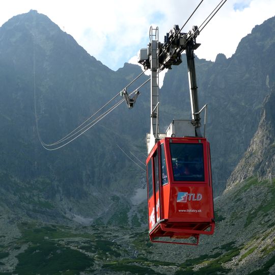
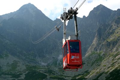
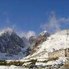
The Cableway Tatranská Lomnica – Lomnický štít was a two-section aerial tramway with four stations along a route of over 6 km. The first section ran from Tatranská Lomnica, behind the Grandhotel Praha, to Skalnaté pleso; the second continued from Skalnaté pleso to Lomnický štít. The red cabin in the photograph carries the TLD logo and the address www.tldtatry.sk.

The cableway was promoted by Juraj Országh, director of the Tatranská Lomnica spa, who secured state funding in 1934. Construction of the first section to Skalnaté pleso began in 1936 and the station opened on 22 December 1937. The summit station was completed in 1940, but public service to Lomnický štít started only in 1942. In January 1945 retreating Nazi forces blew up the valley station and an adjacent support; service resumed to Skalnaté pleso in February 1946 and to the summit in January 1949.

The cableway's name appears in several languages: Visutá lanovka Tatranská Lomnica – Lomnický štít in Czech, Luftseilbahn Lomnitzer Spitze in German and Kolej linowa na Łomnicę in Polish. The middle station Štart takes its name from the start of a former sledging and bobsleigh track nearby, not from the cableway route.

The upper section from Skalnaté pleso to Lomnický štít covers 1,868 metres and climbs 864 metres, with an average gradient of 52 percent and a maximum of 92 percent. The cabin holds 15 people and carries 50 passengers per hour. The summit station, at 2,634 metres, is the highest inhabited place in Slovakia.

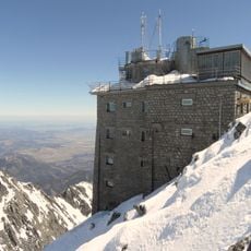
The summit station is a six-storey building at 2,634 m, described in the sources as the highest inhabited place in Slovakia. It was completed in 1940, and a measuring house for experimental physics of the Astronomical Institute of the Slovak Academy of Sciences was added in 1954–1955, its design drawing on Jurkovič's architecture.

The community of curious travelers

AroundUs brings together thousands of curated places, local tips, and hidden gems, enriched daily by 95,379 contributors worldwide.
Start exploring
Length
6 km
Operator
Tatry mountain resorts
Opening Hours
Monday-Sunday 09:00-15:00
GPS coordinates
49.19044,20.22581
Latest update
October 31, 2026 23:20
Reviews
Share your experience

No review yet

Discussions
Start a discussion...

No discussion yet

« Cableway Tatranská Lomnica - Lomnický štít - Aerial tramway in the High Tatras, Slovakia » is provided by Around Us (aroundus.com). Images and texts are derived from Wikimedia project under a Creative Commons license. You are allowed to copy, distribute, and modify copies of this page, under the conditions set by the license, as long as this note is clearly visible.

Discover hidden gems everywhere you go!

From secret cafés to breathtaking viewpoints, skip the crowded tourist spots and find places that match your style. Our app makes it easy with voice search, smart filtering, route optimization, and insider tips from travelers worldwide. Download now for the complete mobile experience.

Around Us App Screenshot
❝

A unique approach to discovering new places❞

— Le Figaro

❝

All the places worth exploring❞

— France Info

❝

A tailor-made excursion in just a few clicks❞

— 20 Minutes

Around Us
Travel Guide & Maps
Download

Send to your phone

QR Code
1

Open the camera app on your mobile.

2

Point at the QR code with your camera. A notification will appear.

3

Tap the notification to open the link.