Enable Location

We need your location to show you interesting places around you

Discover nearby places

Find interesting locations and hidden gems around you

Precise directions

Get accurate directions and distances to places

Your location is never shared with other users. It's only used when you tap the location button.

Malý Salatín

Log in to your account

Start exploring — it's free

Trusted by 60,651 travelers worldwide

Continue with Google
Continue with Apple
or

We will send you a code to connect

By continuing, you accept our Terms and Conditions and our Privacy Policy

Check your inbox

We've sent a pincode in your inbox. Please enter the code below.

Malý Salatín

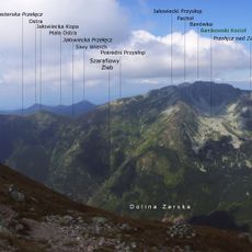
Malý Salatín, Mountain summit in Liptovský Mikuláš District, Slovakia

Description

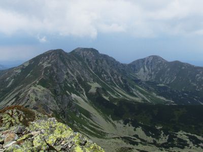
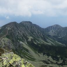
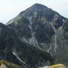
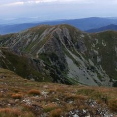
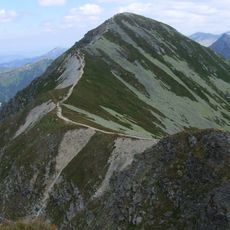
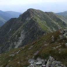
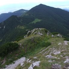
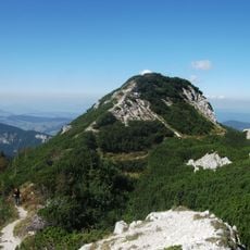
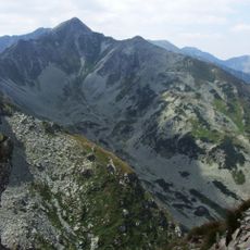
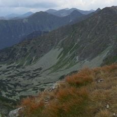
Malý Salatín is a mountain peak in the Western Tatras reaching 2046 meters, with grassy slopes that rise to a dome-shaped summit crowned by rocky outcrops. The terrain around it creates a natural landscape where open grassland gives way to steeper rock formations near the top.

History

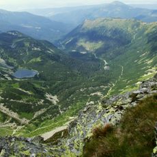
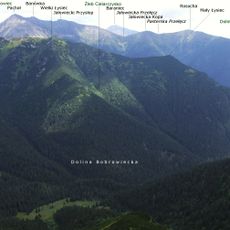
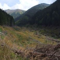
The mountain areas around this peak were used as grazing grounds for cattle from the Jalovecká Valley over past centuries. These traditional practices shaped the landscape and helped establish the trail systems that exist today.

Culture

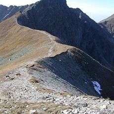
The mountain draws climbers and walkers who follow paths through the Western Tatras, participating in a tradition of mountain exploration that remains central to local outdoor culture. The routes are maintained by mountain clubs that help preserve these practices for visitors and residents alike.

Practical

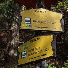
The climb to the summit follows marked trails and takes roughly 1 hour and 45 minutes from Banikovské Pass to the top. Visitors should be prepared for changing weather and uneven ground, as the route crosses open grassland and then steeper terrain near the peak.

Did you know?

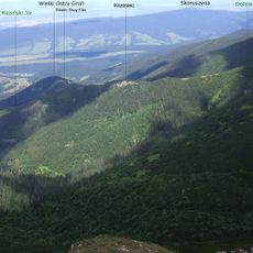
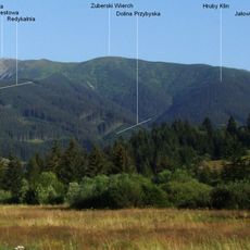
The peak sits between two distinct valleys, Zadná Salatyńská and Skrajná Salatyńská, acting as a natural divider in the broader Rohácka Valley system. This positioning makes it a notable reference point for understanding the geography of the surrounding mountain region.

Elevation above the sea
2,046 m
GPS coordinates
49.21184,19.68801
Latest update
December 14, 2025 20:29

AroundUs brings together thousands of curated places, local tips, and hidden gems, enriched daily by 60,000 contributors worldwide. Discover all places nearby (Liptovský Mikuláš District).

« Malý Salatín - Mountain summit in Liptovský Mikuláš District, Slovakia » is provided by Around Us (aroundus.com). Images and texts are derived from Wikimedia project under a Creative Commons license. You are allowed to copy, distribute, and modify copies of this page, under the conditions set by the license, as long as this note is clearly visible.

Discover hidden gems everywhere you go!

From secret cafés to breathtaking viewpoints, skip the crowded tourist spots and find places that match your style. Our app makes it easy with voice search, smart filtering, route optimization, and insider tips from travelers worldwide. Download now for the complete mobile experience.

Around Us App Screenshot

A unique approach to discovering new places

Le Figaro

All the places worth exploring

France Info

A tailor-made excursion in just a few clicks

20 Minutes

Around Us
Travel Guide & Maps
Download

Send to your phone

QR Code
1

Open the camera app on your mobile.

2

Point at the QR code with your camera. A notification will appear.

3

Tap the notification to open the link.