Enable Location

We need your location to show you interesting places around you

Discover nearby places

Find interesting locations and hidden gems around you

Precise directions

Get accurate directions and distances to places

Your location is never shared with other users. It's only used when you tap the location button.

Alaşehir

Log in to your account

Start exploring — it's free

Trusted by 62,832 travelers worldwide

Continue with Google
Continue with Apple
or

We will send you a code to connect

By continuing, you accept our Terms and Conditions and our Privacy Policy

Check your inbox

We've sent a pincode in your inbox. Please enter the code below.

Alaşehir, District center in Manisa Province, Turkey

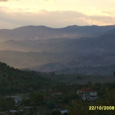
Alaşehir sits at the foot of Mount Bozdağ in western Turkey, where the town spreads along the Kuzuçay River at roughly 190 meters above sea level. The surrounding valleys are lined with vineyards and orchards that give the landscape a green tone.

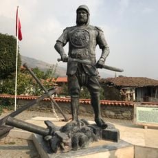
The settlement began as Philadelphia under King Attalos II of Pergamon and grew into a bishopric in early Christianity. The Ottomans captured the town in the late 14th century and renamed it Alaşehir.

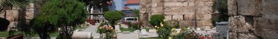
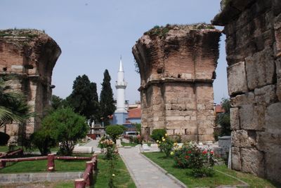
Visitors today can walk among the ruins of public buildings such as a theater and stadium that recall Greek and Roman times. The name comes from Greek Philadelphia, a reminder of when the town was a center for early Christianity.

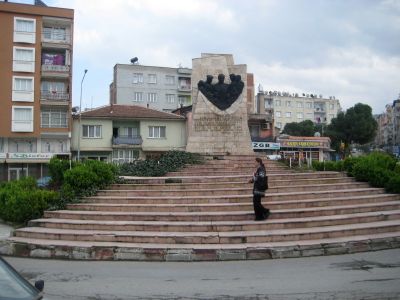
Main roads run through the center, where local markets sell fresh fruit and raisins from the surrounding area daily. Most archaeological remains lie outside the modern town center and can be reached on foot or by vehicle.

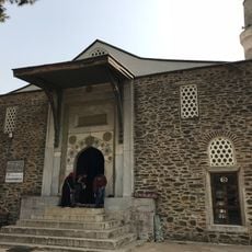
The town was one of the seven churches mentioned in the Book of Revelation, and parts of the 6th-century Basilica of St. John remain partly visible. Hills around the town hold tombs and sarcophagi that mark the different periods of settlement.

The community of curious travelers

AroundUs brings together thousands of curated places, local tips, and hidden gems, enriched daily by 60,000 contributors worldwide.

Start exploring
Location
Elevation above the sea
189 m
Shares border with
Salihli, Kula, Sarıgöl, Eşme, Kuyucak, Nazilli, Kiraz
GPS coordinates
38.35000,28.51667
Latest update
December 13, 2025 18:08
« Alaşehir - District center in Manisa Province, Turkey » is provided by Around Us (aroundus.com). Images and texts are derived from Wikimedia project under a Creative Commons license. You are allowed to copy, distribute, and modify copies of this page, under the conditions set by the license, as long as this note is clearly visible.

Discover hidden gems everywhere you go!

From secret cafés to breathtaking viewpoints, skip the crowded tourist spots and find places that match your style. Our app makes it easy with voice search, smart filtering, route optimization, and insider tips from travelers worldwide. Download now for the complete mobile experience.

Around Us App Screenshot

A unique approach to discovering new places

Le Figaro

All the places worth exploring

France Info

A tailor-made excursion in just a few clicks

20 Minutes

Around Us
Travel Guide & Maps
Download

Send to your phone

QR Code
1

Open the camera app on your mobile.

2

Point at the QR code with your camera. A notification will appear.

3

Tap the notification to open the link.