Koyunoluk Mountain, mountain in Onikişubat, Kahramanmaraş, Turkey
Location: Kahramanmaraş Province
Elevation above the sea: 1,844 m
GPS coordinates: 37.85710,36.58077
Latest update: November 15, 2025 18:53

Kahramanmaraş Piramit building
43.7 km
Sır Dam
39.7 km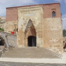
Eshab-ı Kehf Kulliye
49.8 km
Maraş Castle
42.8 km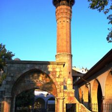
Maraş Mosque
43 km
12 Şubat Stadium
43.6 km
Feke Castle
55.3 km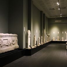
Archaeological museum Kahramanmaraş
43.8 km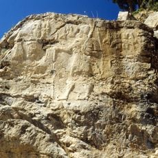
Relief of Hanyeri
63.5 km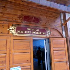
Kahramanmaraş Liberation Museum
42.8 km
Cucusòs
19.6 km
Düziçi Haruniye Ilıcası
57.6 km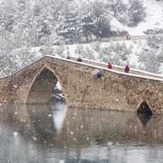
Ceyhan Bridge
32.4 km
Aslantaş Reservoir
62.5 km
Blueland Lunapark
33.1 km
Saint James monastery at Hajën
45.8 km
Galgamaç Şelalesi
39.1 km
Han
49.8 km
Saimbeyli Castle
45.2 km
Tarihi Çukur Hamamı
42.8 km
Durağan Caravanserai
49.8 km
Necip Fazil Kisakurek Cultural Centre Theater Hall
41.2 km
Amfiteatr
37.3 km
Scenic viewpoint
42.8 km
Scenic viewpoint
40.8 km
Scenic viewpoint
46.1 km
Ali Kayası Cam Teras
22.4 km
Kızılkuz Mevkii
51.8 kmReviews
Visited this place? Tap the stars to rate it and share your experience / photos with the community! Try now! You can cancel it anytime.
Discover hidden gems everywhere you go!
From secret cafés to breathtaking viewpoints, skip the crowded tourist spots and find places that match your style. Our app makes it easy with voice search, smart filtering, route optimization, and insider tips from travelers worldwide. Download now for the complete mobile experience.

A unique approach to discovering new places❞
— Le Figaro
All the places worth exploring❞
— France Info
A tailor-made excursion in just a few clicks❞
— 20 Minutes