Chest opened
+${chestReward.xp} XP
Explorer
NOUVEAU ×${chestReward.collectible.quantity}
tapez pour fermer
Chest locked

Open chests in the app

Around Us is built for your phone — chests unlock when you walk, explore and capture nearby places.

Enable Location

We need your location to show you interesting places around you

Discover nearby places

Find interesting locations and hidden gems around you

Precise directions

Get accurate directions and distances to places

Your location is never shared with other users. It's only used when you tap the location button.

Southampton Water

Log in to your account

Start exploring — it's free

Trusted by 72,931 travelers worldwide

Continue with Google
Continue with Apple
or

We will send you a code to connect

By continuing, you accept our Terms and Conditions and our Privacy Policy

Check your inbox

We've sent a pincode in your inbox. Please enter the code below.

Southampton Water
Discussion Reviews 1 Photos
15.9k Popularity

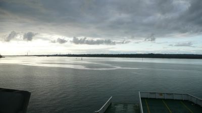
Southampton Water, English tidal estuary

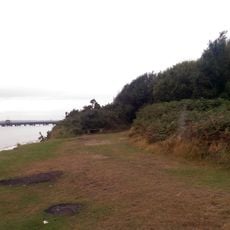
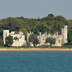
Southampton Water is a large tidal estuary on the southern coast of England, extending about 6 miles inland from the Solent. The Test and Itchen rivers flow into it, creating a natural harbor protected by salt marshes on the western side and steeper woodland terrain on the eastern side, with the city of Southampton situated at its northern edge.

This estuary formed after the last ice age when rising sea levels flooded river valleys, creating a ria or drowned valley. Over centuries, the natural deep harbor helped Southampton develop into a major British port, initially due to ideal shipping conditions and later through dredging to accommodate larger vessels.

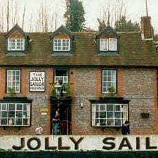
Southampton Water is deeply tied to maritime traditions and shapes daily life in the surrounding villages. Along the shores of Hythe and Hamble, boating culture is woven into the community, with locals and visitors spending time on the water and watching ships move through the harbor.

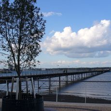
The water experiences tidal movement with an extended period of high water called the double tide, making passage easier for vessels at various times. Visitors planning boat trips should consult nautical charts, watch for buoy markers and shipping traffic, and wear life jackets, especially near the busy port docks and commercial shipping lanes.

The double tide phenomenon creates an unusually long period of high water, allowing ships extra time to enter and leave the harbor safely. This rare tidal pattern results from the estuary's unique shape and the water movement patterns of the adjoining Solent channel.

The community of curious travelers

AroundUs brings together thousands of curated places, local tips, and hidden gems, enriched daily by 60,000 contributors worldwide.

Start exploring
Location
GPS coordinates
50.85081,-1.34065
Latest update
February 19, 2026 23:20
Reviews
Share your experience

No review yet

Discussions
Start a discussion...

No discussion yet

« Southampton Water - English tidal estuary » is provided by Around Us (aroundus.com). Images and texts are derived from Wikimedia project under a Creative Commons license. You are allowed to copy, distribute, and modify copies of this page, under the conditions set by the license, as long as this note is clearly visible.

Discover hidden gems everywhere you go!

From secret cafés to breathtaking viewpoints, skip the crowded tourist spots and find places that match your style. Our app makes it easy with voice search, smart filtering, route optimization, and insider tips from travelers worldwide. Download now for the complete mobile experience.

Around Us App Screenshot

A unique approach to discovering new places

Le Figaro

All the places worth exploring

France Info

A tailor-made excursion in just a few clicks

20 Minutes

Around Us
Travel Guide & Maps
Download

Send to your phone

QR Code
1

Open the camera app on your mobile.

2

Point at the QR code with your camera. A notification will appear.

3

Tap the notification to open the link.