Enable Location

We need your location to show you interesting places around you

Discover nearby places

Find interesting locations and hidden gems around you

Precise directions

Get accurate directions and distances to places

Your location is never shared with other users. It's only used when you tap the location button.

Mynydd Maendy

Log in to your account

Start exploring — it's free

Trusted by 63,533 travelers worldwide

Continue with Google
Continue with Apple
or

We will send you a code to connect

By continuing, you accept our Terms and Conditions and our Privacy Policy

Check your inbox

We've sent a pincode in your inbox. Please enter the code below.

Mynydd Maendy
Discussion Reviews 1 Photos
1.1k Popularity

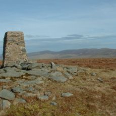
Mynydd Maendy, Summit in Rhondda Cynon Taf, Wales.

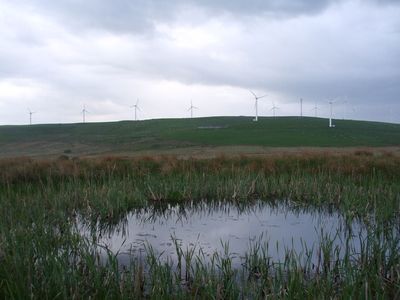
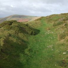
Mynydd Maendy is a hill in Wales with a rounded shape and moorland vegetation that covers its slopes at an elevation of around 301 meters. The land is grazed by sheep and now supports twenty wind turbines for power generation.

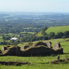
The site hosted a Celtic hillfort from the Iron Age around 800 BC, which is the largest undefended settlement of this type in southeast Wales. This fortress demonstrates early occupation and use of the area by local communities.

The name comes from Welsh words meaning stone house, linking the land to its past inhabitants and their way of living. This connection shows how the landscape itself carries the memory of those who once lived there.

The site is easy to reach and offers views over the surrounding region from the top, especially during clear weather. Well-established paths lead to the summit and suit different fitness levels.

The wind turbines on the summit date from the 1990s and are being replaced with newer structures that generate more power. This shift shows how the use of the mountain landscape has changed over time.

The community of curious travelers

AroundUs brings together thousands of curated places, local tips, and hidden gems, enriched daily by 60,000 contributors worldwide.

Start exploring
Elevation above the sea
301 m
GPS coordinates
51.57000,-3.47000
Latest update
December 14, 2025 18:41
Reviews
Share your experience

No review yet

Discussions
Start a discussion...

No discussion yet

« Mynydd Maendy - Summit in Rhondda Cynon Taf, Wales » is provided by Around Us (aroundus.com). Images and texts are derived from Wikimedia project under a Creative Commons license. You are allowed to copy, distribute, and modify copies of this page, under the conditions set by the license, as long as this note is clearly visible.

Discover hidden gems everywhere you go!

From secret cafés to breathtaking viewpoints, skip the crowded tourist spots and find places that match your style. Our app makes it easy with voice search, smart filtering, route optimization, and insider tips from travelers worldwide. Download now for the complete mobile experience.

Around Us App Screenshot

A unique approach to discovering new places

Le Figaro

All the places worth exploring

France Info

A tailor-made excursion in just a few clicks

20 Minutes

Around Us
Travel Guide & Maps
Download

Send to your phone

QR Code
1

Open the camera app on your mobile.

2

Point at the QR code with your camera. A notification will appear.

3

Tap the notification to open the link.