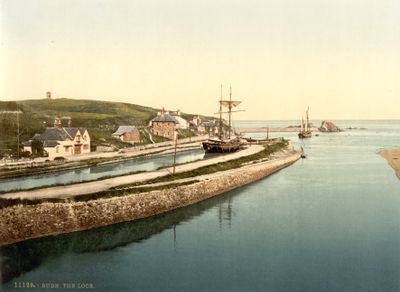
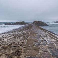
Bude Canal, Historic canal system in Cornwall and Devon, England.
Description
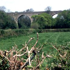
Bude Canal is a waterway system in Cornwall and Devon that once stretched over 35 miles through farmland and countryside. The route used inclined planes and locks to move boats across different levels of terrain.
History
Built between 1819 and 1825, this waterway transported mineral-rich sand from the coast to farming areas for many decades. It fell out of use around 1891 as other transport methods became more practical.
Culture
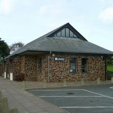
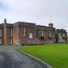
The waterway shaped how people moved goods and connected communities across the countryside for generations. Today, locals and visitors use the towpath as a place for walking and cycling, keeping the route part of daily life.
Practical
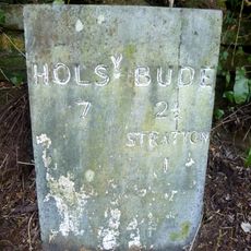
The restored canal path starting from Bude is easiest to walk in the first two miles, where pathways are well-maintained and clearly marked. Wheelchair-accessible sections and information boards explain how the engineering system worked.
Did you know?
The Hobbacott Down section features one of Britain's steepest water-transport inclines, where boats were lifted and lowered using a system with water-filled buckets. This mechanical method allowed boats to move efficiently across major height differences.
AroundUs brings together thousands of curated places, local tips, and hidden gems, enriched daily by 60,000 contributors worldwide. Discover all places nearby (United Kingdom).
The Storm Tower
625 m
Sandymouth Beach
3.8 km
St Olaf's Church, Bude
2.2 km
St Michael and All Angels Church, Bude
172 m
St Andrew's Church, Bude
2.5 km
Duckpool to Furzey Cove
3.3 km
Our Lady and St Anne's Church, Widemouth Bay
4.2 km
Parish Church of St Marwenne
3 km
Church of St Swithin
3.8 km
The Tree Inn
2.4 km
Central Methodist Chapel
195 m
Flexbury Park Methodist Church
924 m
Nanny Moore's Bridge
269 m
Stratton War Memorial
2.5 km
Bude Library
109 m
Shalder Hill War Memorial
174 m
Woolston Viaduct
4.6 km
Rose Cottage
3 km
The Castle And Walls To The North West And South East
180 m
Milestone Opposite Brooks Garden Centre (Ngr Ss2398305435)
3.4 km
Milepost About 100 Metres North Of Rodds Bridge
1.2 km
The Thatch
942 m
Lych Gate to Churchyard of Church of St Marwenne
3 km
Woodknowle
4.2 km
The Breakwater
645 m
K6 Telephone Kiosk, Poughill
2.1 km
Milestone, Bush, cutting on old road over Hunthill
3.6 km
Milestone, on line of old main road, NW of Townsend
2.5 kmDiscover hidden gems everywhere you go!
From secret cafés to breathtaking viewpoints, skip the crowded tourist spots and find places that match your style. Our app makes it easy with voice search, smart filtering, route optimization, and insider tips from travelers worldwide. Download now for the complete mobile experience.
A unique approach to discovering new places❞
— Le Figaro
All the places worth exploring❞
— France Info
A tailor-made excursion in just a few clicks❞
— 20 Minutes