Enable Location

We need your location to show you interesting places around you

Discover nearby places

Find interesting locations and hidden gems around you

Precise directions

Get accurate directions and distances to places

Your location is never shared with other users. It's only used when you tap the location button.

Ward County

Log in to your account

Start exploring — it's free

Trusted by 61,366 travelers worldwide

Continue with Google
Continue with Apple
or

We will send you a code to connect

By continuing, you accept our Terms and Conditions and our Privacy Policy

Check your inbox

We've sent a pincode in your inbox. Please enter the code below.

Ward County, Administrative division in North Dakota, United States

Description

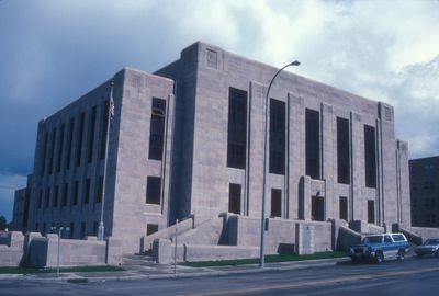
Ward County is an administrative division in north-central North Dakota spanning roughly 2,000 square miles with rolling terrain, lakes, and farming areas. The county operates from Minot as its central hub and provides services across a landscape of agricultural and natural features.

History

The county was established on April 14, 1885, and named after Mark Ward, a pioneer of the area. The first county seat was located in Burlington but moved to Minot in 1888, where it has remained since.

Culture

The county's name honors Mark Ward, an early settler of the region. Residents connect through shared agricultural traditions and recreational use of local wildlife areas for outdoor activities and nature watching.

Practical

Visitors can explore the area through three wildlife refuges that offer activities like bird watching and hiking. The administrative center in Minot serves as a starting point for accessing the county's services and facilities.

Did you know?

The area contains three national wildlife refuges that protect different habitats and attract rare bird species. These reserves make the region an important destination for nature enthusiasts and birders seeking specialized viewing opportunities.

GPS coordinates
48.24883,-101.62426
Latest update
December 7, 2025 20:21

AroundUs brings together thousands of curated places, local tips, and hidden gems, enriched daily by 60,000 contributors worldwide. Discover all places nearby (Ward County).

Around this place
United States of America

91st Missile Wing LGM-30 Minuteman Missile Launch Sites

57.8 km
Scandinavian Heritage Park
United States of America

Scandinavian Heritage Park

24.3 km
740th Missile Squadron
United States of America

740th Missile Squadron

27.1 km
741st Missile Squadron
United States of America

741st Missile Squadron

27.1 km
Maysa Arena
United States of America

Maysa Arena

22 km
Dakota Territory Air Museum
United States of America

Dakota Territory Air Museum

25 km
742d Missile Squadron
United States of America

742d Missile Squadron

27.1 km
Great Northern Railway Underpass
United States of America

Great Northern Railway Underpass

57.3 km
Taube Museum of Art
United States of America

Taube Museum of Art

24.6 km
Old Main (Minot State University)
United States of America

Old Main (Minot State University)

24 km
Westgaard Bridge
United States of America

Westgaard Bridge

62.3 km
Renville County Courthouse
United States of America

Renville County Courthouse

57.9 km
Eastwood Park Bridge
United States of America

Eastwood Park Bridge

25.3 km
Granville State Bank
United States of America

Granville State Bank

58.6 km
Minot Carnegie Library
United States of America

Minot Carnegie Library

24.8 km
Bruce M. Van Sickle Federal Building and U.S. Courthouse
United States of America

Bruce M. Van Sickle Federal Building and U.S. Courthouse

24.6 km
Mountrail County Courthouse
United States of America

Mountrail County Courthouse

57.4 km
Alfred and Clara Sevareid House
United States of America

Alfred and Clara Sevareid House

55.6 km
Union National Bank and Annex
United States of America

Union National Bank and Annex

24.7 km
Tufveson House
United States of America

Tufveson House

24 km
Wabek Consolidated School
United States of America

Wabek Consolidated School

40 km
Andrew Carr, Sr., House
United States of America

Andrew Carr, Sr., House

23.9 km
Van Hook State Wildlife Management Area
United States of America

Van Hook State Wildlife Management Area

59.9 km
Ward County Courthouse
United States of America

Ward County Courthouse

25 km
First English Free Lutheran Church (Lostwood)
United States of America

First English Free Lutheran Church (Lostwood)

64.3 km
Scandinavian Heritage Association
United States of America

Scandinavian Heritage Association

24.4 km
Paul Broste Rock Museum
United States of America

Paul Broste Rock Museum

49.5 km
Minot Industrial Historic District
United States of America

Minot Industrial Historic District

25 km
Show the full map
« Ward County - Administrative division in North Dakota, United States » is provided by Around Us (aroundus.com). Images and texts are derived from Wikimedia project under a Creative Commons license. You are allowed to copy, distribute, and modify copies of this page, under the conditions set by the license, as long as this note is clearly visible.

Discover hidden gems everywhere you go!

From secret cafés to breathtaking viewpoints, skip the crowded tourist spots and find places that match your style. Our app makes it easy with voice search, smart filtering, route optimization, and insider tips from travelers worldwide. Download now for the complete mobile experience.

Around Us App Screenshot

A unique approach to discovering new places

Le Figaro

All the places worth exploring

France Info

A tailor-made excursion in just a few clicks

20 Minutes

Around Us
Travel Guide & Maps
Download

Send to your phone

QR Code
1

Open the camera app on your mobile.

2

Point at the QR code with your camera. A notification will appear.

3

Tap the notification to open the link.