Enable Location

We need your location to show you interesting places around you

Discover nearby places

Find interesting locations and hidden gems around you

Precise directions

Get accurate directions and distances to places

Your location is never shared with other users. It's only used when you tap the location button.

Freedom Trail

Log in to your account

Start exploring — it's free

Trusted by 61,908 travelers worldwide

Continue with Google
Continue with Apple
or

We will send you a code to connect

By continuing, you accept our Terms and Conditions and our Privacy Policy

Check your inbox

We've sent a pincode in your inbox. Please enter the code below.

Freedom Trail

Freedom Trail, Heritage trail in Boston, US

The Freedom Trail is a themed walk through Boston, Massachusetts, marked by a red line of brick or paint that connects 16 historic sites over 2.5 miles (4 kilometers). It begins at Boston Common park and runs through downtown and the North End toward Charlestown, crossing the city's core districts.

The path began in 1951 when journalist William Schofield suggested connecting sites from the American Revolution to protect them from neglect. Over the following decades, the route was formalized with its red marker and became a way to make the independence movement's history accessible within the urban fabric.

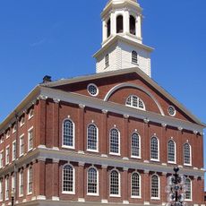
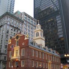
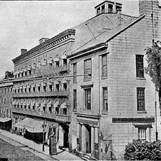
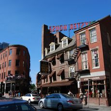
The route passes through neighborhoods where daily Boston life blends with colonial-era structures, showing how past centuries still shape the cityscape. Along the way, churches, assembly halls, and burial grounds stand beside modern shops and offices, making past and present coexist side by side.

Visitors can follow the path independently using maps or join tours led by guides in period costume. Information centers at the start and finish points offer orientation and background details about the individual stops.

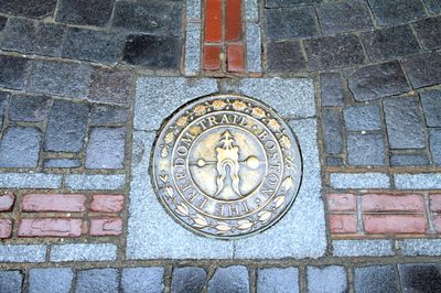
The marking on sidewalks does not always run as a continuous line but sometimes appears as a series of symbols or bricks integrated into the urban design. This understated approach lets the city protect old structures without imposing heavy signage.

The community of curious travelers

AroundUs brings together thousands of curated places, local tips, and hidden gems, enriched daily by 60,000 contributors worldwide.

Start exploring
Location
Inception
1951
GPS coordinates
42.35996,-71.05676
Latest update
December 12, 2025 20:39
Around this place
Show the full map
« Freedom Trail - Heritage trail in Boston, US » is provided by Around Us (aroundus.com). Images and texts are derived from Wikimedia project under a Creative Commons license. You are allowed to copy, distribute, and modify copies of this page, under the conditions set by the license, as long as this note is clearly visible.

Discover hidden gems everywhere you go!

From secret cafés to breathtaking viewpoints, skip the crowded tourist spots and find places that match your style. Our app makes it easy with voice search, smart filtering, route optimization, and insider tips from travelers worldwide. Download now for the complete mobile experience.

Around Us App Screenshot

A unique approach to discovering new places

Le Figaro

All the places worth exploring

France Info

A tailor-made excursion in just a few clicks

20 Minutes

Around Us
Travel Guide & Maps
Download

Send to your phone

QR Code
1

Open the camera app on your mobile.

2

Point at the QR code with your camera. A notification will appear.

3

Tap the notification to open the link.