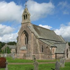
Settle to Carlisle Line, Railway line in Yorkshire Dales, England.
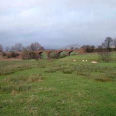
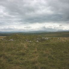
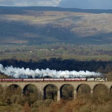
The Settle to Carlisle Line is a railway running through the Yorkshire Dales and North Pennines with stone viaducts and tunnels crossing natural valleys. The route connects multiple stations while traversing mountainous landscapes punctuated by substantial engineering structures.
Construction started in 1869 with thousands of workers, primarily Irish laborers, who built this last major railway line in England entirely by hand. Its completion marked a turning point, as few rail lines were constructed this way afterward.
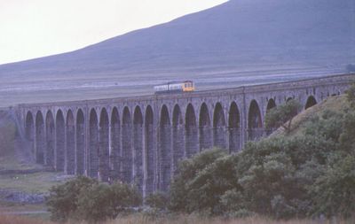
The Ribblehead Viaduct stands as a celebrated engineering landmark with its distinctive stone arches that define the landscape visually. Travelers recognize the structure immediately as a symbol of Victorian railway construction when passing through the region.
Trains operate regularly between Leeds and Carlisle with stops at several stations along the route. The best time to travel is during favorable weather, when views of the mountains are at their clearest.
Dent is England's highest mainline railway station, sitting in an isolated location surrounded by mountains. The station was built to connect remote mountain villages to the network, though today it sees only a handful of trains.
Location: Yorkshire and the Humber
Official opening: 1875
Part of: National Rail
GPS coordinates: 54.51700,-2.45600
Latest update: December 17, 2025 11:21
Crosby Garrett Helmet
4.8 km
St Columba's Church, Warcop
4.3 km
St James' Church, Great Ormside
4 km
St Andrew's Church, Crosby Garrett
4.6 km
Pate Hole
3.1 km
Church of St Luke
5 km
Church of St Peter
2.5 km
Chamley Arms
4.8 km
Warcop War Memorial
4.6 km
Well To East Of Grange Hall
3.4 km
Courtfield Hotel
6.4 km
Barn To North East Of Old Rectory
4.7 km
Gaythorne Hall
5.6 km
Coupland Viaduct
5 km
Footbridge Over Dale Beck West Of Roadbridge
2.8 km
Crosby Garrett Viaduct at NT 727 093
4.8 km
The Old Rectory
4.7 km
Outer wall to Appleby Castle grounds, from South Lodge to the river
6.4 km
Hollin Stump round cairn
5.7 km
Ormside Hall And Adjoining Barns
4 km
Bleatarn Chapel
2.2 km
Drybeck Hall And Attached Buildings
4 km
Roadside Preaching Cross To South West Of Church
3.9 km
Castle Bank House
6.4 km
Milestone To South East Of Sandford Thorn
5 km
Smardale Railway Viaduct
6.1 km
Maypole To South Of The Fox
4.6 km
Grange Hall And Adjoining Buildings
3.4 kmVisited this place? Tap the stars to rate it and share your experience / photos with the community! Try now! You can cancel it anytime.
Discover hidden gems everywhere you go!
From secret cafés to breathtaking viewpoints, skip the crowded tourist spots and find places that match your style. Our app makes it easy with voice search, smart filtering, route optimization, and insider tips from travelers worldwide. Download now for the complete mobile experience.
A unique approach to discovering new places❞
— Le Figaro
All the places worth exploring❞
— France Info
A tailor-made excursion in just a few clicks❞
— 20 Minutes